MyCoast: Maryland allows you to communicate flooding and storm damage in your community. It is a portal to collect and analyze photos which are linked to precipitation, riverine, and tidal data to create reports that help government agencies, business owners, and residents understand impacts in your community and encourage action to reduce localized flooding. Thank you for submitting photos!
MyCoast: Maryland
Documenting Flooding & Storm Damage to Inspire Action


How it Works

You Add Your
Picture or Report
Take your picture via our mobile app (below) or submit it via your browser when you get back to your computer.

We Fetch
Background Data
Our servers retrieve weather and tidal information to add context to your photo.

Your Report
Informs Decision
Coastal leaders and groups can use your data to make better decisions.
To date, Maryland participants have submitted 2,222 reports with 5,136 photographs.
Maryland MyCoast Tools
Use these buttons to view existing photos and submit your own
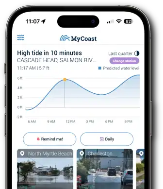
Submitting Photos
is Simple with the
MyCoast App!

