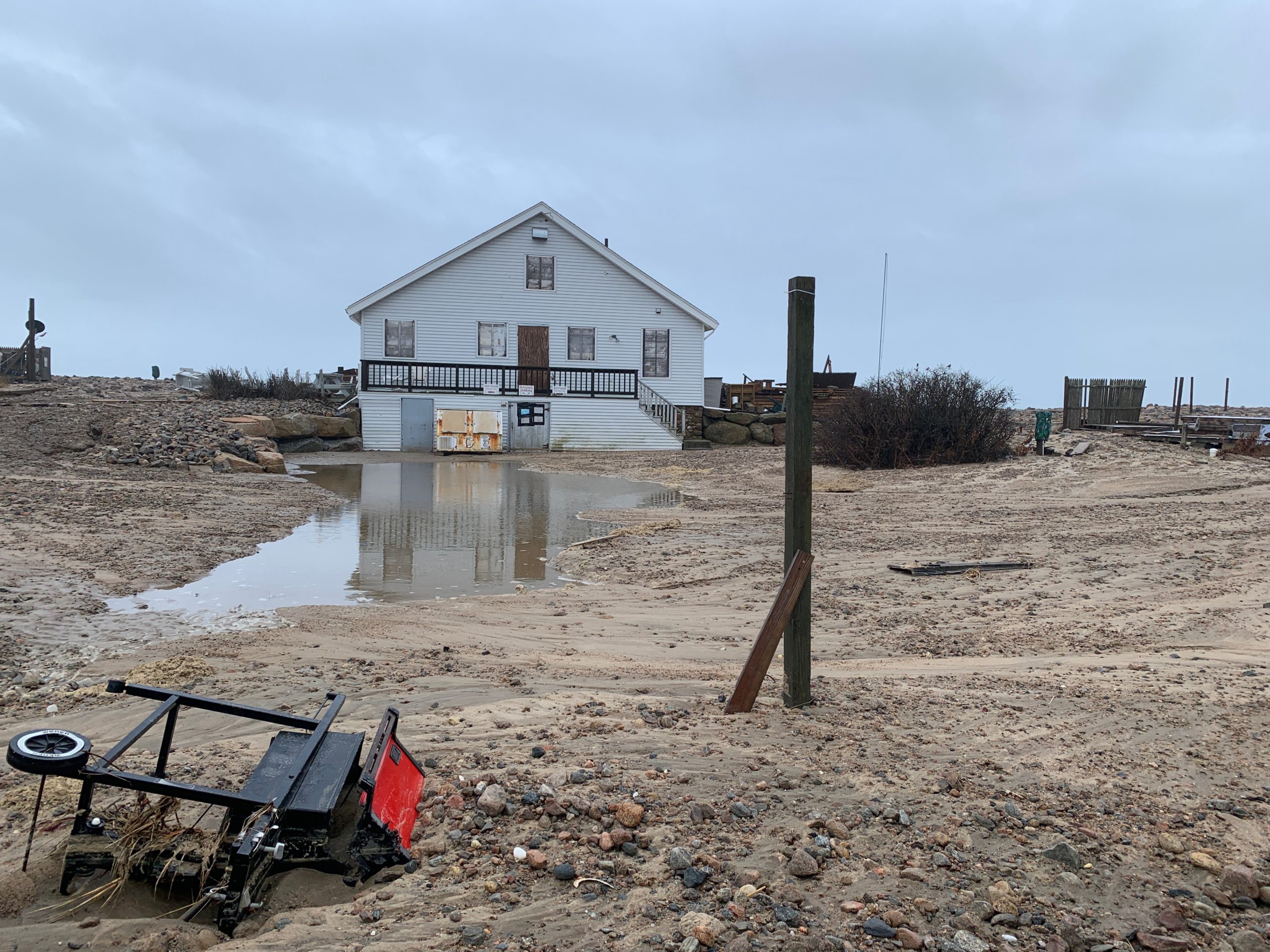
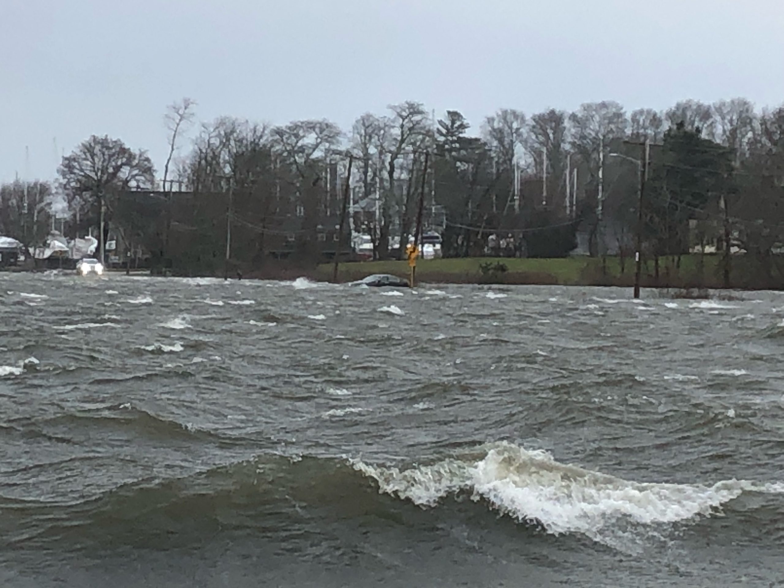
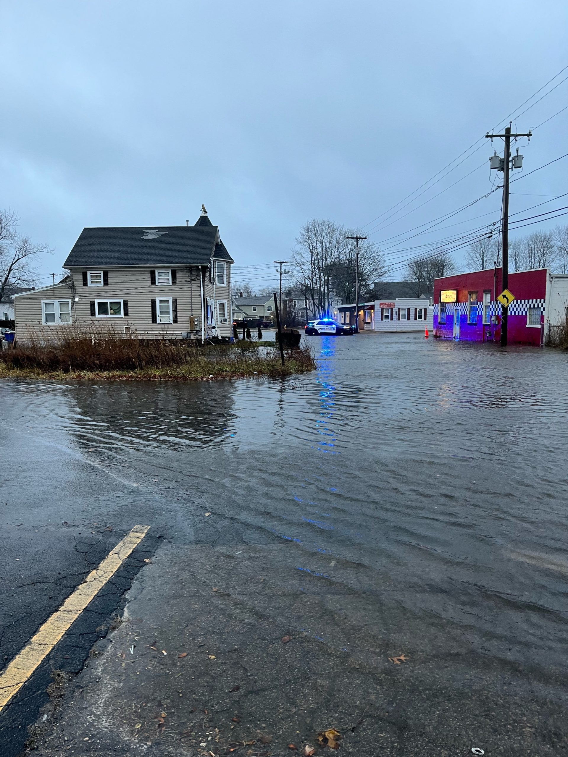
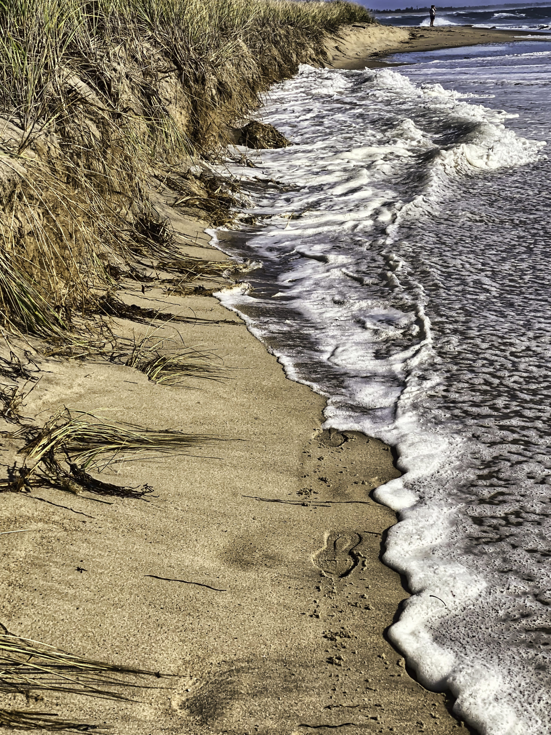
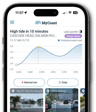
MyCoast: Rhode Island is a portal to collect and analyze photos of shorelines across the Ocean State. Information collected is used to capture the impact of flood hazards today, and to illustrate possible future conditions. Photos, linked to data about weather and tides, create reports that help stakeholders like government agencies, business owners, and residents to understand shoreline change and make informed decisions.
MyCoast:
Rhode Island
Snap the Shore,
Track the Change
MyCoast:
Rhode Island
Snap the Shore, Track the Change
MyCoast: Rhode Island is a portal to collect and analyze photos of shorelines across the Ocean State. Information collected is used to capture the impact of flood hazards today, and to illustrate possible future conditions. Photos, linked to data about weather and tides, create reports that help stakeholders like government agencies, business owners, and residents to understand shoreline change and make informed decisions.


How it Works

You Add Your Picture or Report
Take your picture via our mobile app (below) or submit it via your browser when you get back to your computer.

We Fetch Background Data
Our servers retrieve weather and tidal information to add context to your photo.

Your Report Informs Decisions
Coastal leaders and groups can use your data to make better decisions.


Submitting Photos
is Simple with the
MyCoast App!


Featured King Tides


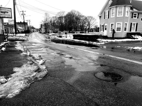


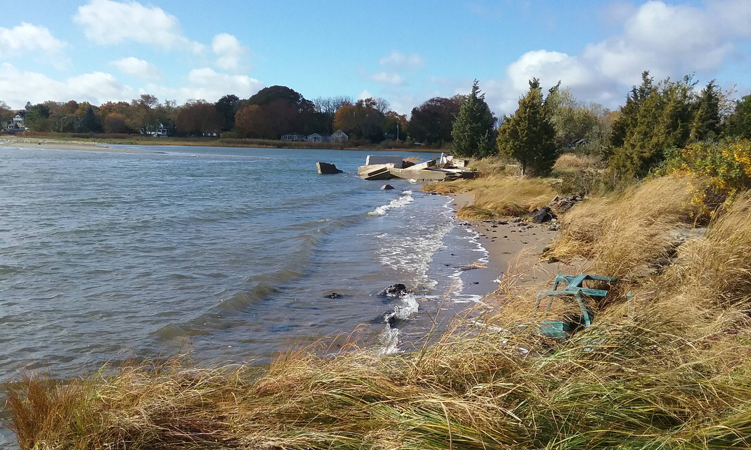


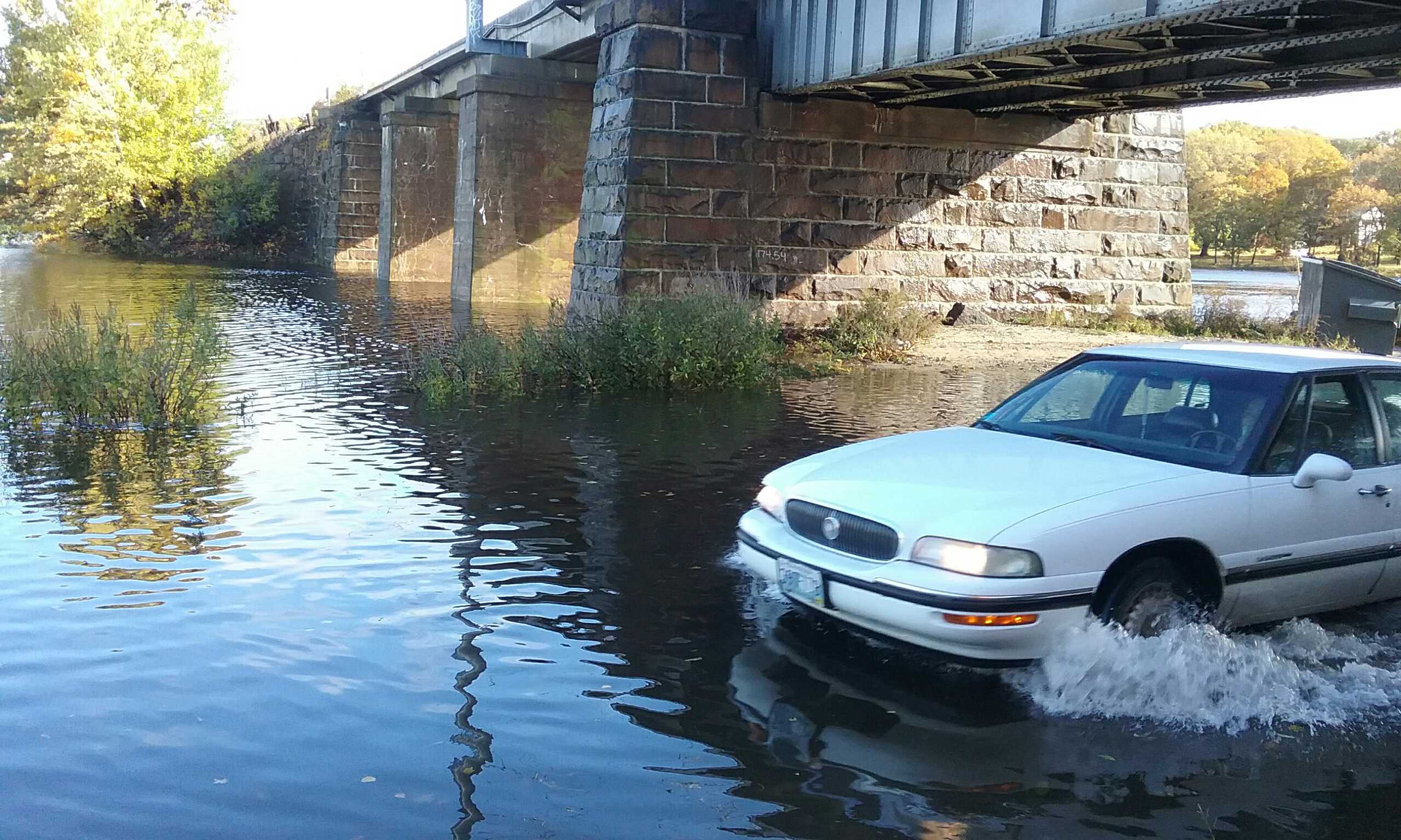


Featured Storm Reports