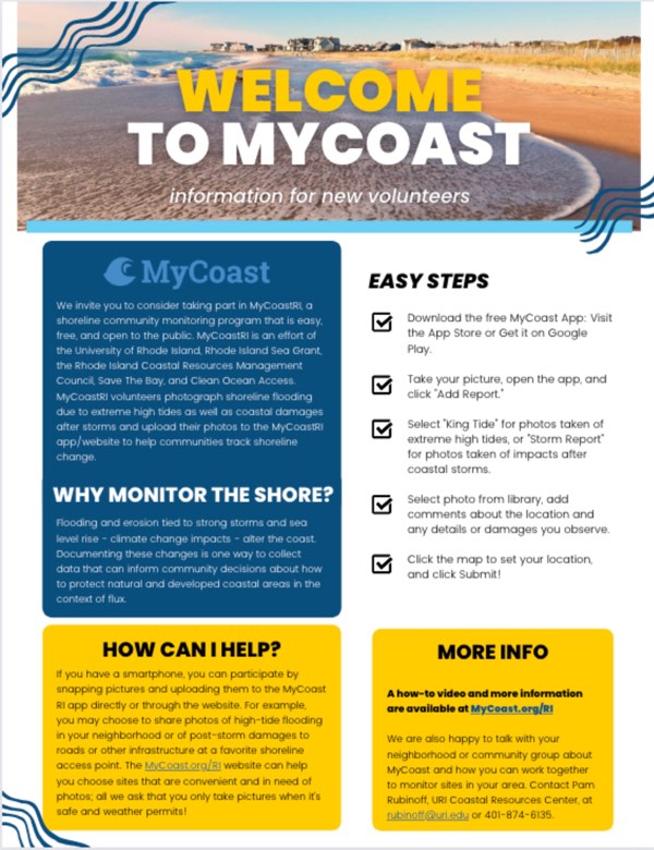
A quick and easy introduction to MyCoast.
Rhode Island MyCoast Resources
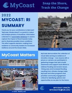
Report on 2024 accomplishments.
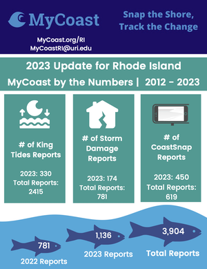
Reflecting on 2022 accomplishments and looking ahead to 2023 plans.
Learn how to use MyCoast through a short video tutorial.
What is a king tide?
An online tool that describes MyCoast, shares interactive maps of the MyCoast sites around RI and includes user insights.
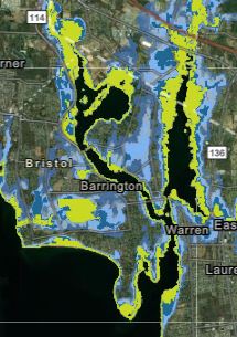
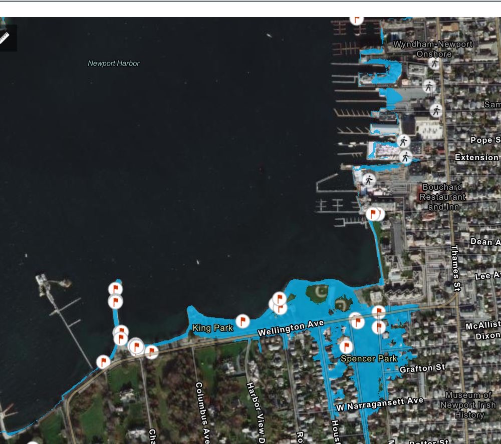
See how MyCoast photos compare to sea level rise and storm surge levels around RI.
Photo tips to take your MyCoast photos to the next level.
Learn how to use Search for Photos in MyCoast.
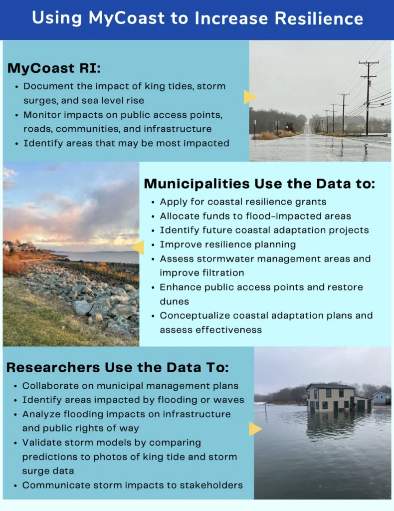
Tips for How MyCoast is Used to Increase Resilience.
Feedback from MyCoastRI data users.
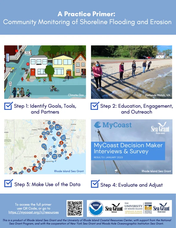
Tips for community shoreline monitoring.