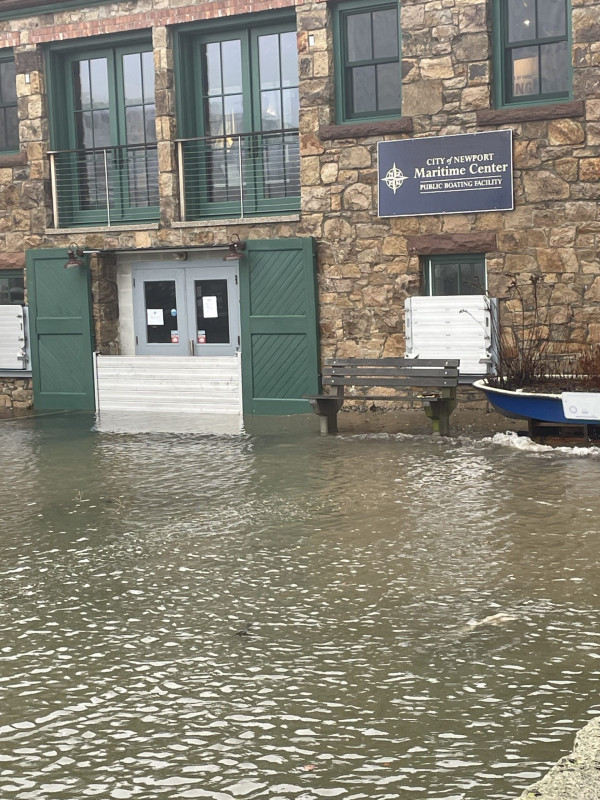
Christies Landing

Newport, RI


Damage Reported


Roads

Street/Road: Unspecified

Marinas and Harbors
Buildings

Specific Damage:

  • Water flow around or under buildings

Hazardous Materials
Beach

State: Inaccessible

Coastal Structures

Specific Damage:

  • Splashover

Natural Resources
Current Response

01/13/2024 | 10:06 am

Tidal Overview

1 hours 12 minutes after high tide

Data from NEWPORT (1.6 miles away)

Water Level (at time of report): 10:06 am, 6.6'

High Tide (Predicted): 8:55 am, 4.3'

High Tide (Observed): 8:54 am, 7'

Observed Predicted water level Report time

Weather Overview

Wind Speed: 12.6 MPH

Wind Direction: SE (143°)

Temperature: 50℉

Rainfall (Calendar Day): 0.032"

Rainfall (Past 24 Hours): 0.67"

(Click here for full weather details)


You must be logged in to post a comment.