Ocean County
Surf City, NJ
High Water Report
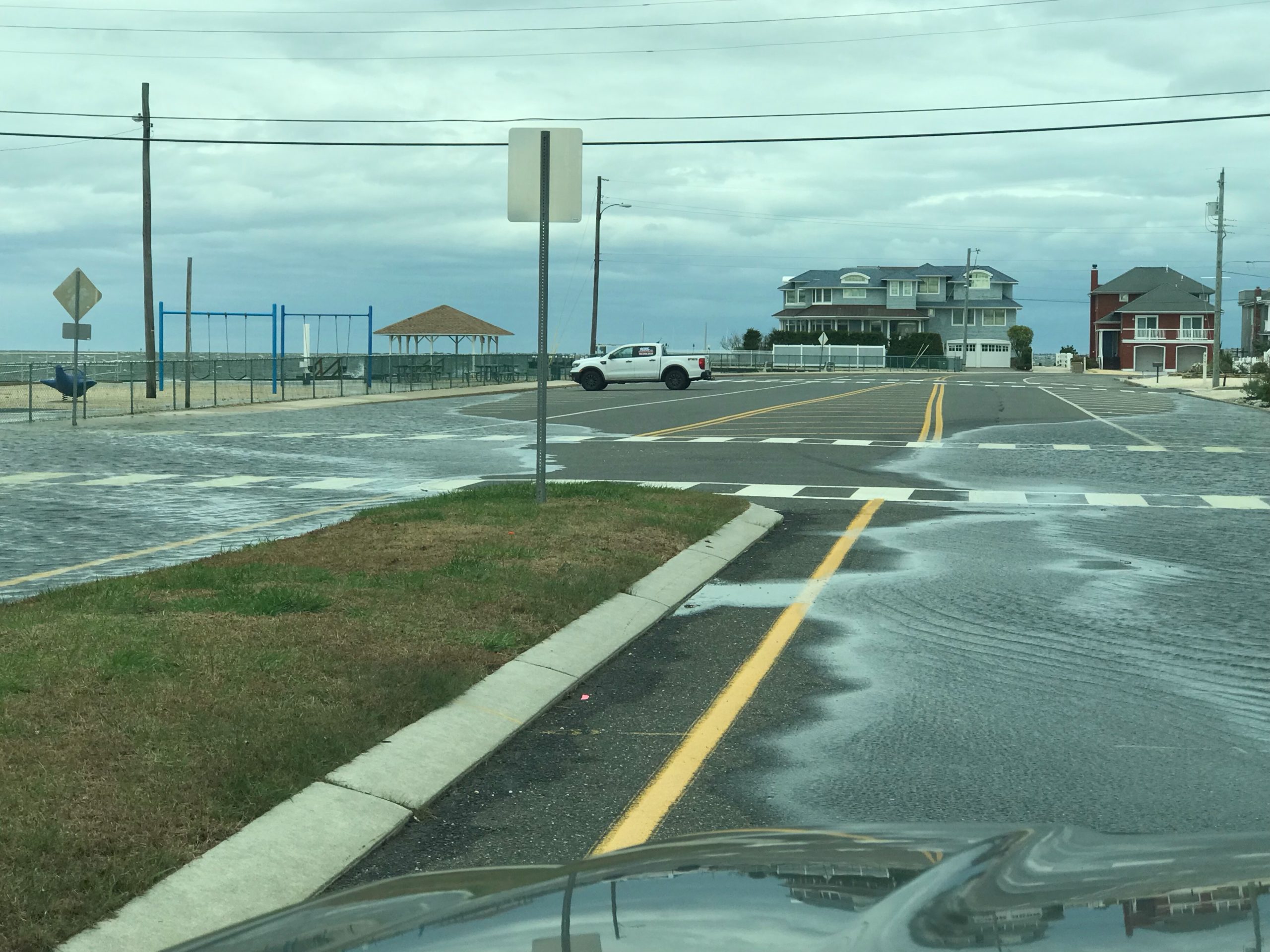
User Submitted Data
Source of Flooding:
- Bay
Cause of Flooding:
- High Tide
Tidal Overview
![]() 1 hours 9 minutes before high tide
1 hours 9 minutes before high tide
Data from North Beach (0.8 miles away)
All heights shown relative to Mean Lower Low Water (MLLW): the daily low tide level averaged over a 19-year period.
High Tide (Predicted): 3:51 pm, 1' MLLW
Loading NOAA Tide Data…
■ Observed
■ Predicted water level
⬤ Report time
The accuracy of the predicted tides at the photo location may vary depending on distance from the nearest tide station and due to wind, rain, and other short-term meteorological events.
Weather Overview
Wind Speed: 11.2 MPH
Wind Direction: N (350°)
Temperature: 62℉
Rainfall (Calendar Day): 0"
Rainfall (Past 24 Hours): 0.38"
1 Comment. Leave new
This was at the 2.8 Foot level on the Stevens Flood Prediction System
To see a graphic representation of the flooding go to
https://hudson.dl.stevens-tech.edu/sfas/d/index.shtml?station=U226
Enter the date that you want