"Water flooding up out of the inlet and onto the sidewalk. Intense wind was pushing waves over the edge of the wall and flooding the sidewalk."
Source of Flooding:
Ocean
Cause of Flooding:
Rain
05/28/2021 | 8:52 pm
Tidal Overview
1 hours 23 minutes before high tide
Data from Manasquan Inlet, USCG Station (0.1 miles away) All heights shown relative to Mean Lower Low Water (MLLW): the daily low tide level averaged over a 19-year period.
High Tide (Predicted): 10:15 pm, 5.3'
■ Observed■ Predicted water level⬤ Report time
The accuracy of the predicted tides at the photo location may vary depending on distance from the nearest tide station and due to wind, rain, and other short-term meteorological events.
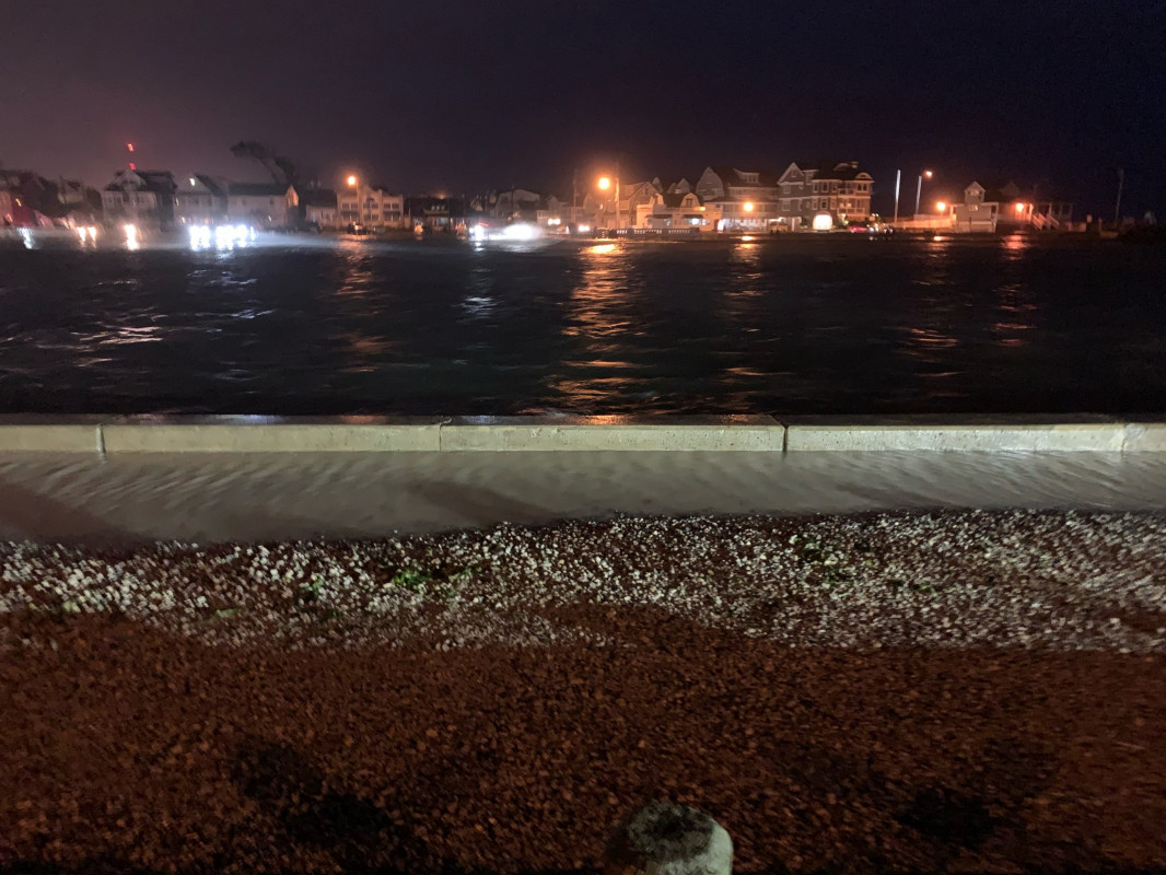
"Water flooding up out of the inlet and onto the sidewalk. Intense wind was pushing waves over the edge of the wall and flooding the sidewalk."