Roy Carpenter Beach Rd
South Kingstown, RI
Coastal Resilience Report
by Owen Reuther
01/30/2020 | 3:10 pm
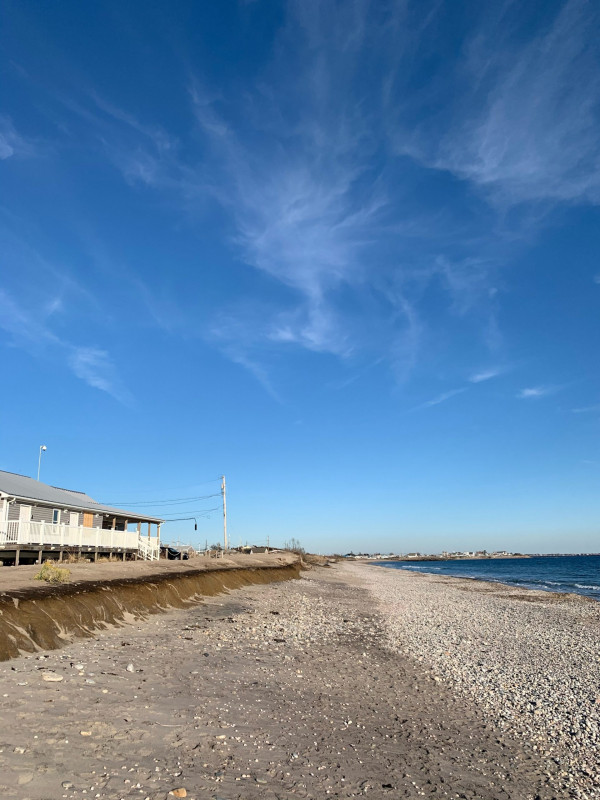
Photo description: Beach eroding at Chris Carpenters beach Matunuck, RI
Coastal resources in/directly adjacent to project footprint:
- beach (sandy)
- beach (mixed sediment)
- beach (cobble)
- dune
- coastal bank
Project elevation:
- above mean high water (MHW)
Coastal infrastructure present at site:
- multi-use path or road
- other
Site stability:
- eroding
Vegetative cover of project area:
- sparse (<25%)
Dominant vegetative type within project area: grasses
Displaced/unanchored and degraded project materials:
- none
- erosion-control mats/blankets
- rocks
- other
Human impacts at project site:
- runoff
- foot traffic
- other
Other human impacts: Walk way
Marine-related impacts:
- marine debris
- storm damage
You must be logged in to post a comment.