South Kingstown, RI
Moonstone Beach Rd
Coastal Resilience Report

User Submitted Data
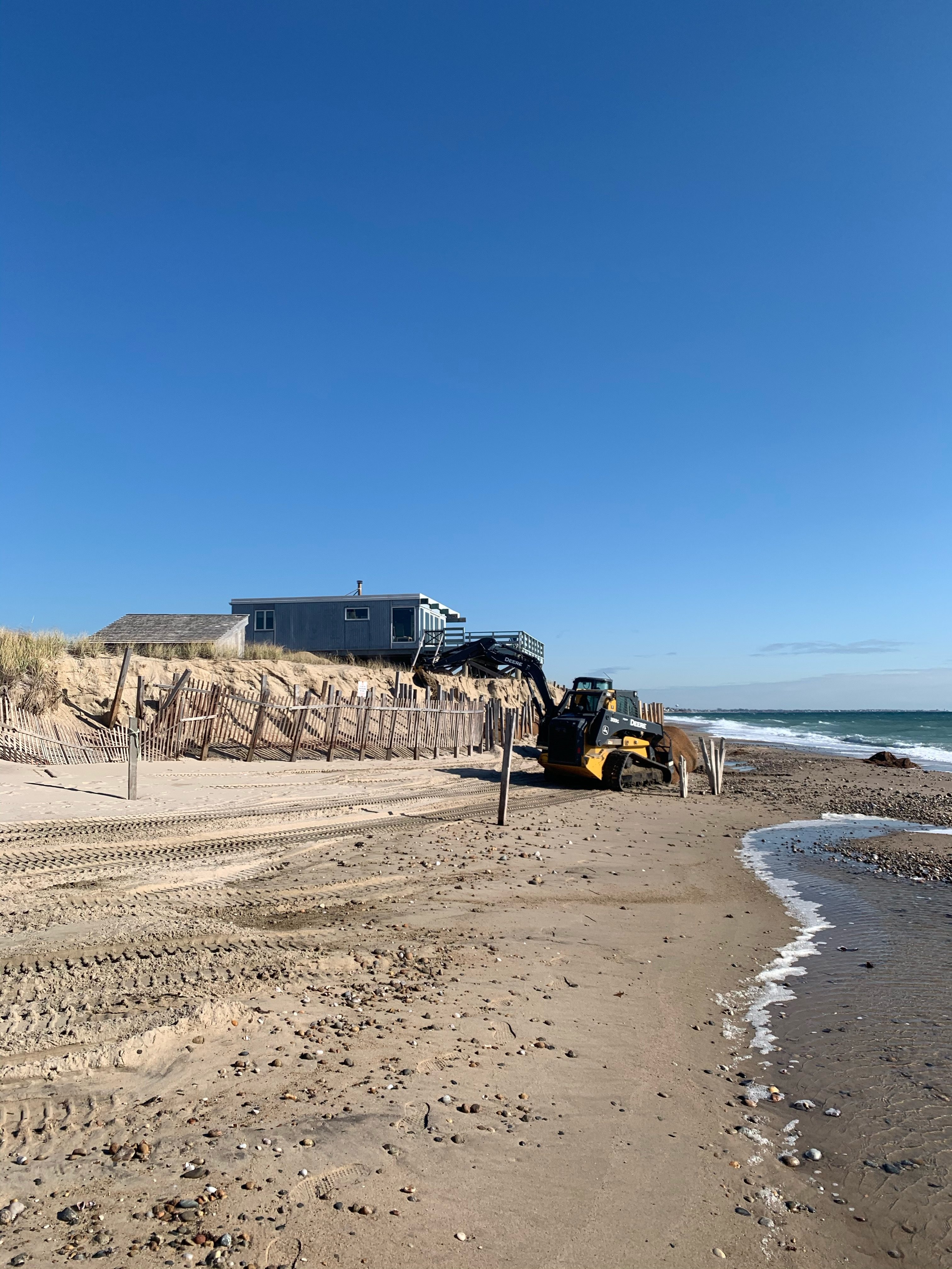
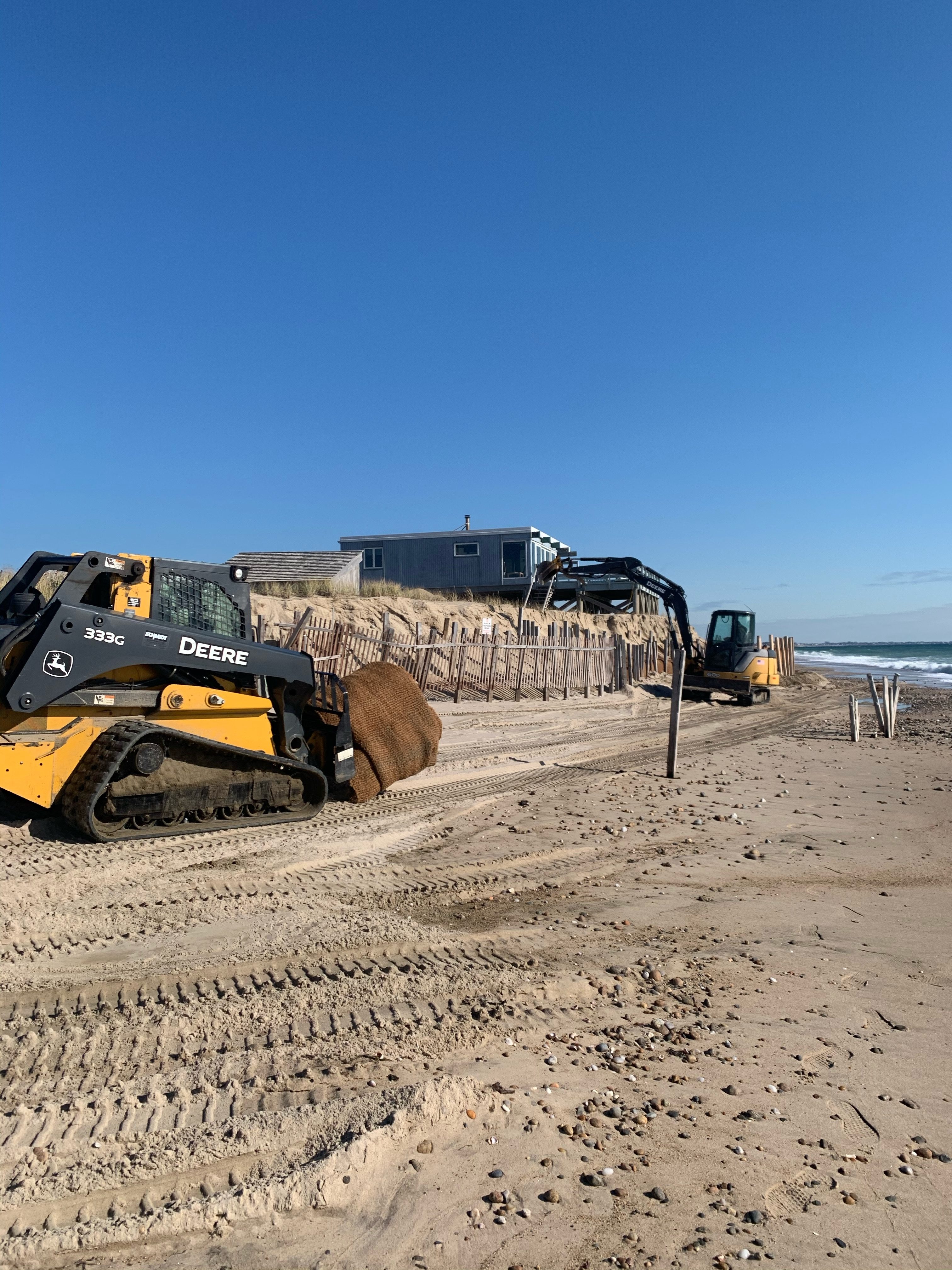
Photo description: The past two storms have destroyed the dune in front of this house at Moonstone Beach. The crew is trying to rebuild the wall in front of the house.
Coastal resources in/directly adjacent to project footprint:
- beach (sandy)
- dune
Project elevation:
- above mean high water (MHW)
Coastal infrastructure present at site:
- bulkhead/seawall
Site stability:
- eroding
Vegetative cover of project area:
- moderate (25-75%)
Dominant vegetative type within project area: grasses
Displaced/unanchored and degraded project materials:
- erosion-control mats/blankets
- rocks
Human impacts at project site:
- runoff
- foot traffic
- vehicles
Marine-related impacts:
- storm damage
Tidal Overview
![]() 2 hours 0 minutes after high tide
2 hours 0 minutes after high tide
Data from Point Judith, Harbor of Refuge (4.5 miles away)
High Tide (Predicted): 9:08 am, 3.6' MLLW
Loading NOAA Tide Data…
Weather Overview
Wind Speed: 14.6 MPH
Wind Direction: WSW (244°)
Temperature: 50℉
Rainfall (Calendar Day): 0"
Rainfall (Past 24 Hours): 0"