"Water is streaming out of the storm drain and down to the creek."
Source of Flooding:
River/Stream
Cause of Flooding:
High Tide
Rain
04/30/2023 | 6:44 pm
Tidal Overview
1 hours 35 minutes after high tide
Data from Matawan Creek, Route 35 bridge (1.1 miles away) All heights shown relative to Mean Lower Low Water (MLLW): the daily low tide level averaged over a 19-year period.
High Tide (Predicted): 5:09 pm, 4.6' MLLW
■ Observed■ Predicted water level⬤ Report time
The accuracy of the predicted tides at the photo location may vary depending on distance from the nearest tide station and due to wind, rain, and other short-term meteorological events.
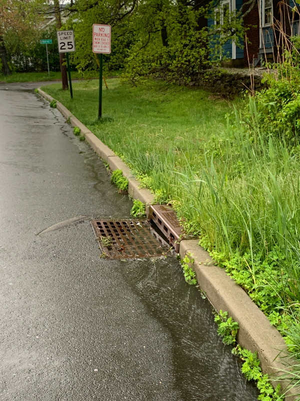
"Water is streaming out of the storm drain and down to the creek."