Westerly, RI
Westerly
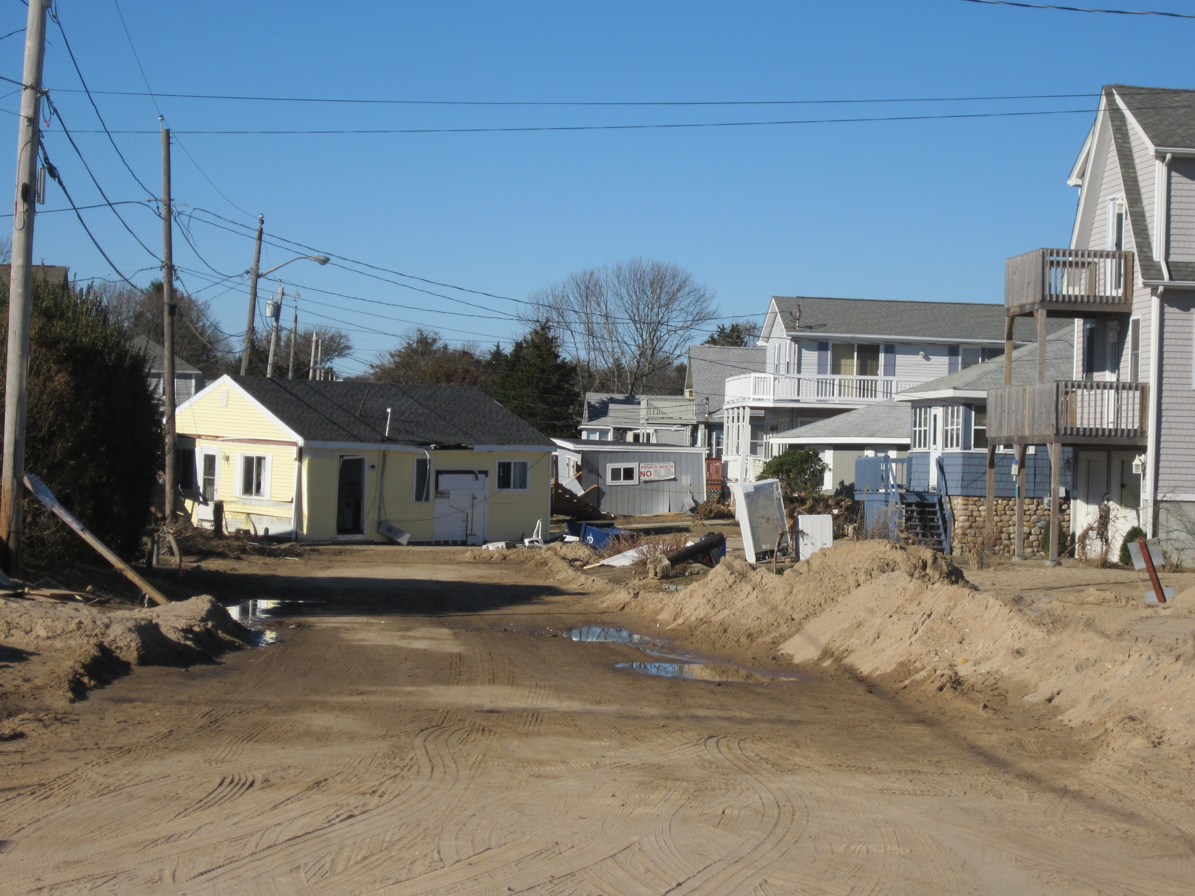
Storm Reporter Report
Damage Reported
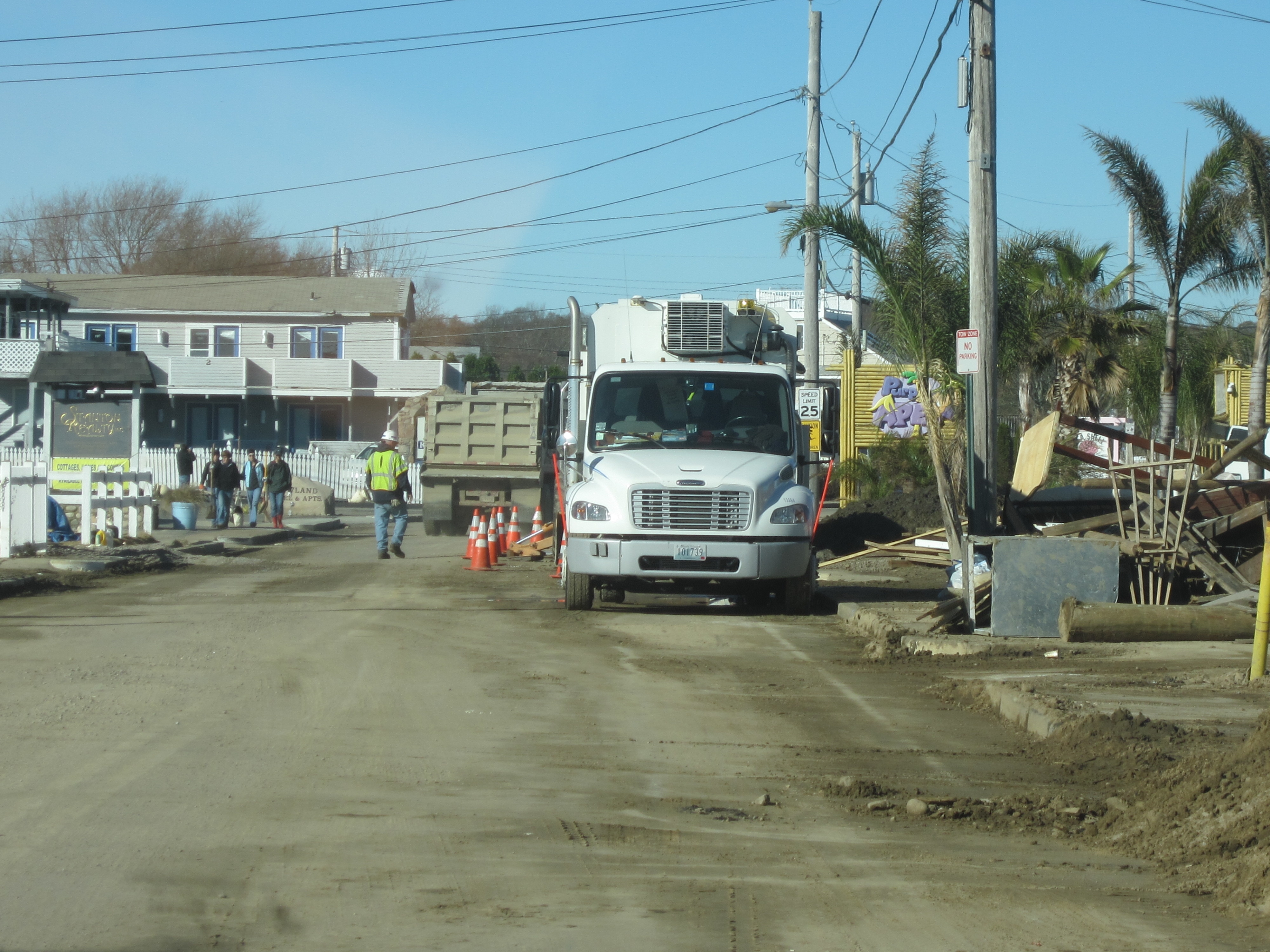
Roads
Street/Road: Unspecified
Specific Damage:
- Splashover
- Impassable (trees)
- Impassable (flood water)
- Impassable (utility lines)
- Impassable (overwash)
- Impassable (washed out)
Marinas and Harbors
Specific Damage:
- Damaged piers/docks
- Displaced floats
- Displaced boats
Displaced floats: 0 float
Displaced boats: 0 boat
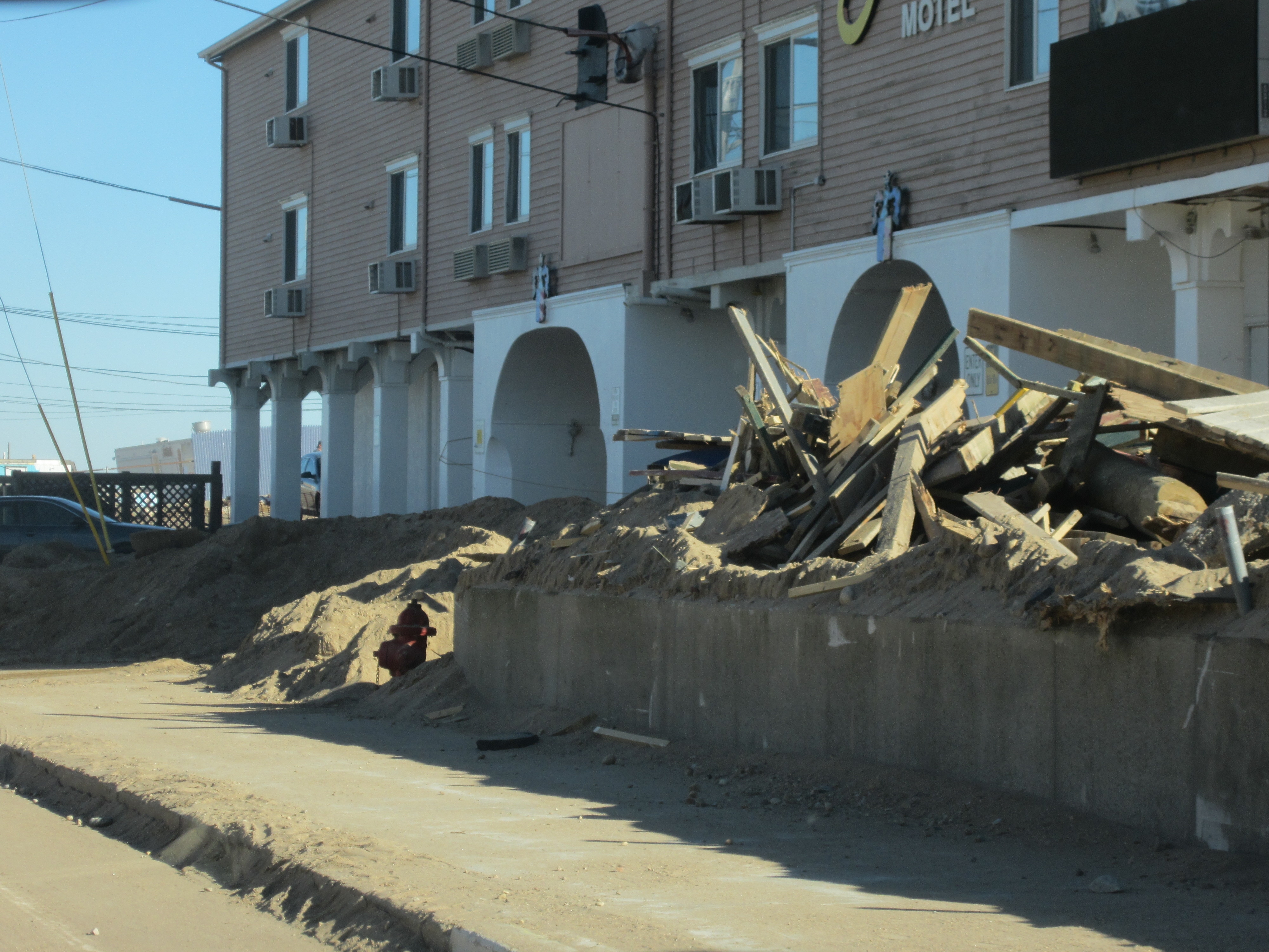
Buildings
Specific Damage:
- Damaged walls/roofs
- Damaged stairs/decks
- Damaged windows/sidings
- Damaged foundations/pilings
- Water flow around or under buildings
Hazardous Materials
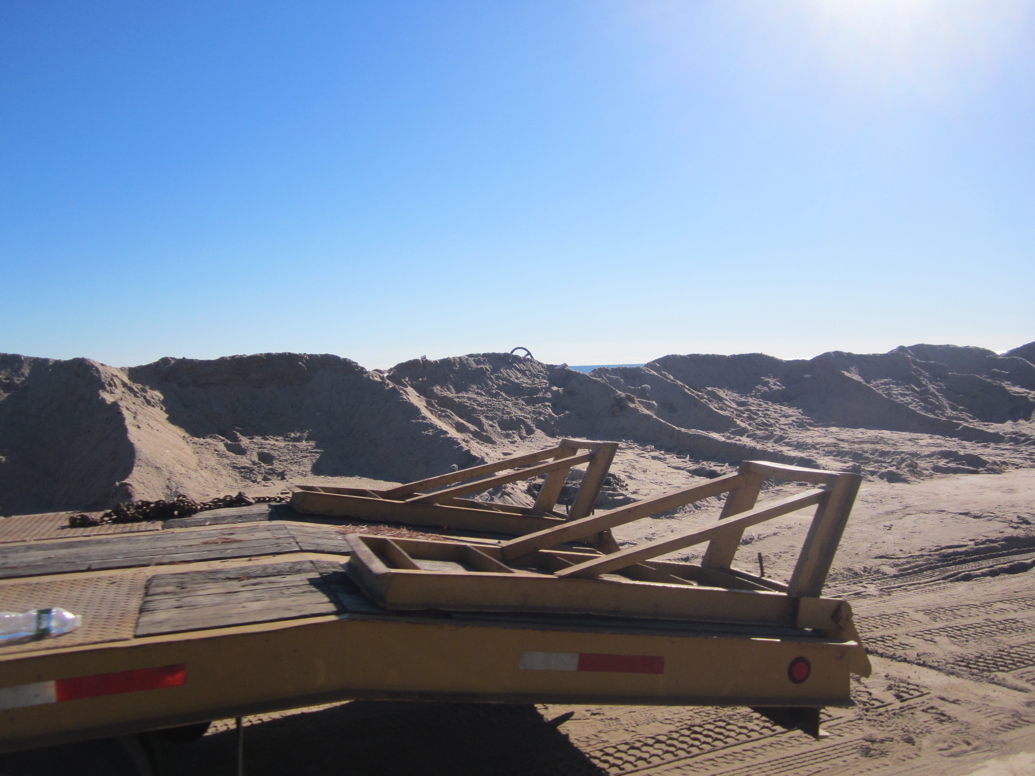
Beach
State: Y
Coastal Structures
Specific Damage:
- Splashover
- Damaged stairs/walkovers
- Leaning bulkheads/seawalls
- Undermined bulkheads/seawalls
- Collapsed bulkheads/seawalls
Foot/Cycling Paths
Natural Resources
Specific Damage:
- Damaged sand fencing
- Eroded beach
- Overwashed beach/dune
Current Response
Response:
- Utility repair
Tidal Overview
![]() 0 hours 49 minutes after high tide
0 hours 49 minutes after high tide
Data from NEW LONDON, State Pier (14.2 miles away)
Water Level (at time of report): 12:00 pm, 3' MLLW
High Tide (Predicted): 1:01 pm, 2.7' MLLW
High Tide (Observed): 12:42 pm, 3.1' MLLW
■ Observed
■ Predicted water level
⬤ Report time
Weather Overview
Wind Speed: 6.8 MPH
Wind Direction: W (260°)
Temperature: 51℉
Rainfall (Calendar Day): 0"
Rainfall (Past 24 Hours): 0"
You must be logged in to post a comment.
"Atlantic Ave and surrounding areas suffered severe damage after Hurricane Sandy."