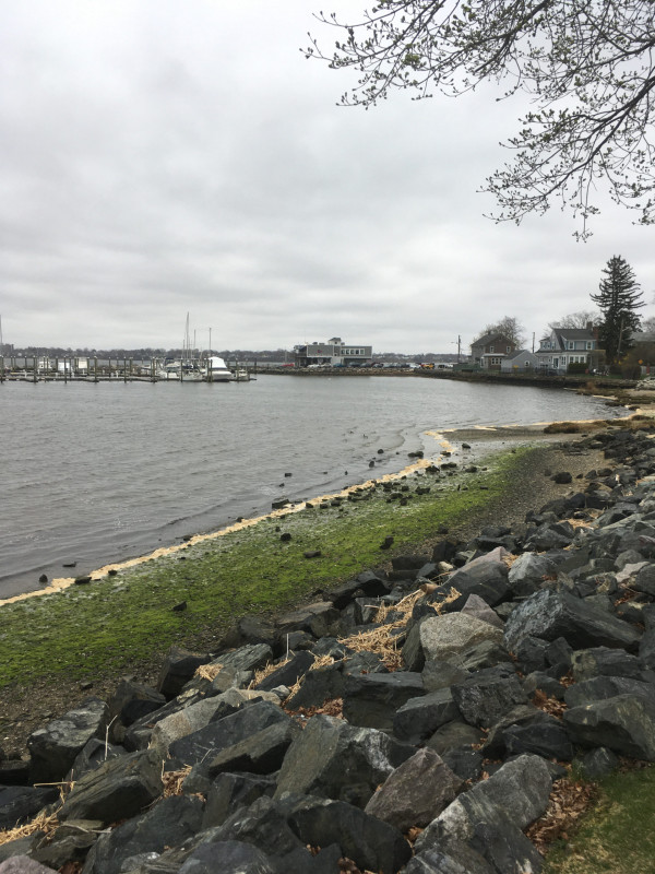
Cranston, RI

Edgewood

Coastal Resilience Report

User Submitted Data

Coastal resources in/directly adjacent to project footprint:

  • beach (sandy)
  • beach (mixed sediment)
  • beach (cobble)

Project elevation:

  • between MHW and mean low water (MLW)

Coastal infrastructure present at site:

  • bulkhead/seawall
  • multi-use path or road

Site stability:

  • unknown

Vegetative cover of project area:

  • sparse

Dominant vegetative type within project area: grasses

Displaced/unanchored and degraded project materials:

  • rocks

Tidal Overview

4 hours 5 minutes before high tide

Data from Providence, State Pier no.1 (2.9 miles away)

Water Level (at time of report): 4:43 pm, 2' MLLW

High Tide (Predicted): 8:51 pm, 4.8' MLLW

High Tide (Observed): 8:48 pm, 5.5' MLLW

Loading NOAA Tide Data…

Observed Predicted water level Report time
Weather Overview

Wind Speed: 13.5 MPH

Wind Direction: NE (42°)

Temperature: 49℉

Rainfall (Calendar Day): 0"

Rainfall (Past 24 Hours): 0"

Click here for full weather details


You must be logged in to post a comment.