Cumberland County
Portland, ME
Coastal Resilience Report
User Submitted Data
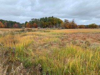
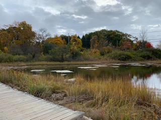
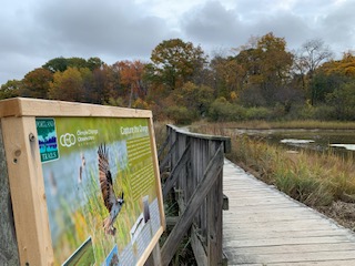
Photo description: Portland Trails Fore River Sanctuary Climate Change Observatory picture post site. Latitude: 43.660406 | Longitude: -70.309083
Coastal resources in/directly adjacent to project footprint:
- salt marsh (estuarine/protected)
Coastal infrastructure present at site:
- multi-use path or road
- other
Type of other obstruction: foot bridge
Site stability:
- stable
Human impacts at project site:
- foot traffic
Tidal Overview
![]() 3 hours 41 minutes before high tide
3 hours 41 minutes before high tide
Data from PORTLAND (3.4 miles away)
Water Level (at time of report): 10:43 am, 3.7' MLLW
High Tide (Predicted): 2:20 pm, 11.3' MLLW
High Tide (Observed): 2:24 pm, 11.1' MLLW
Loading NOAA Tide Data…
■ Observed
■ Predicted water level
⬤ Report time
Weather Overview
Wind Speed: 12.7 MPH
Wind Direction: SSW (200°)
Temperature: 57℉
Rainfall (Calendar Day): 0"
Rainfall (Past 24 Hours): 0.01"
You must be logged in to post a comment.