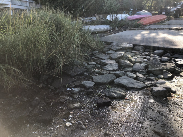
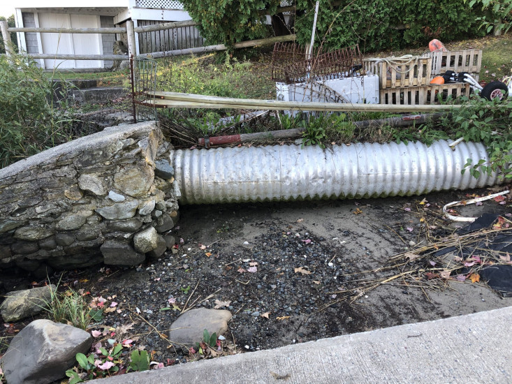

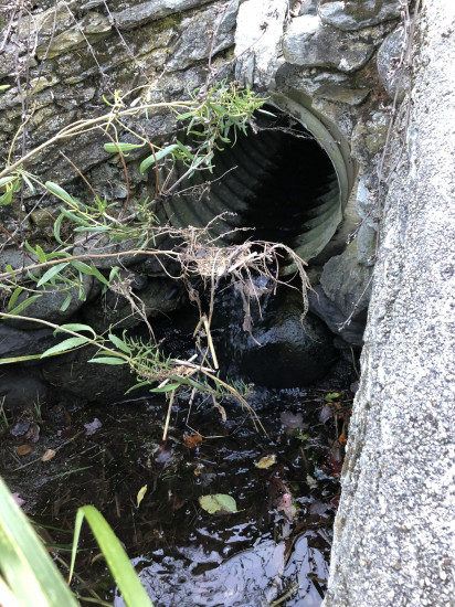
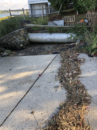
Photo description: Where water drains on the corner of Everett and Sherman on the Kickemuit River
Coastal resources in/directly adjacent to project footprint:
- salt marsh (estuarine/protected)
Project elevation:
- below MLW
Coastal infrastructure present at site:
- culvert
- multi-use path or road
Site stability:
- eroding
Vegetative cover of project area:
- moderate (25-75%)
Dominant vegetative type within project area: grasses
Displaced/unanchored and degraded project materials:
- erosion-control mats/blankets
- rocks
Human impacts at project site:
- runoff
- vehicles
Marine-related impacts:
- wrack
- marine debris
- storm damage
You must be logged in to post a comment.
"Residents on the street tell me that when the rain comes it runs rapidly down the street. I also noticed that there is driving onto the marsh to load boats as seen by the vehicle tracks on the marsh at low tide. the culvert is exposed and was dripping> debris mat material was showing and rocks were moved. The concrete boat ramp is severely eroded. Vehicles are using the ramp to drive onto the marsh. There is also storm debris here from last high tides. This is the most severe erosion of all the access points in the neighborhood."