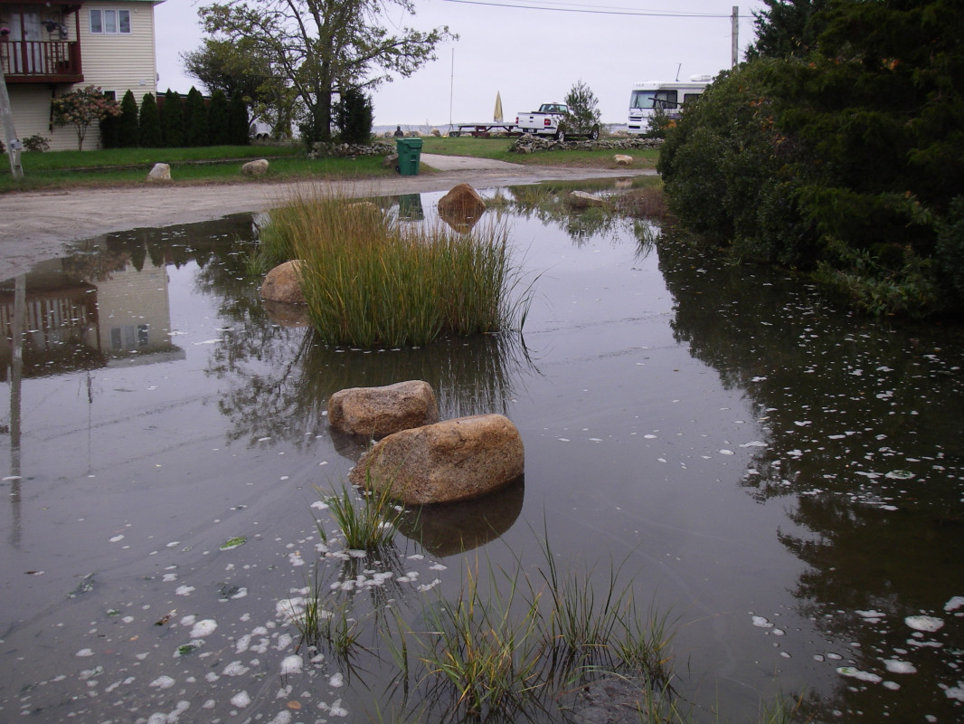
Photo description: marsh formation on closed road
Coastal resources in/directly adjacent to project footprint:
- salt marsh (estuarine/protected)
Project elevation:
- above mean high water (MHW)
Coastal infrastructure present at site:
- multi-use path or road
- other
Type of other obstruction: boulders to block vehicular access
Site stability:
- stable
Vegetative cover of project area:
- sparse (<25%)
Dominant vegetative type within project area: grasses
Displaced/unanchored and degraded project materials:
- none
Human impacts at project site:
- runoff
- foot traffic
Marine-related impacts:
- wrack
You must be logged in to post a comment.
"Coldwell Street has been closed to vehicular traffic for several years and is no longer maintained. Portions of the road flood with tides >1 foot MHHW. Saltmarsh plants (spartina) were noted growing in the former road."