Barnstable County
Sandwich, MA
(Whitecap Path Sandwich Massachusetts)
Storm Report
Impacts Reported
User Submitted Data
Roads
Street/Road: Unspecified
Marinas and Harbors
Buildings
Hazardous Materials
Beach
Coastal Structures
Specific Impacts:
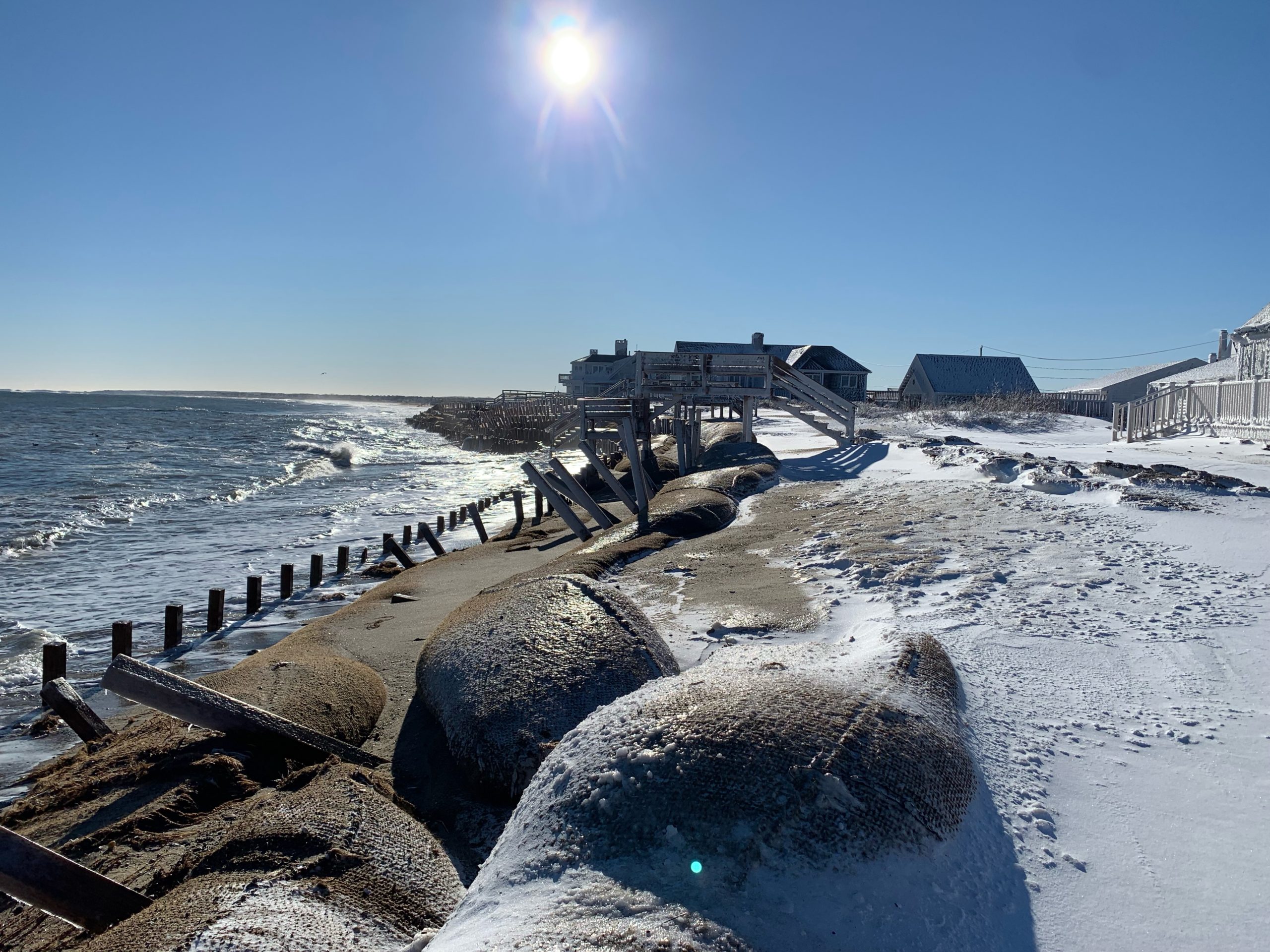
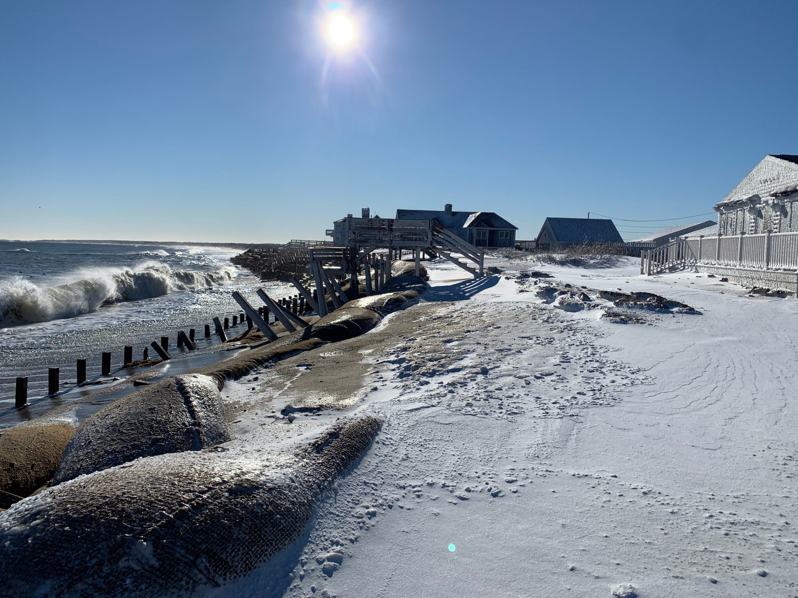
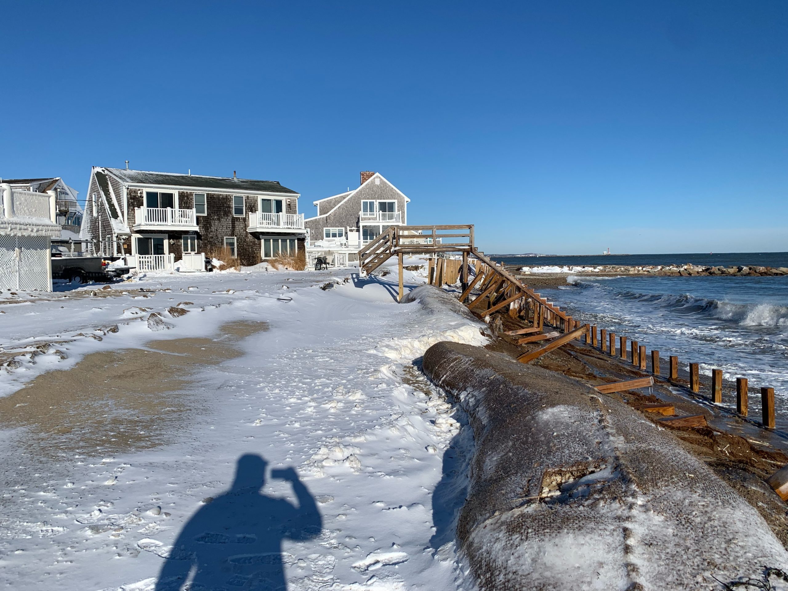
- Damaged stairs/walkovers
Comments: The artificial dune has eroded out from many of the walk overs on white cap path
Foot/Cycling Paths
Natural Resources
Specific Impacts:
- Damaged sand fencing
- Eroded beach
- Eroded dune
Comments: The COIR envelopes have sustained serious damage. Significant erosion to the artificial dune and all sand coverage. The water level is high so it’s hard to tell about beach erosion, but I would assume that has eroded significantly as well.
Current Response
Response:
- None
Tidal Overview
![]() 0 hours 4 minutes after high tide
0 hours 4 minutes after high tide
Data from Sandwich Marina, Cape Cod Canal, east entrance (1 miles away)
High Tide (Predicted): 9:04 am, 10.4' MLLW
Loading NOAA Tide Data…
■ Observed
■ Predicted water level
⬤ Report time
Weather Overview
Wind Speed: 15.5 MPH
Wind Direction: WNW (296°)
Temperature: 15℉
Rainfall (Calendar Day): 0"
Rainfall (Past 24 Hours): 0.22"
You must be logged in to post a comment.
Due to all the snow it is difficult to tell if previous high tides have flooded the area, but it doesn’t look like it right now.