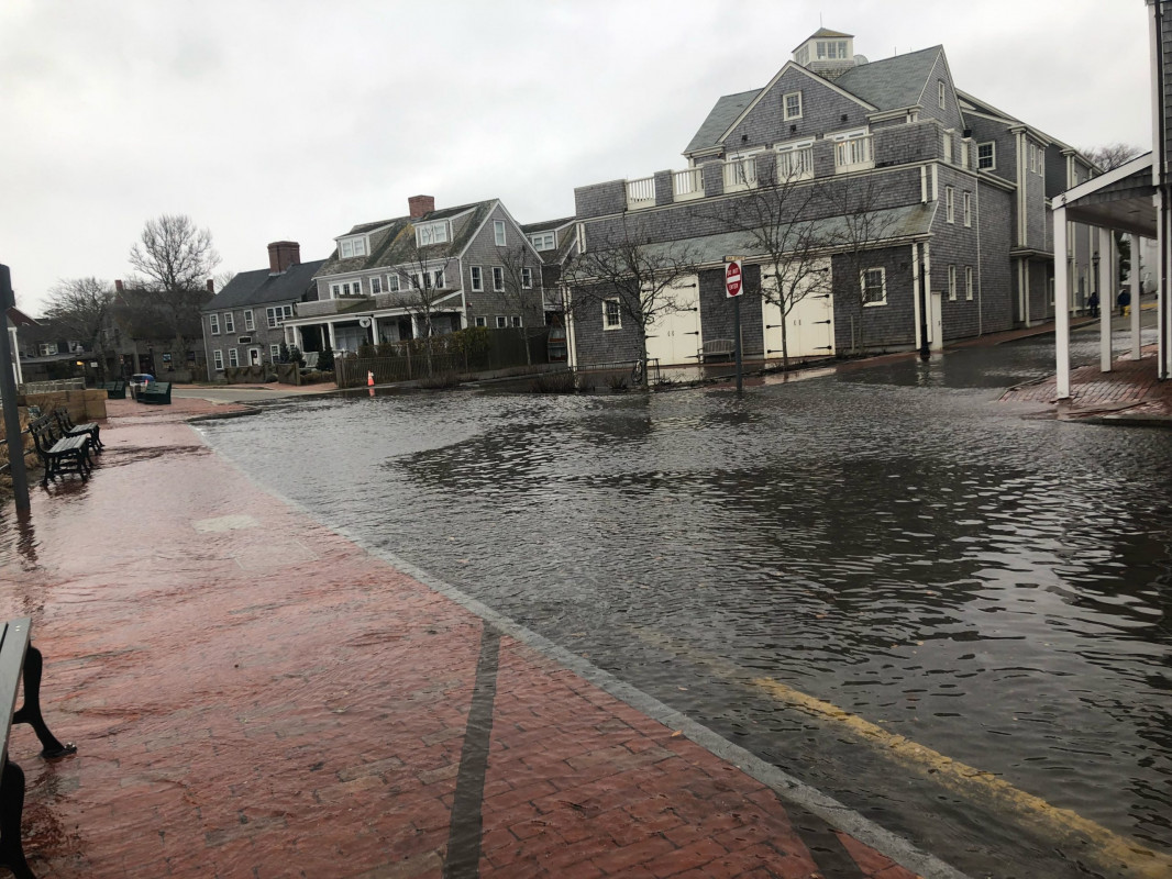
Nantucket, MA (Easy St)

Nantucket County

Impacts Reported


Roads

Specific Impacts:

  • Impassable (flood water)
  • Impassable (overwash)

Comments: Depth appears to be at least 5-6 in at the deepest area. Flood water coming from drains and washing over from the harbor.

Marinas and Harbors
Buildings
Hazardous Materials
Beach

State: Accessible

Coastal Structures
Natural Resources
Current Response

Response:

  • None


01/03/2022 | 12:00 pm

Tidal Overview

0 hours 6 minutes before high tide

Data from NANTUCKET (0.1 miles away)

Water Level (at time of report): 12:00 pm, 5.6'

High Tide (Predicted): 12:09 pm, 4.3'

High Tide (Observed): 12:06 pm, 5.6'

Observed Predicted water level Report time

Weather Overview

Wind Speed: 13.5 MPH

Wind Direction: NNE (25°)

Temperature: 37℉

Rainfall (Calendar Day): 0.69"

Rainfall (Past 24 Hours): 0.07"


You must be logged in to post a comment.