Yarmouth, MA (Bass Hole Beach)

Barnstable County

Impacts Reported


Roads

Street/Road: Unspecified
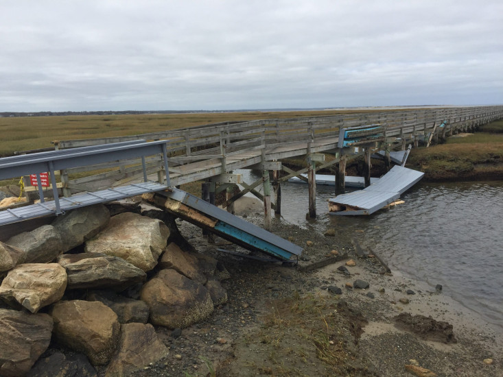
Marinas and Harbors

Specific Impacts:

  • Damaged piers/docks
  • Displaced floats

Displaced floats: 8 floats

Buildings
Hazardous Materials
Beach

State: Inaccessible

Comments: Large wrack deposits

Coastal Structures

Specific Impacts:

  • Splashover
  • Undermined bulkheads/seawalls

Comments: Some washout of revetment material

Natural Resources
Current Response

10/29/2021 | 10:46 am

Tidal Overview

4 hours 30 minutes after high tide

Data from Sesuit Harbor, East Dennis (4.8 miles away)

High Tide (Predicted): 6:16 am, 8.3'

Observed Predicted water level Report time

Weather Overview

Wind Speed: 8.1 MPH

Wind Direction: NE (49°)

Temperature: 53℉

Rainfall (Calendar Day): 0"

Rainfall (Past 24 Hours): 0"

(Click here for full weather details)


You must be logged in to post a comment.