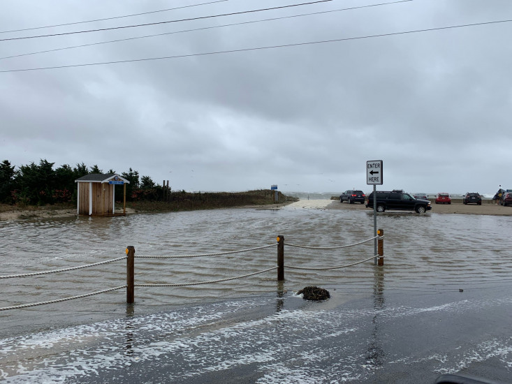
Roads
Street/Road: Unspecified
Specific Impacts:
- Impacted, but passable
Comments: The walk over closest to the jetty was allowing flood water into the parking lot and part of the road.
Marinas and Harbors
Buildings
Hazardous Materials
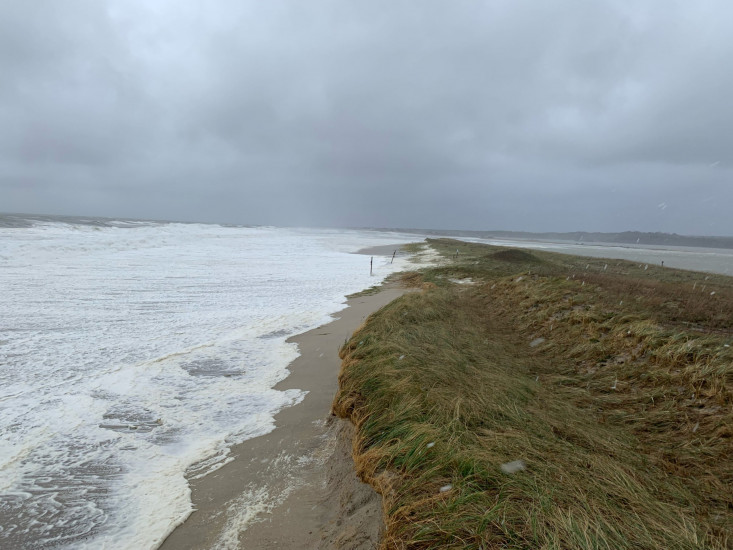
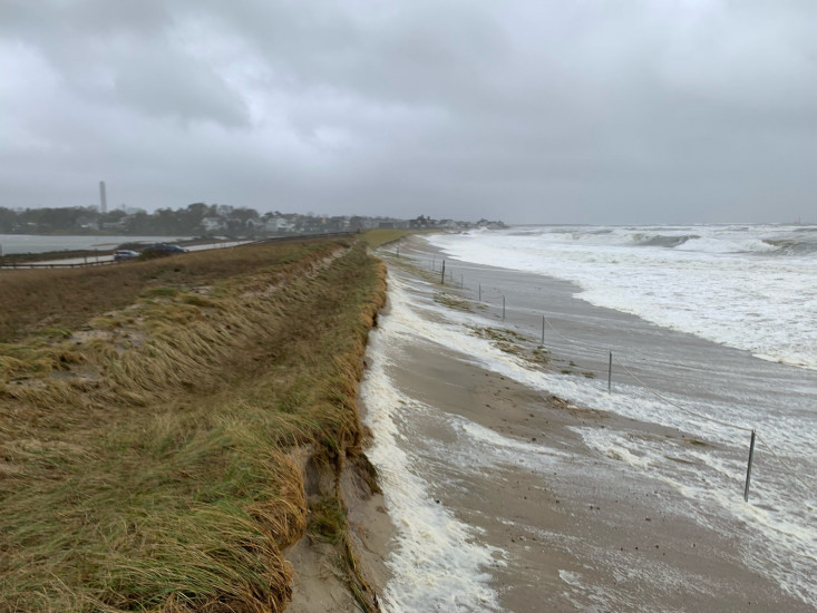
Beach
Natural Resources
Specific Impacts:
- Eroded beach
- Eroded dune
- Overwashed beach/dune
Comments: A significant portion of the barrier beach(west of boardwalk) is being actively over washed
Current Response
Response:
- None
You must be logged in to post a comment.