Roads
Street/Road: Unspecified
Specific Impacts:
- Impassable (flood water)
Comments: Beach access point for vehicles. Now a drop of about 7 feet. No vehicle access for the foreseeable future. Three homes on Esther's Island now have no access
Marinas and Harbors
Buildings
Hazardous Materials
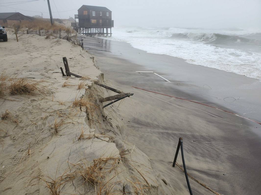
Beach
State: Y
Comments: Sever erosion
Coastal Structures
Foot/Cycling Paths
Natural Resources
Specific Impacts:
- Eroded beach
- Eroded dune
Current Response
Response:
- None
You must be logged in to post a comment.