Nantucket, MA (289 Hummock pond road.)

Nantucket County

Impacts Reported


Roads

Street/Road: Unspecified

Specific Impacts:

  • Impacted, but passable

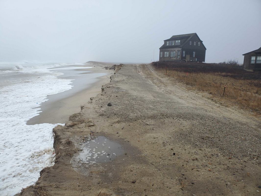
Comments: House on cribbing since move in September. Private access road and bluff continue to erode. 12 to 13 yards to cribbing

Marinas and Harbors
Buildings
Hazardous Materials
Beach

State: Inaccessible

Comments: Continued erosion

Coastal Structures
Natural Resources

Specific Impacts:

  • Eroded bank/bluff

Current Response

02/02/2021 | 10:46 am

Tidal Overview

4 hours 8 minutes before high tide

Data from NANTUCKET (4.1 miles away)

Water Level (at time of report): 10:46 am, 3.1'

High Tide (Predicted): 3:42 pm, 3.3'

High Tide (Observed): 2:54 pm, 5.6'

Observed Predicted water level Report time

Weather Overview

Wind Speed: 18.3 MPH

Wind Direction: N (360°)

Temperature: 43℉

Rainfall (Calendar Day): 0"

Rainfall (Past 24 Hours): 1.05"

(Click here for full weather details)


You must be logged in to post a comment.