Plymouth County
Kingston, MA
Coastal Resilience Report
User Submitted Data
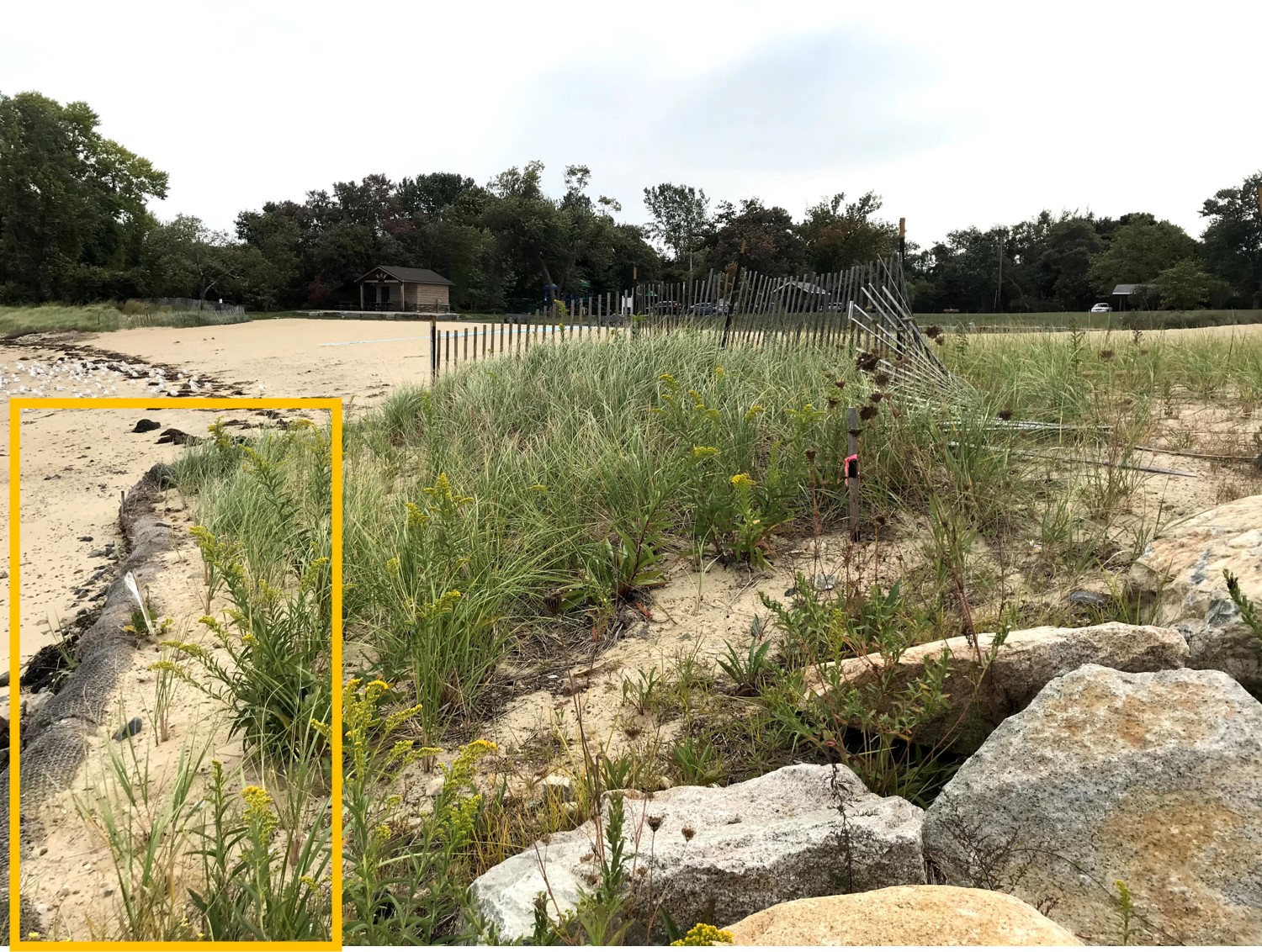
Photo description: GB-NLS-3: Upper coir log/toe of dune. (Same photo used for GB-NLS-4 transects).
Coastal resources in/directly adjacent to project footprint:
- dune
Project elevation:
- above mean high water (MHW)
Coastal infrastructure present at site:
- groin/jetty
- multi-use path or road
Site stability:
- stable
Vegetative cover of project area:
- moderate
Dominant vegetative type within project area: grasses
Displaced/unanchored and degraded project materials:
- none
Marine-related impacts:
- wrack
Tidal Overview
![]() 5 hours 39 minutes after high tide
5 hours 39 minutes after high tide
Data from Plymouth (2.8 miles away)
High Tide (Predicted): 4:15 am, 10.1' MLLW
Loading NOAA Tide Data…
■ Observed
■ Predicted water level
⬤ Report time
Weather Overview
Wind Speed: 5.3 MPH
Wind Direction: NW (311°)
Temperature: 70℉
Rainfall (Calendar Day): 0"
Rainfall (Past 24 Hours): 0"
You must be logged in to post a comment.
GB-NLS-3: Upper coir log/toe of dune. (Same photo used for GB-NLS-4 transect). Note, only one maintained coir log as of May 2020.