
Roads
Street/Road: Unspecified
Marinas and Harbors
Buildings
Hazardous Materials
Beach
State: Y
Comments: Moderate erosion
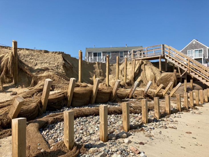
Coastal Structures
Specific Impacts:
- Damaged stairs/walkovers
Comments: Substantial damage to erosion control structures including sand filled coir bags and support timbers
Natural Resources
Specific Impacts:
- Damaged sand fencing
- Eroded beach
- Eroded dune
- Eroded bank/bluff
Comments: Moderate erosion of protective berm/bank in front of houses.
Current Response
Response:
- None
You must be logged in to post a comment.
"Existing erosion control protected structures but have been severely degraded and compromised. Remnants of sand filled coir bags scattered over beach down drift"