Barnstable County
Sandwich, MA (Town Neck Beach, White Cap Path)
Storm Report
Impacts Reported
Roads
Street/Road: Unspecified
Marinas and Harbors
Buildings
Hazardous Materials
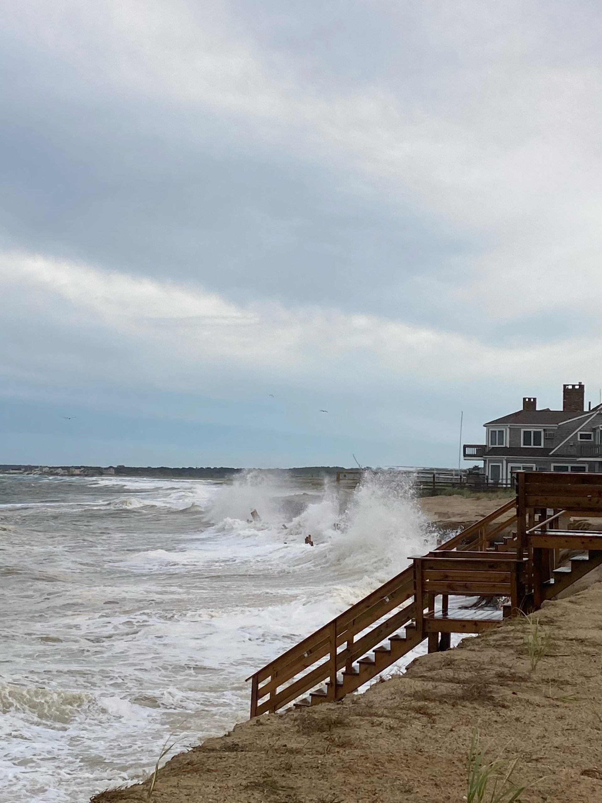
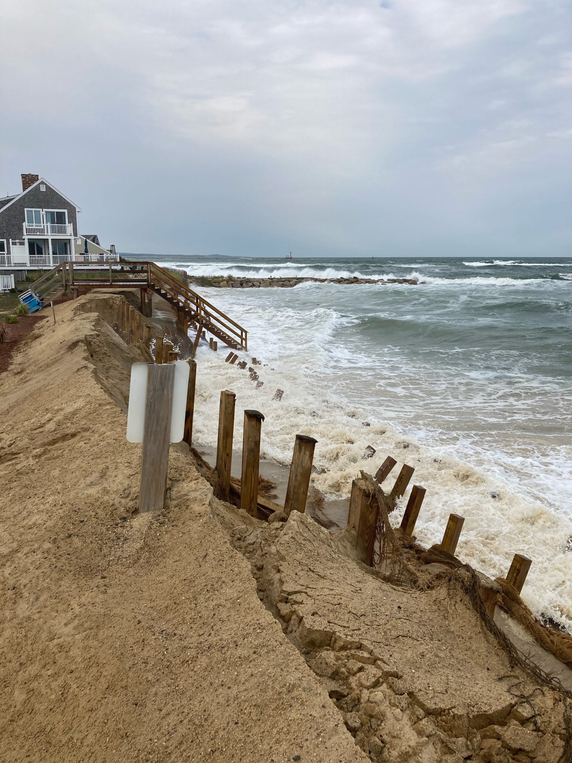
Beach
State: Y
Comments: Moderate erosion
Coastal Structures
Specific Impacts:
- Damaged stairs/walkovers
Comments: Undermined and damaged coconut husk material, stairs, other wooden support structures
Foot/Cycling Paths
Natural Resources
Specific Impacts:
- Damaged sand fencing
- Eroded beach
- Eroded dune
Comments: Much of the sacrificial sand on created berm has been lost.
Current Response
Response:
- None
Tidal Overview
![]() 0 hours 44 minutes after high tide
0 hours 44 minutes after high tide
Data from Sandwich Marina, Cape Cod Canal, east entrance (1 miles away)
High Tide (Predicted): 3:53 pm, 10.3' MLLW
■ Observed
■ Predicted water level
⬤ Report time
Weather Overview
Wind Speed: 16.2 MPH
Wind Direction: NNW (331°)
Temperature: 62℉
Rainfall (Calendar Day): 0"
Rainfall (Past 24 Hours): 0"
You must be logged in to post a comment.