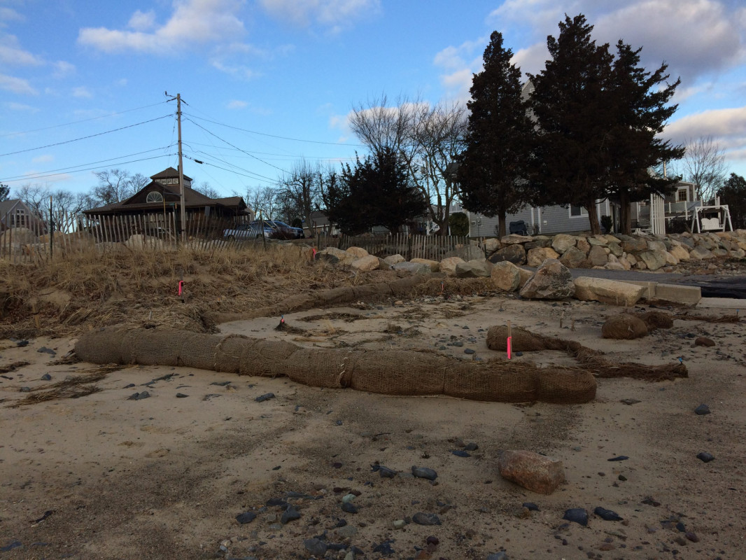
Photo description: GB-NLS-3: Upper coir log/high marsh/toe of dune. (Same photo used for GB-NLS-2 and GB-NLS-4 transects). No high marsh vegetation remaining.
Coastal resources in/directly adjacent to project footprint:
- dune
- salt marsh (fronting beach)
Project elevation:
- above mean high water (MHW)
Coastal infrastructure present at site:
- groin/jetty
- multi-use path or road
Site stability:
- eroding
Vegetative cover of project area:
- sparse (<25%)
Dominant vegetative type within project area: grasses
Displaced/unanchored and degraded project materials:
- coir rolls
- other
Other displaced/unanchored materials: Additional damage to upper coir log
Marine-related impacts:
- storm damage
You must be logged in to post a comment.
"GB-NLS-3: Upper coir log/high marsh/toe of dune. (Same photo used for GB-NLS-2 and GB-NLS-4 transects). No high marsh vegetation remaining."