Photo description: Collins Cove fringing salt marsh
Coastal resources in/directly adjacent to project footprint:
- beach (mixed sediment)
- salt marsh (estuarine/protected)
- intertidal (mud)
Project elevation:
- above mean high water (MHW)
- between MHW and mean low water (MLW)
Coastal infrastructure present at site:
- revetment
- multi-use path or road
Site stability:
- stable
Vegetative cover of project area:
- sparse (<25%)
Dominant vegetative type within project area: grasses
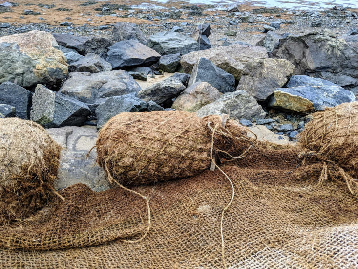
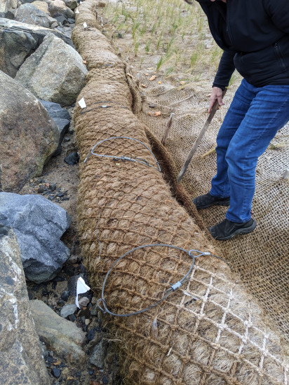
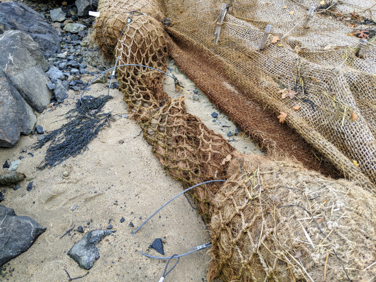
Displaced/unanchored and degraded project materials:
- coir rolls
- erosion-control mats/blankets
- other
Other displaced/unanchored materials: coir rolls ripped at cables and sand washed out from under blanket
Marine-related impacts:
- wrack
- storm damage
You must be logged in to post a comment.
"issue with coir rolls, but grasses well rooted and spreading"