Plymouth, MA (Nameloc Rd Plymouth)
Plymouth County
Storm Report
03/13/2018 | 11:39 am
Impacts Reported
Roads
Street/Road: Unspecified
Marinas and Harbors
Buildings
Hazardous Materials
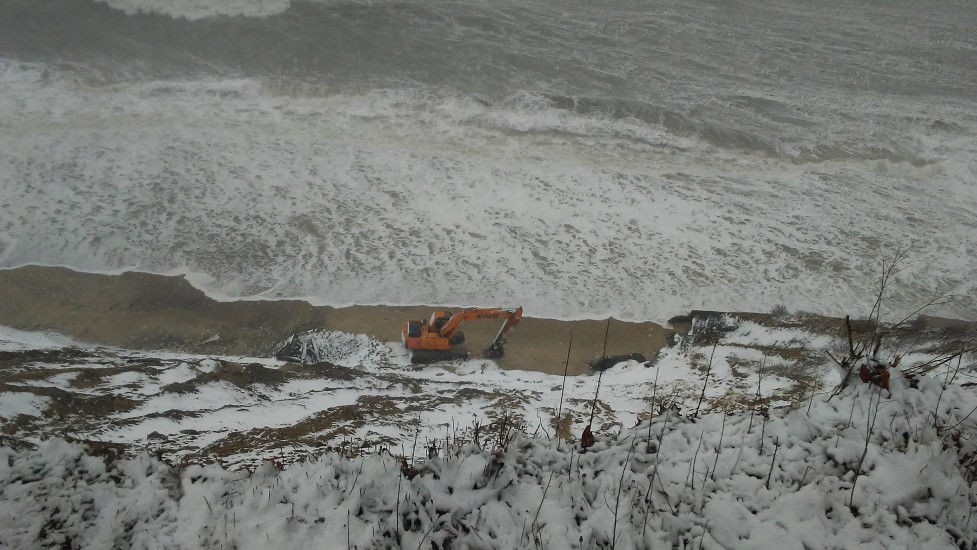
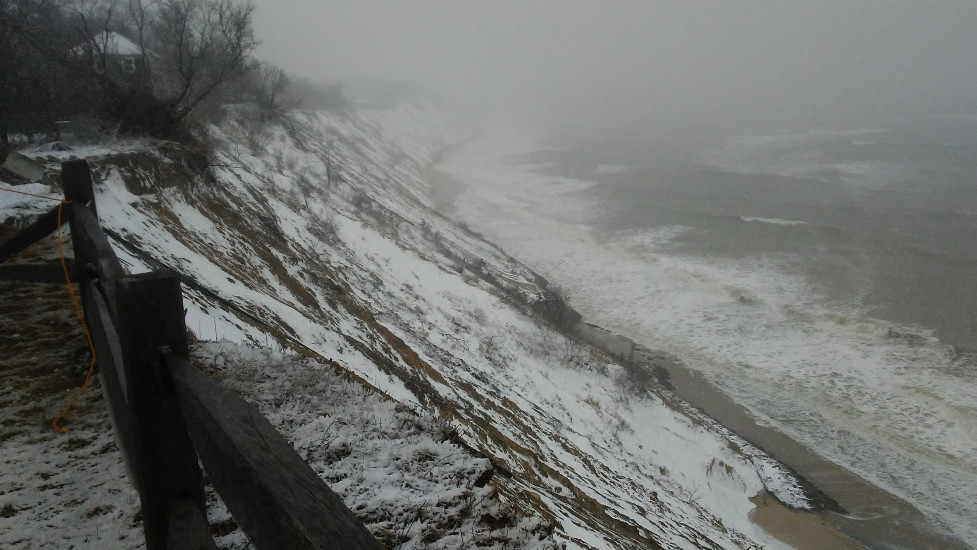
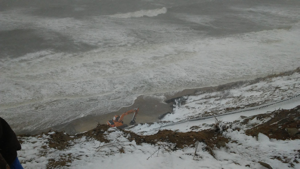
Beach
State: Inaccessible
Coastal Structures
Natural Resources
Specific Impacts:
- Eroded beach
- Eroded bank/bluff
Current Response
You must be logged in to post a comment.