Barnstable County
Truro, MA
(Truro- Ballston Beach)
Storm Report
User Submitted Data
Roads
Street/Road: Unspecified
Specific Impacts:
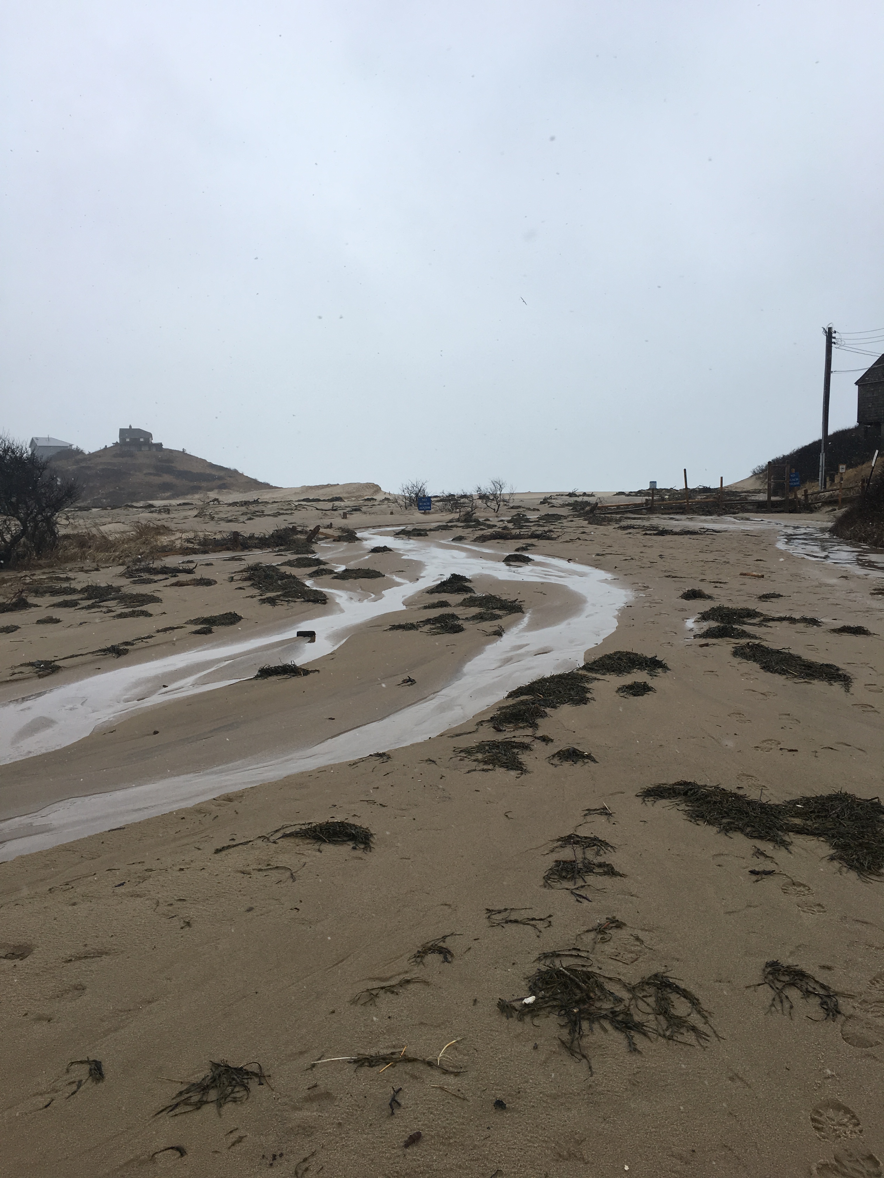
- Impassable (overwash)
Comments: Parking lot is closed, was totally flooded at high tide and during 3/3 storm.
Marinas and Harbors
Buildings
Specific Impacts:
- Water flow around or under buildings
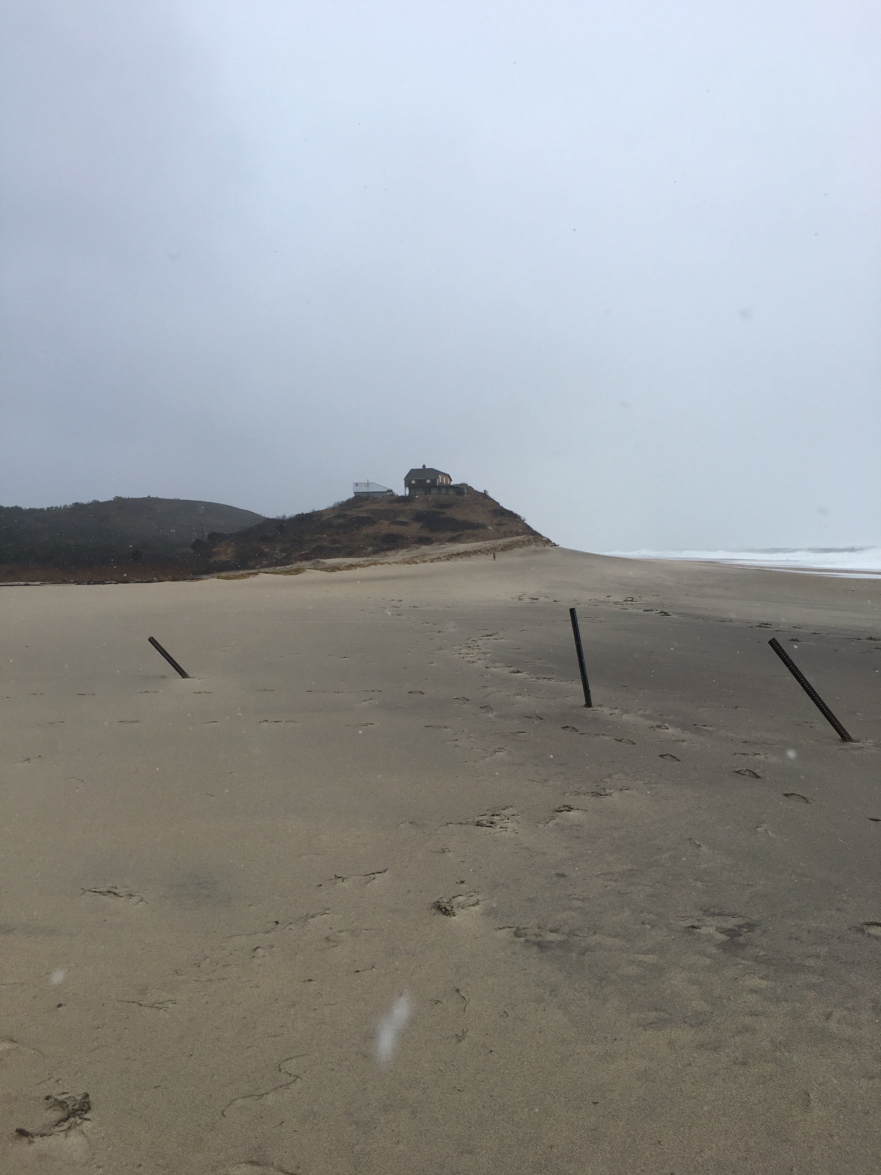
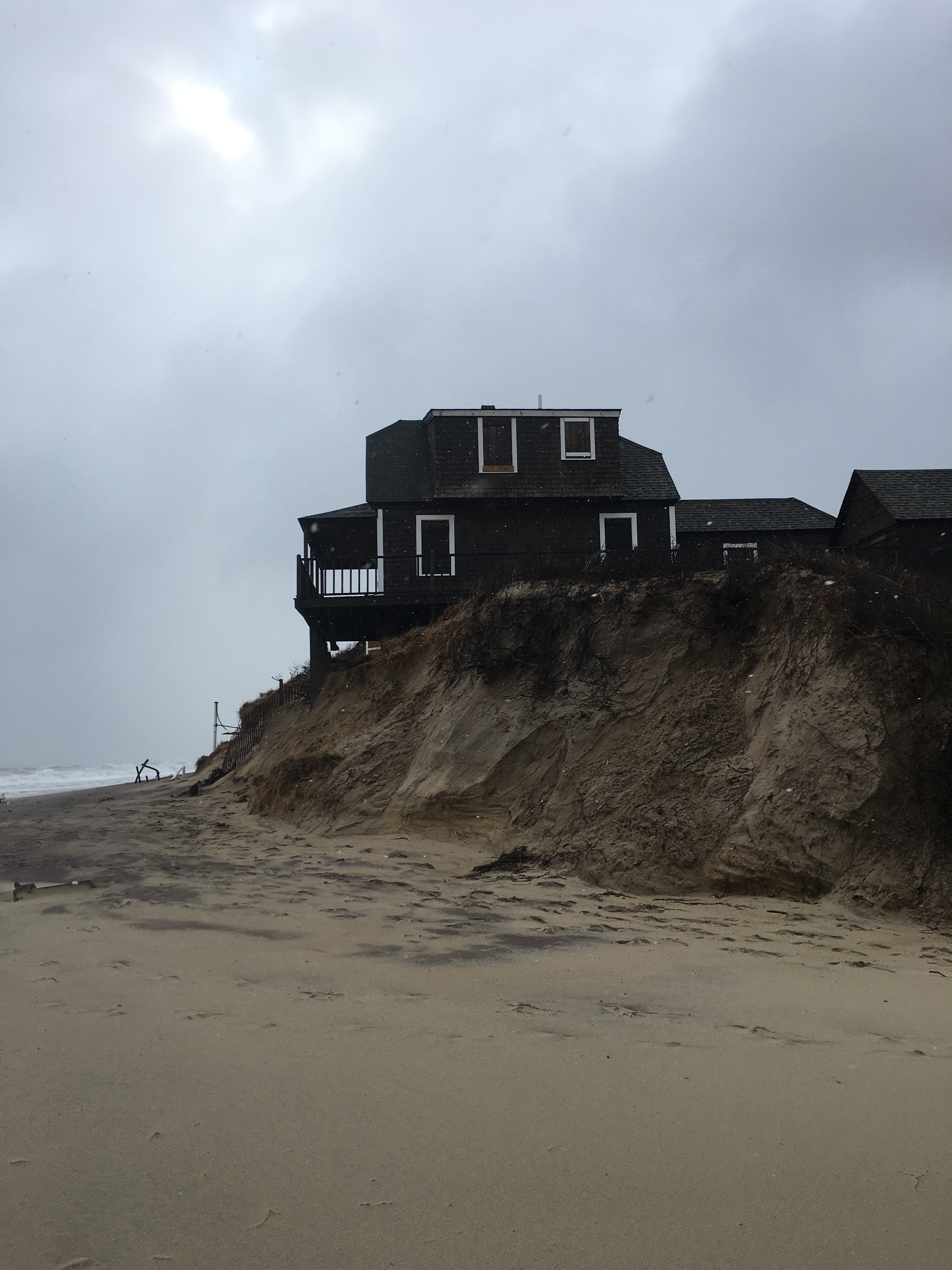
Comments: It appears that the bluff eroded underneath several houses on the shoreline. There were 2-3 exposed pipes- I'm unclear what they were (perhaps wells).
Hazardous Materials
Beach
Coastal Structures
Foot/Cycling Paths
Natural Resources
Specific Impacts:
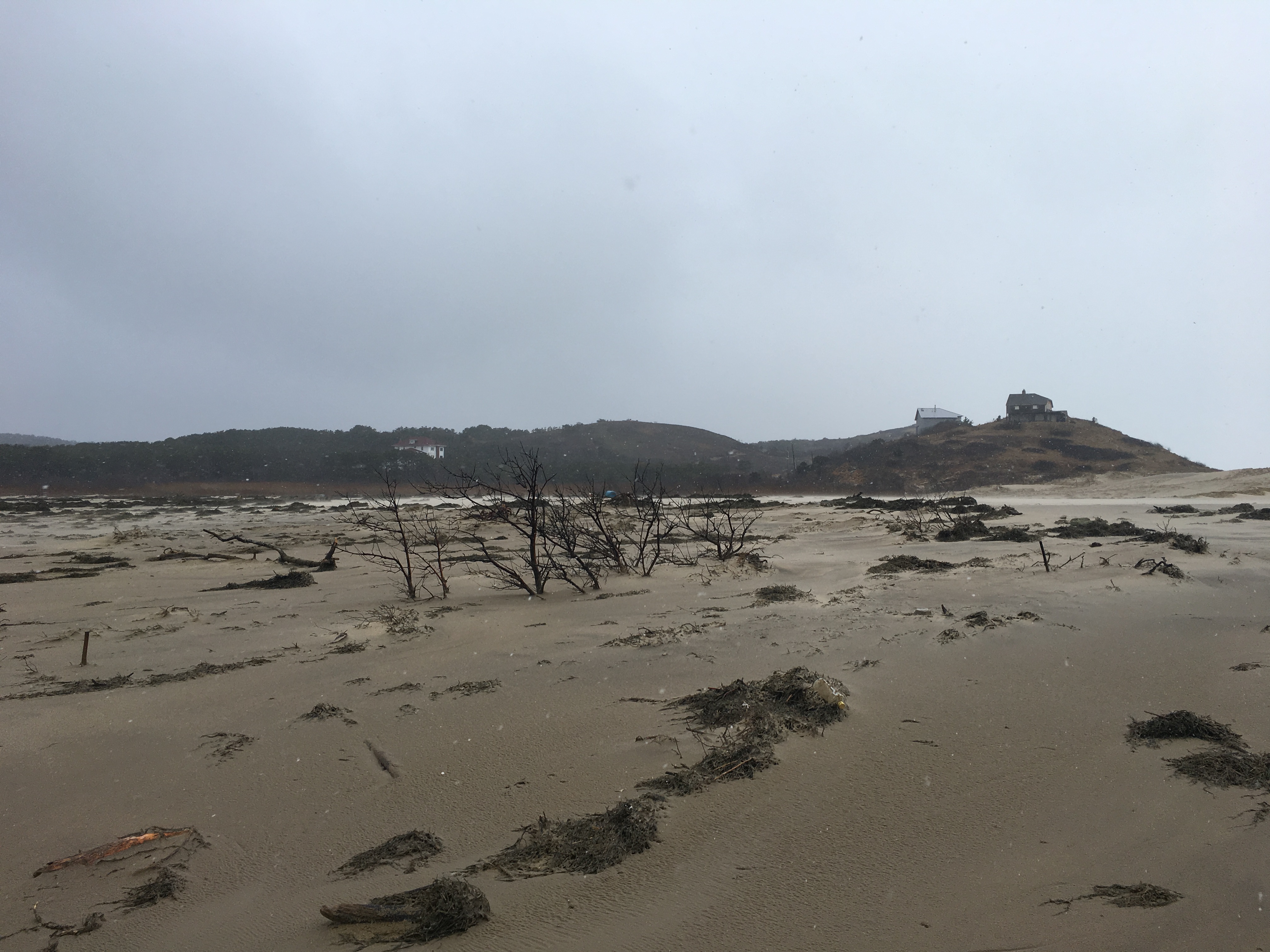
- Eroded beach
- Eroded dune
- Eroded bank/bluff
- Overwashed beach/dune
- Wrack on wetlands
Comments: The initial barrier breach occurred in 2013, but tidal flow and waves went through the breach during this storm and the storm on 3/3. NPS has mapped the overwash width, analysis pending. It appears that water flowed up through the breach, to the parking lot and upland wetlands, depositing sand and leaving wrack behind.
Current Response
Tidal Overview
![]() 5 hours 41 minutes after high tide
5 hours 41 minutes after high tide
Data from Provincetown (9.3 miles away)
High Tide (Predicted): 3:49 am, 9.5' MLLW
Loading NOAA Tide Data…
Weather Overview
Wind Speed: 22.4 MPH
Wind Direction: NW (318°)
Temperature: 34℉
Rainfall (Calendar Day): 0.001"
Rainfall (Past 24 Hours): 0.9"