Plymouth County
Marshfield, MA
(Brant Rock)
Storm Report
Impacts Reported
User Submitted Data
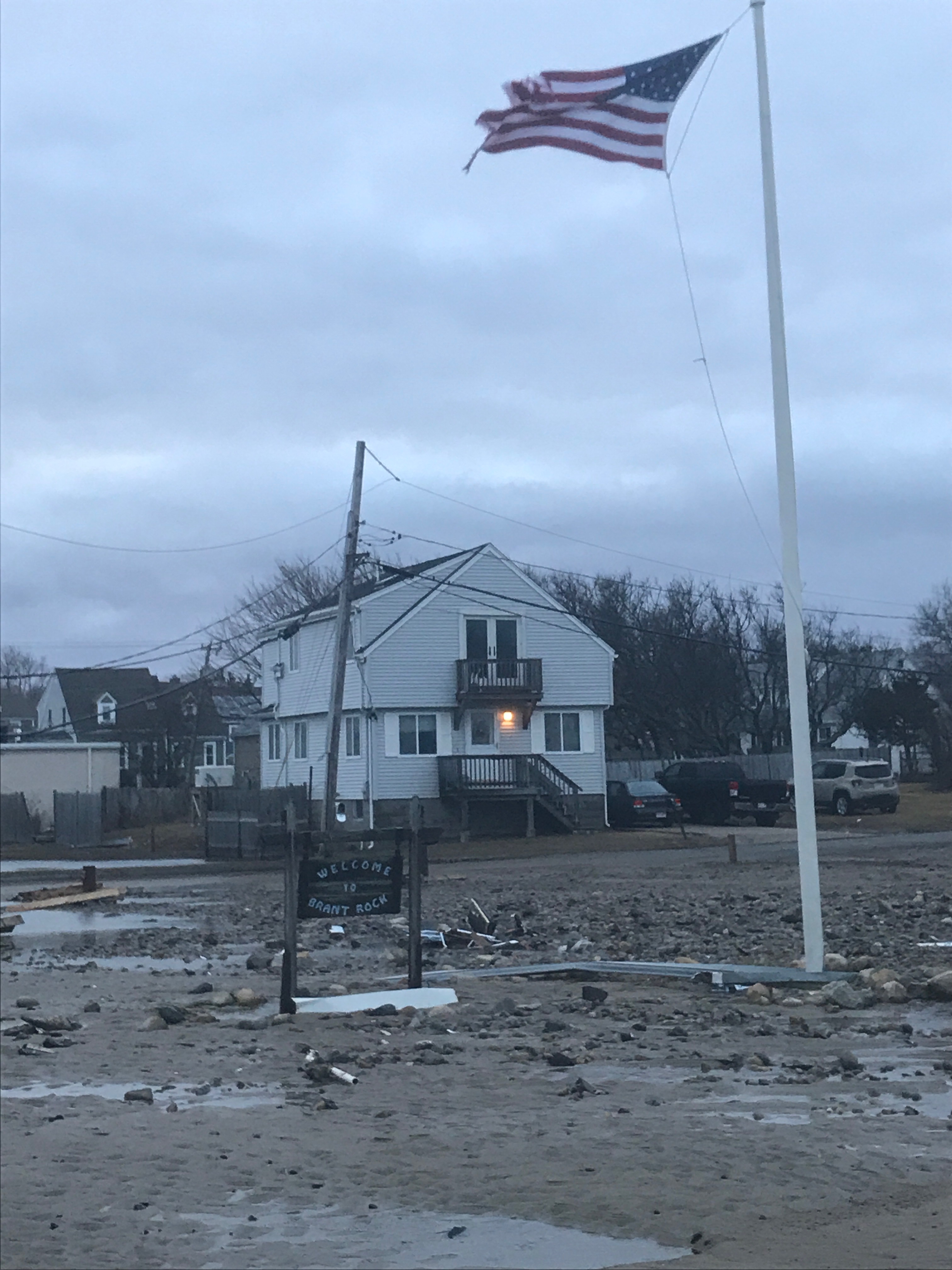
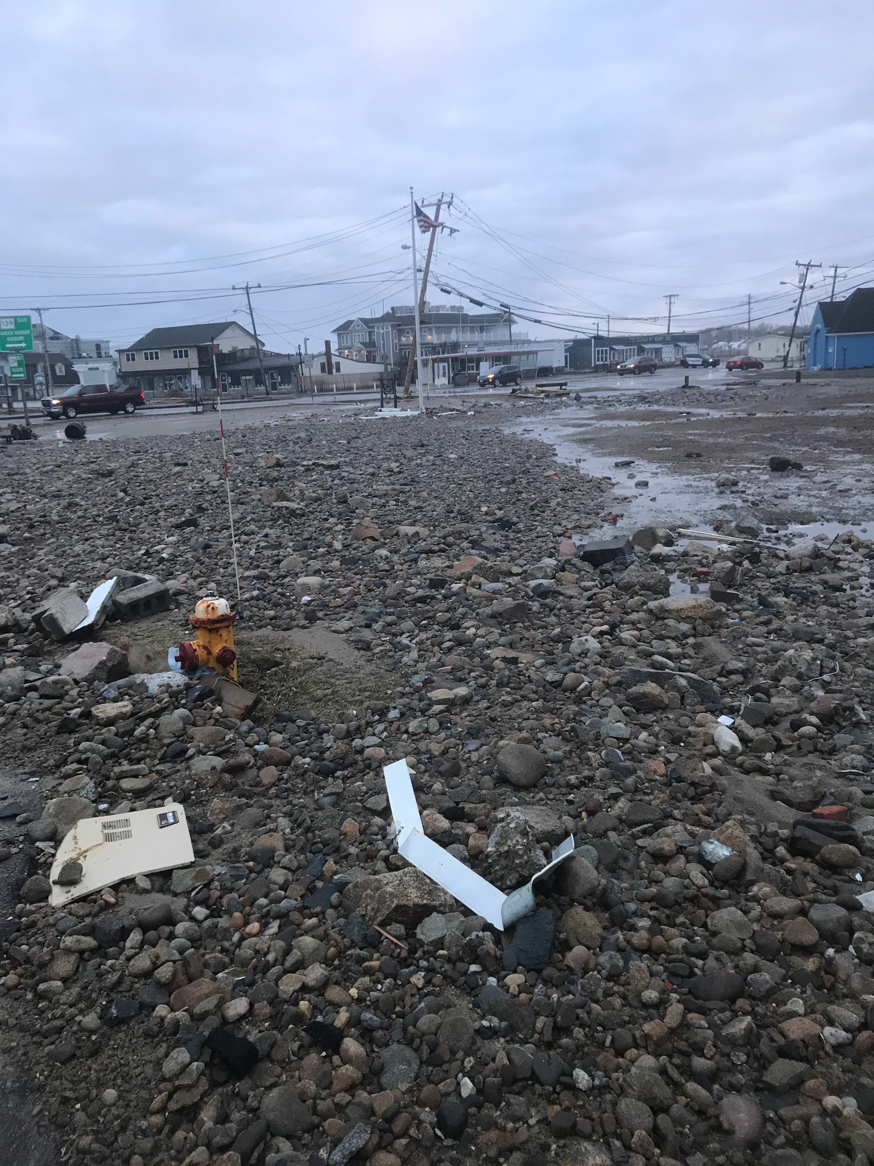
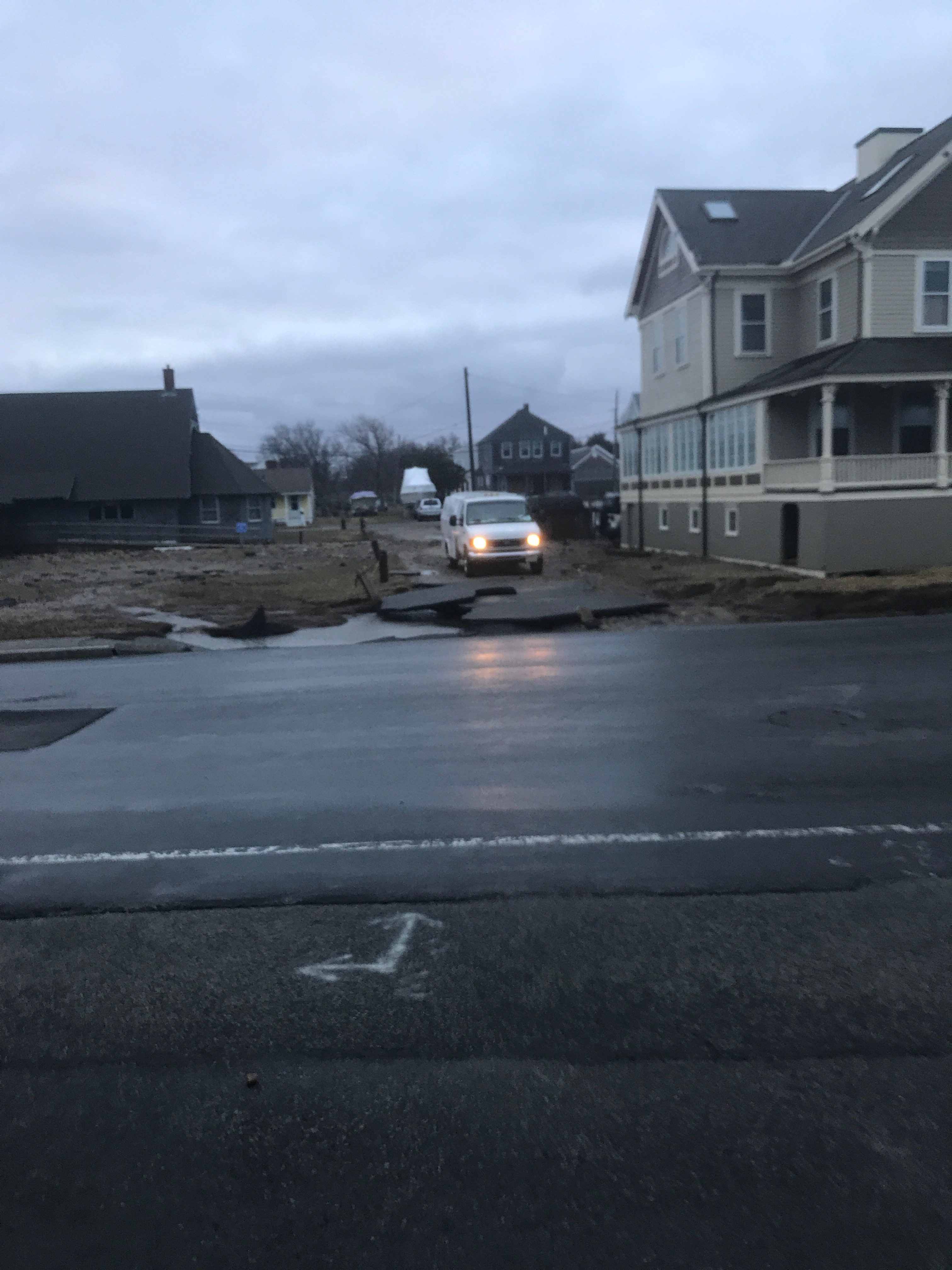
Roads
Street/Road: Unspecified
Specific Impacts:
- Splashover
- Impacted, but passable
Marinas and Harbors
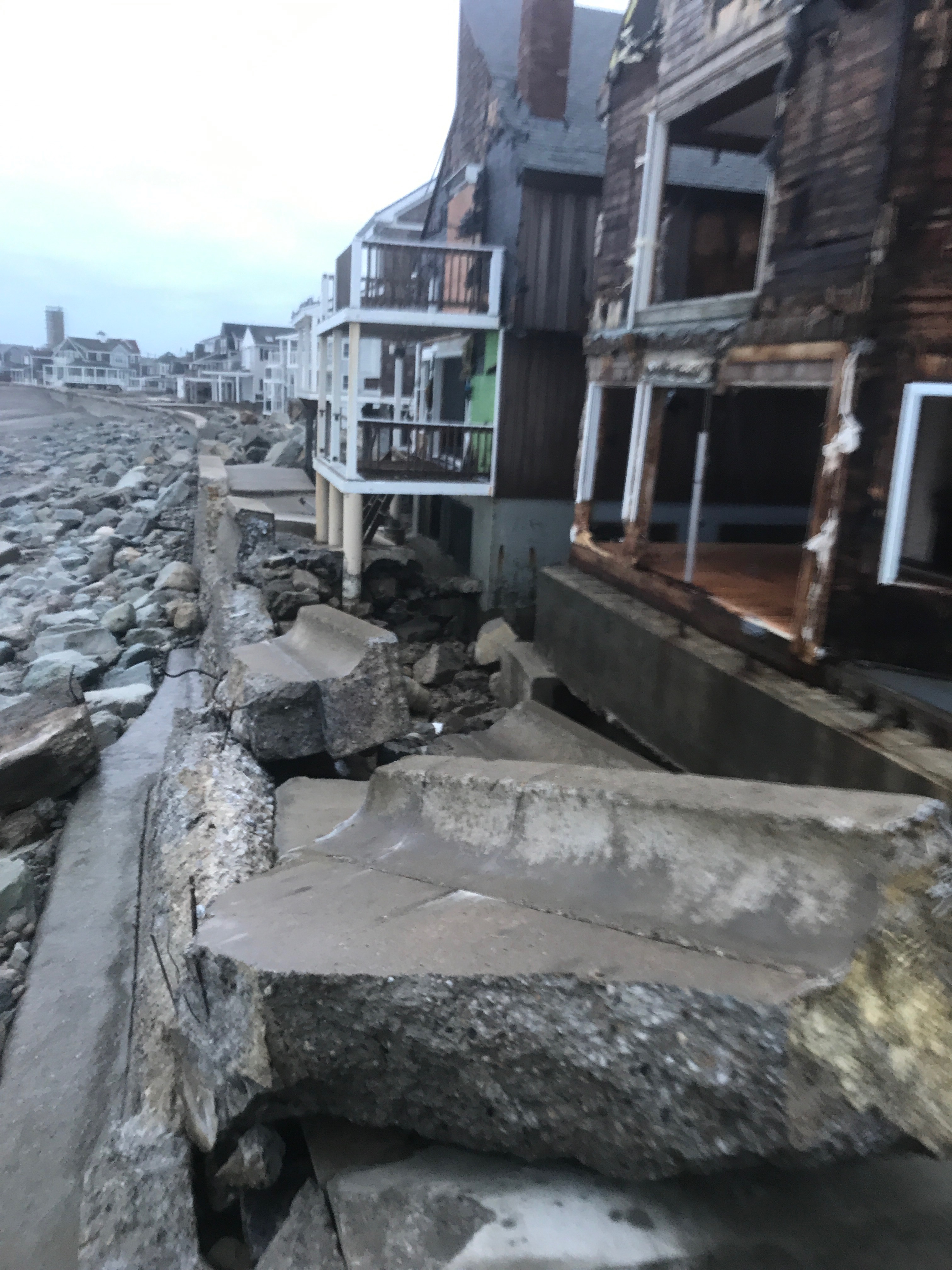
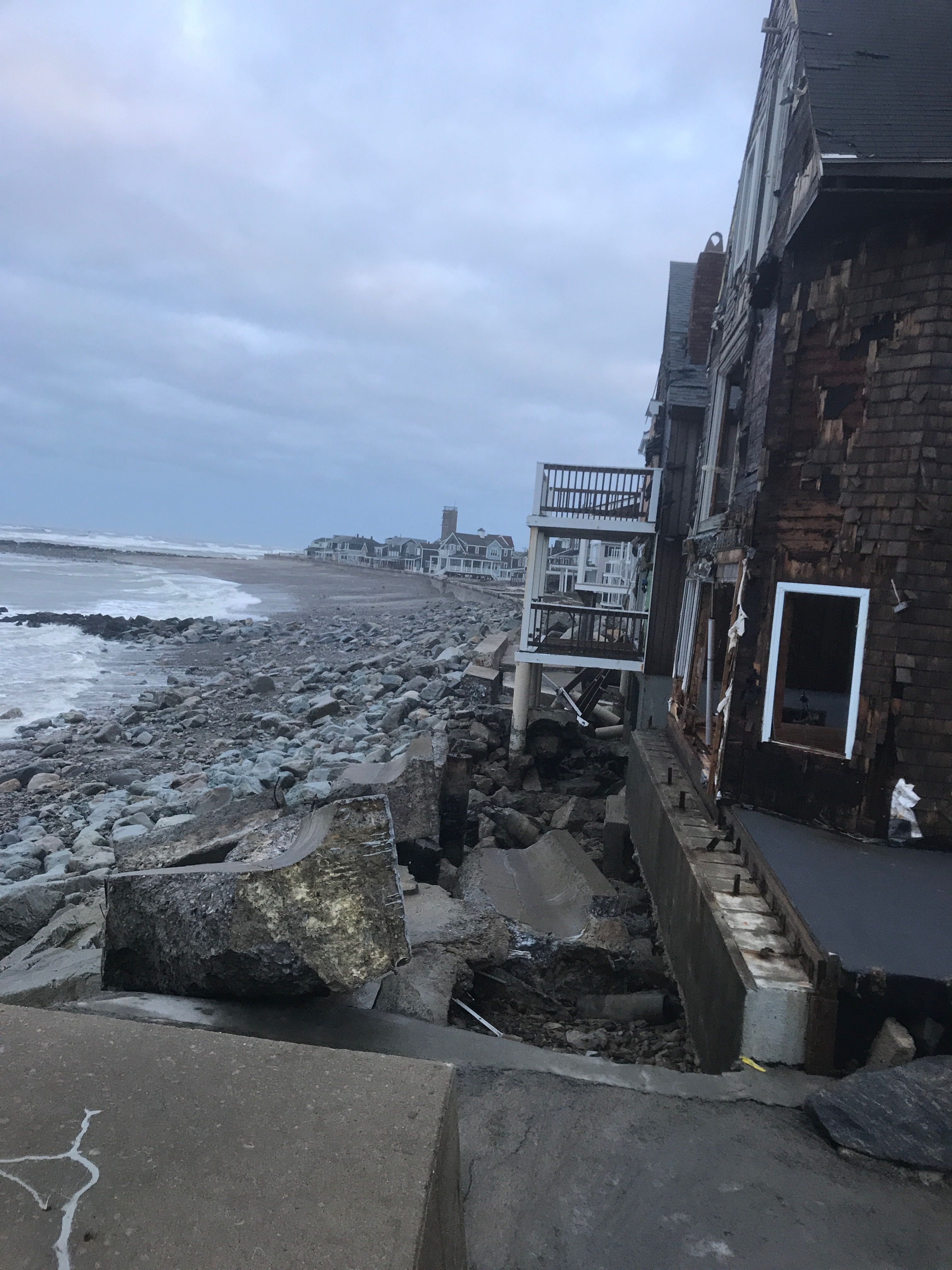
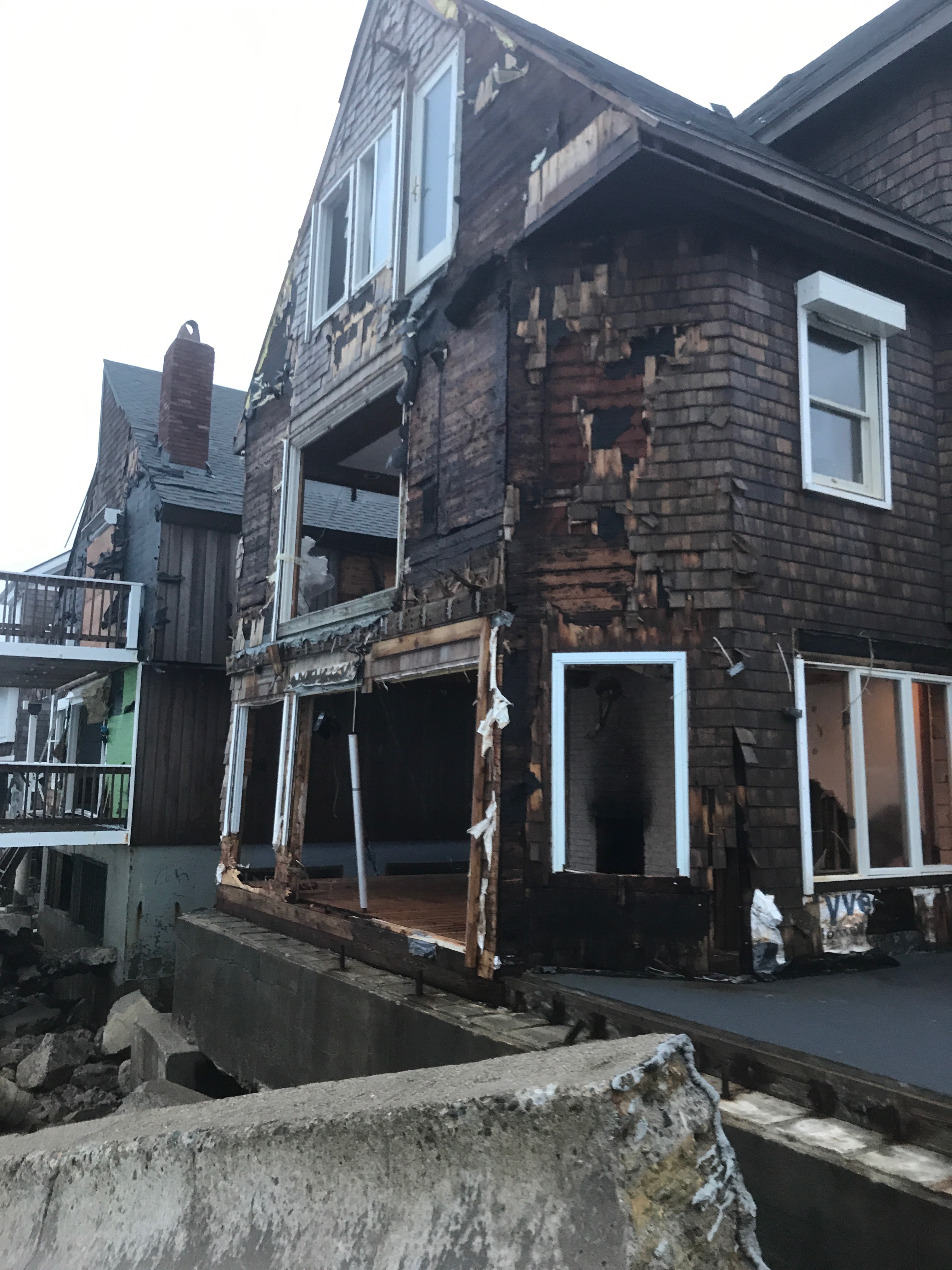
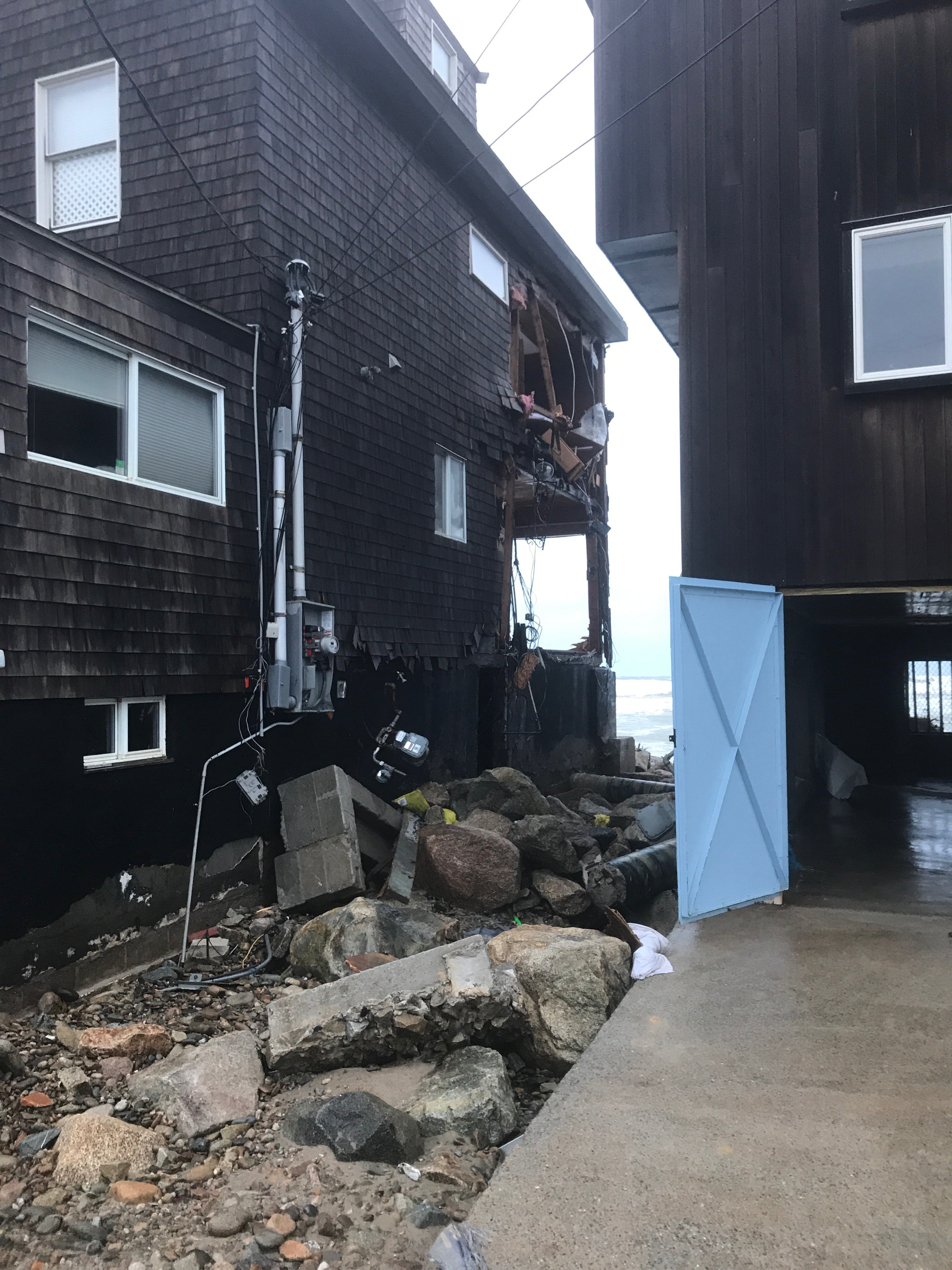
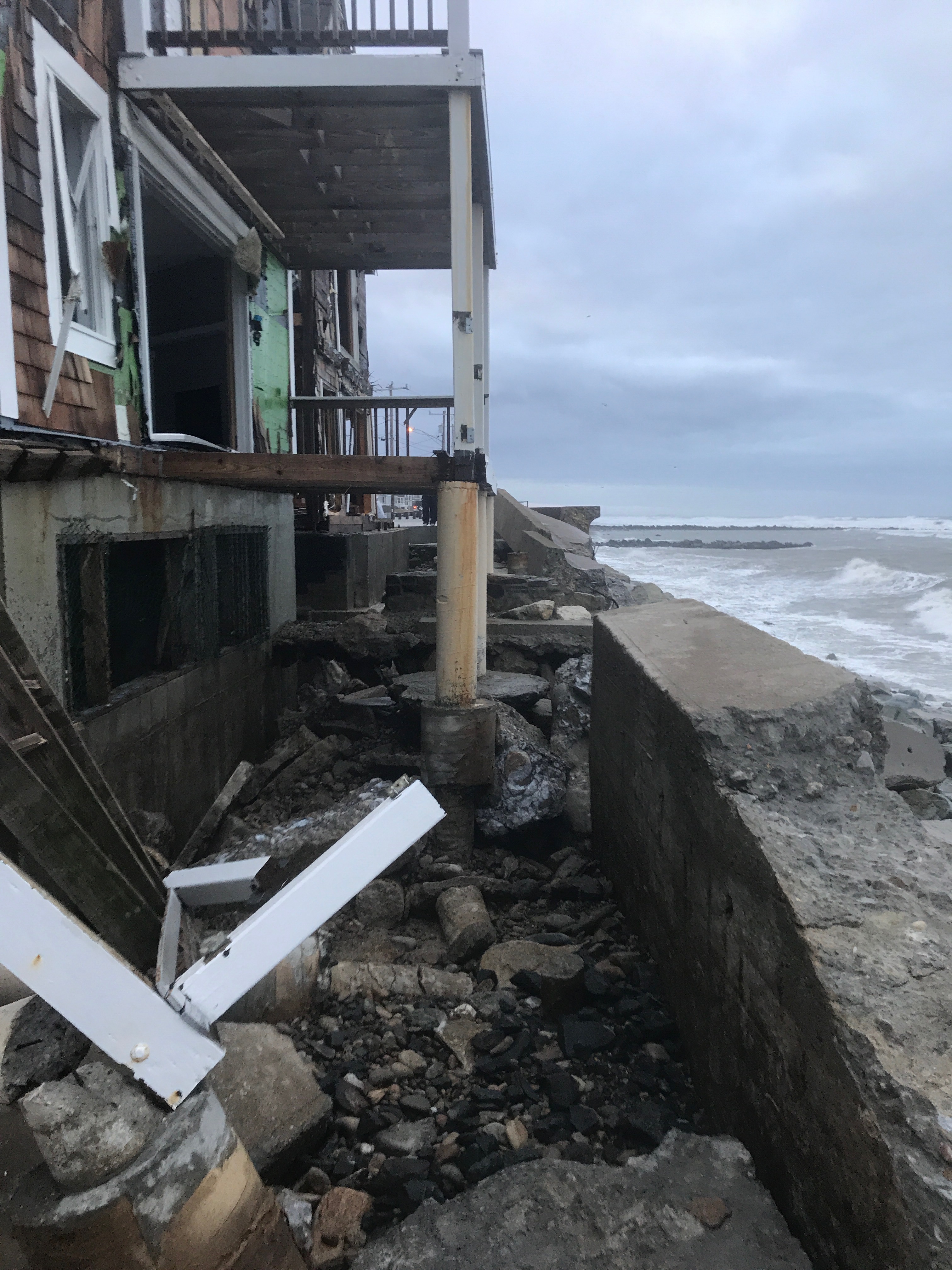
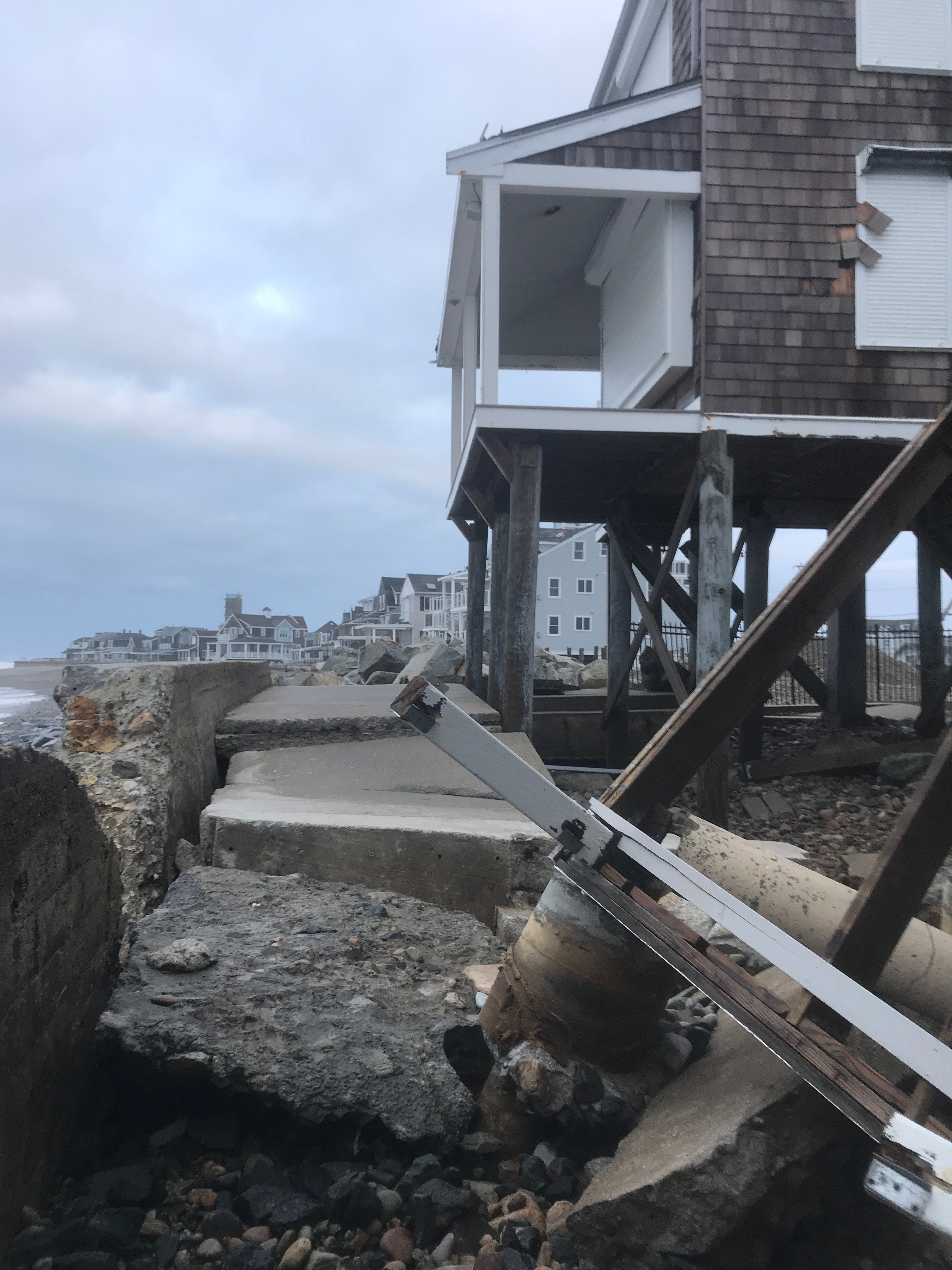
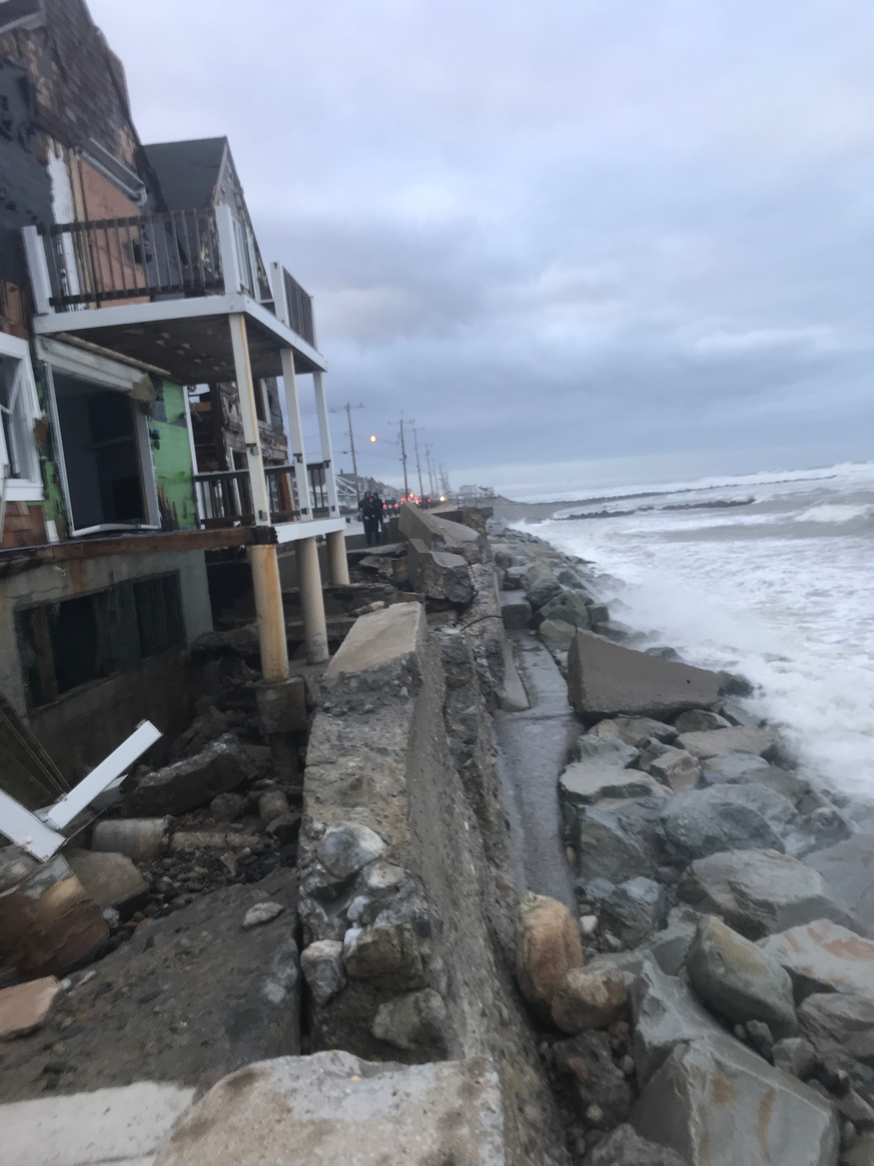
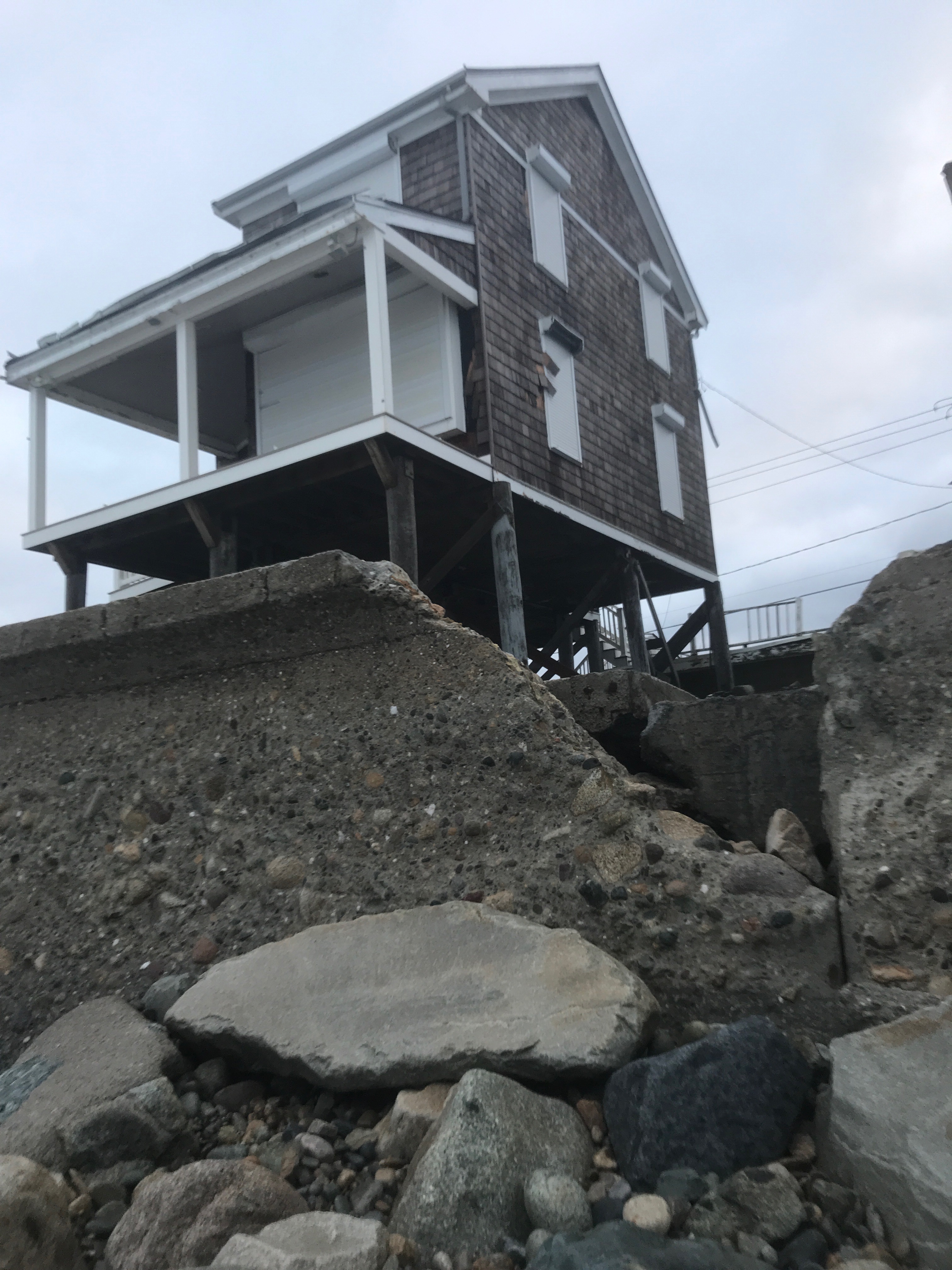
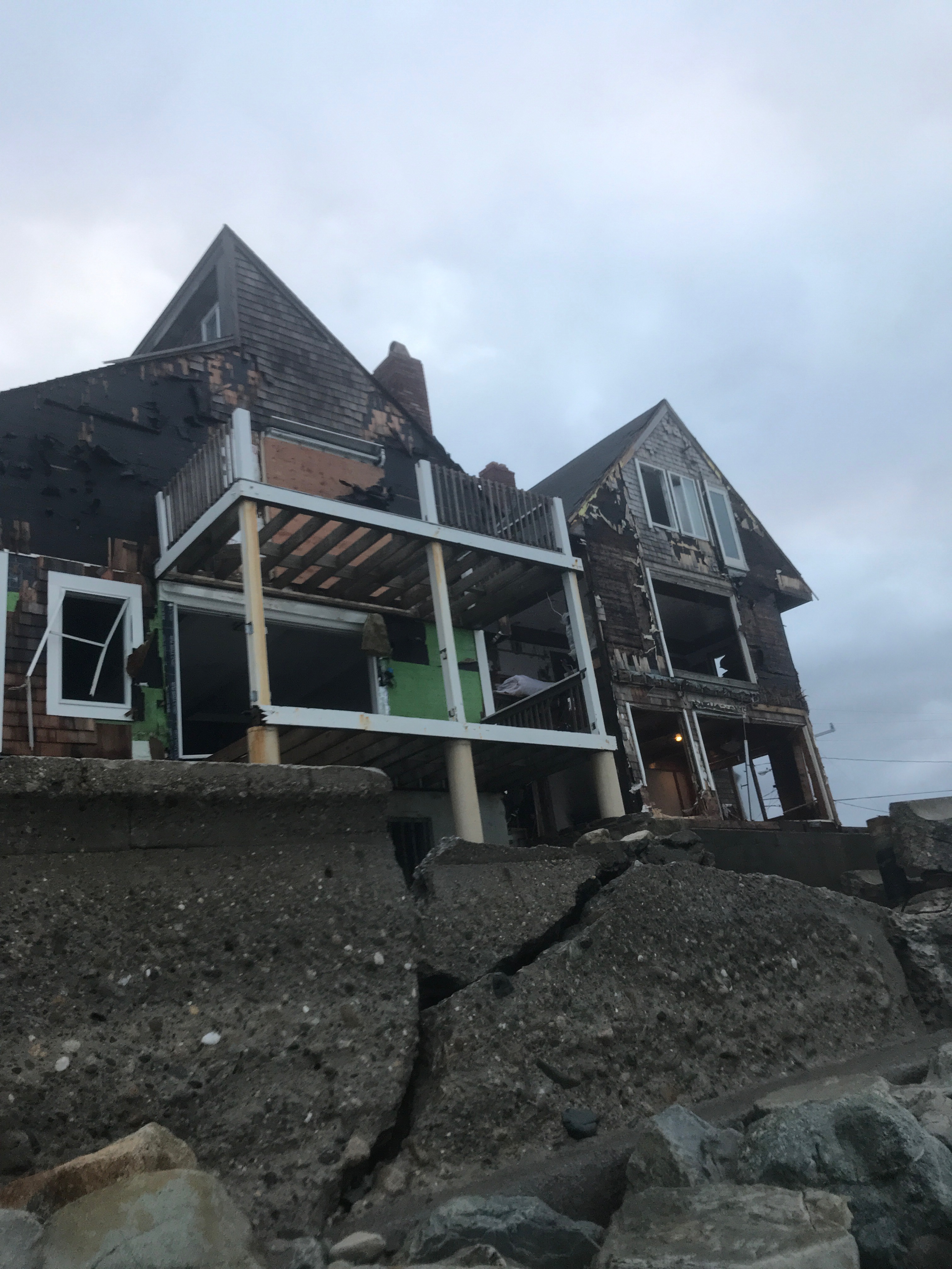
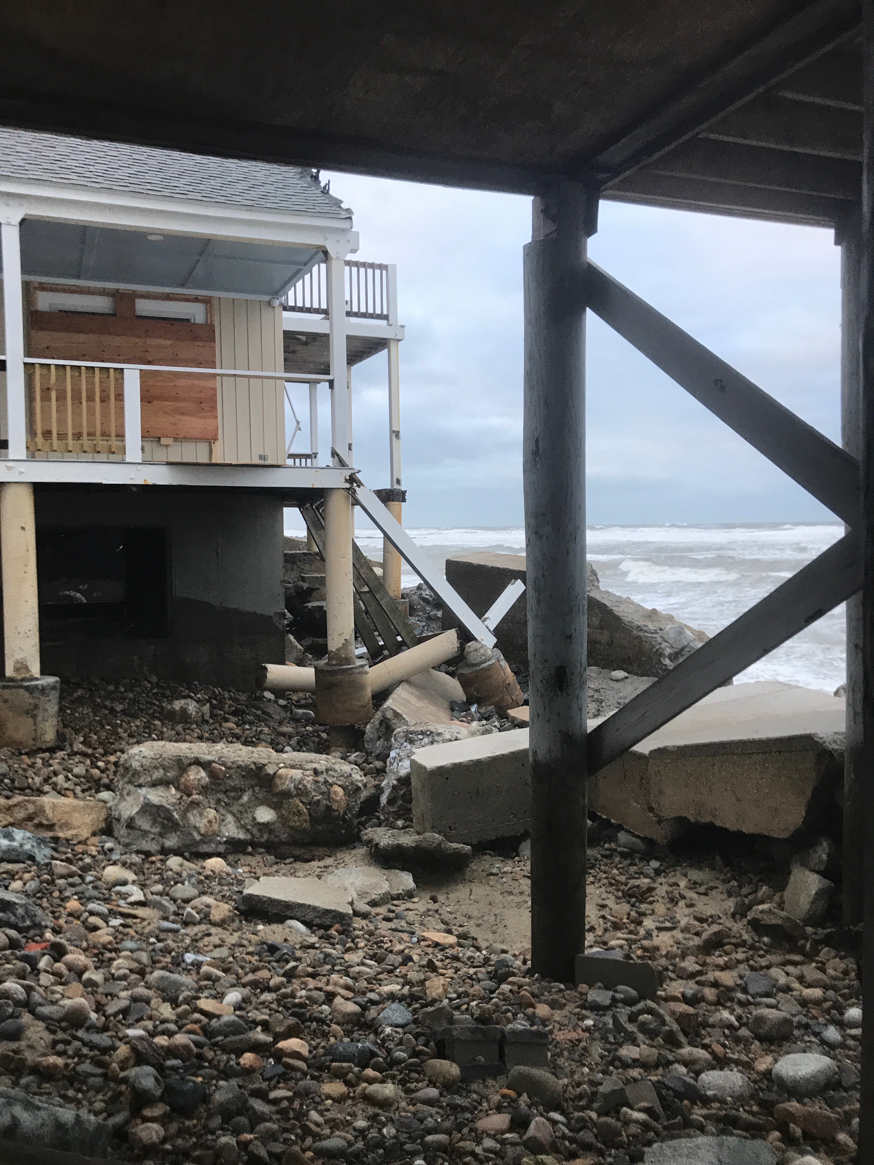
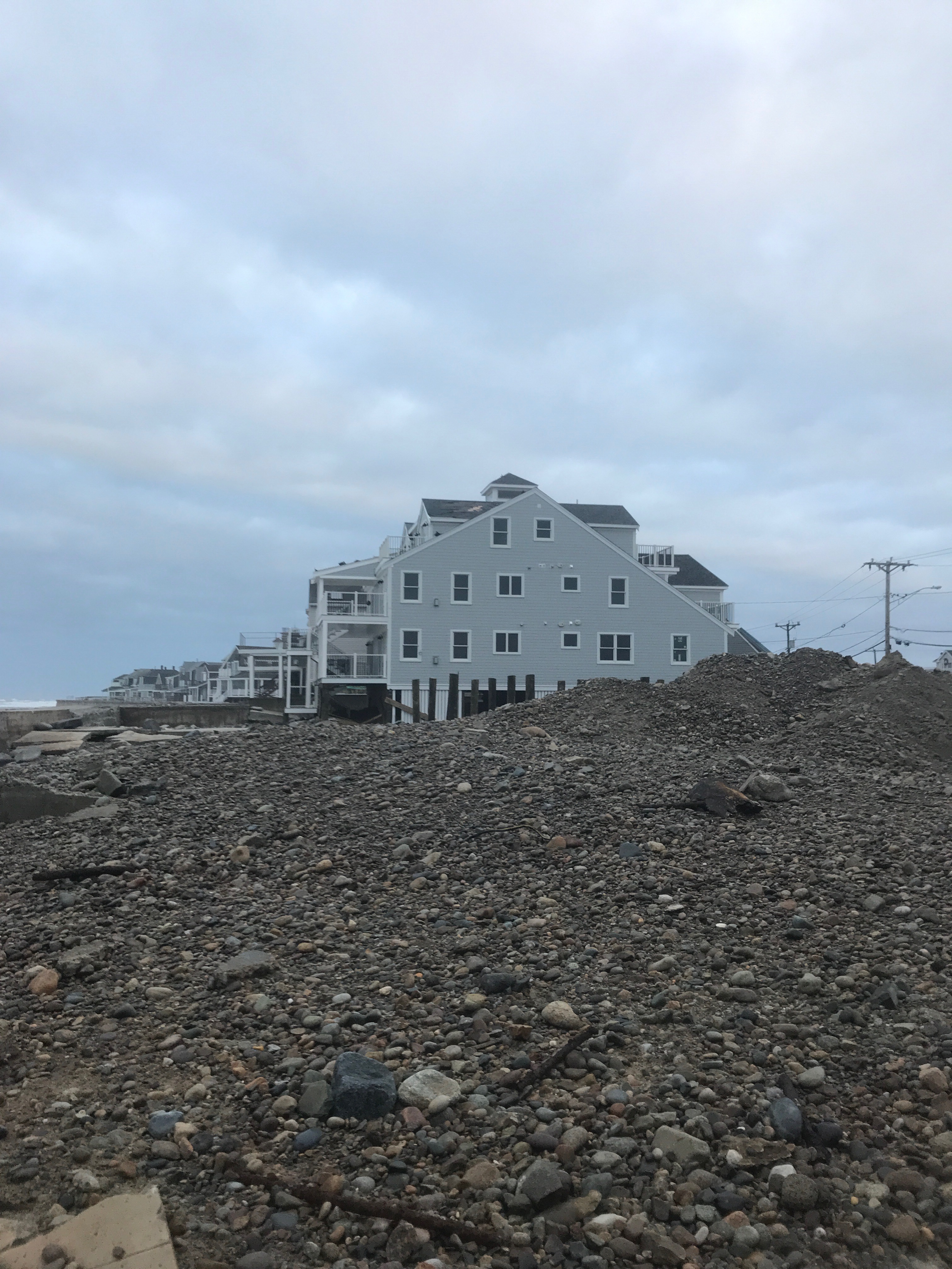
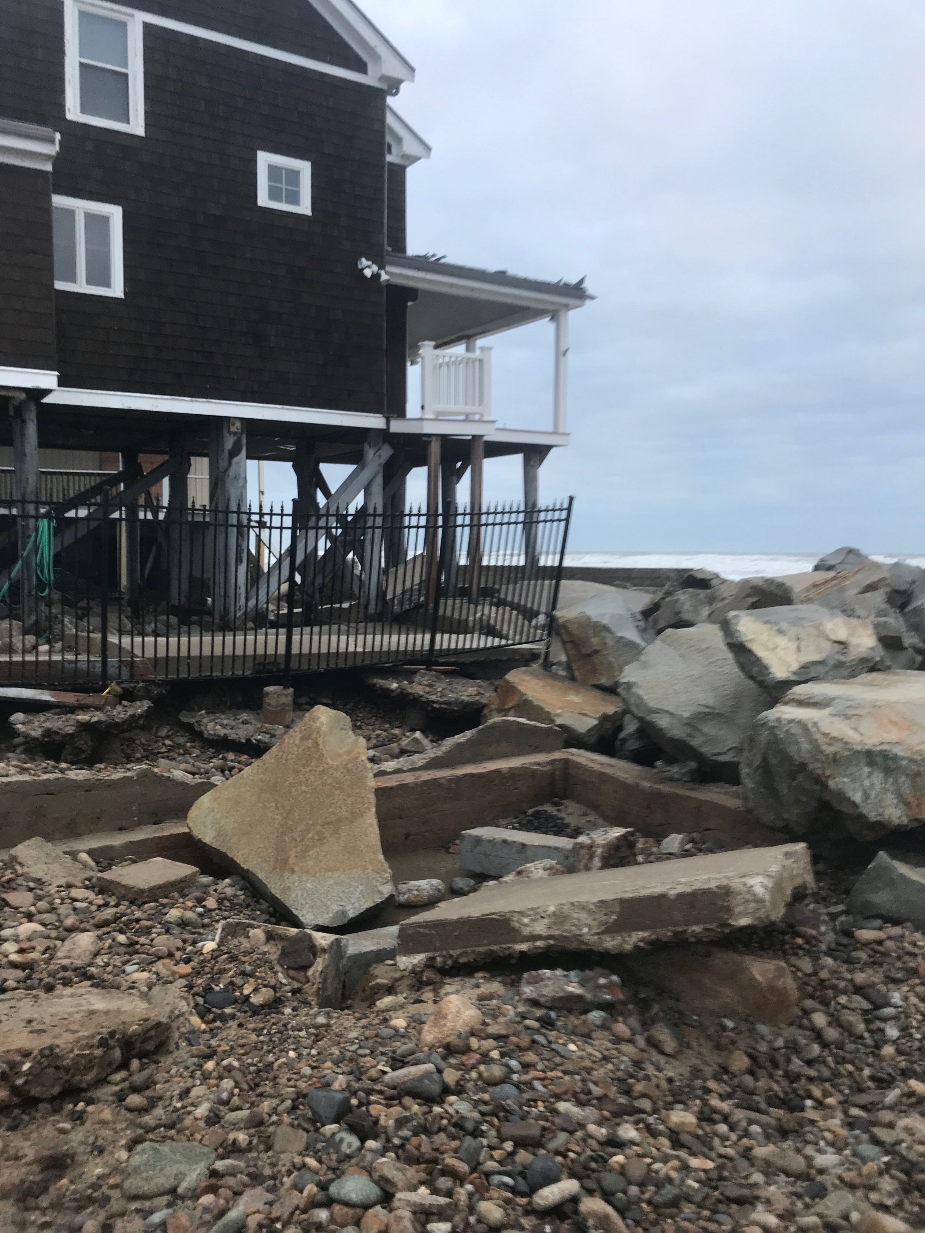
Buildings
Specific Impacts:
- Water flow around or under buildings
- Damaged stairs/decks
- Damaged windows/sidings
- Damaged walls/roofs
- Damaged foundations/pilings
- Displaced/destroyed
Hazardous Materials
Beach
Coastal Structures
Specific Impacts:
- Splashover
- Damaged stairs/walkovers
- Leaning bulkheads/seawalls
- Undermined bulkheads/seawalls
Foot/Cycling Paths
Natural Resources
Current Response
Response:
- Utility repair
- Road clearing
Tidal Overview
![]() 5 hours 8 minutes after high tide
5 hours 8 minutes after high tide
Data from Brant Rock, Green Harbor River (0.6 miles away)
High Tide (Predicted): 12:13 pm, 10.9' MLLW
Loading NOAA Tide Data…
■ Observed
■ Predicted water level
⬤ Report time
Weather Overview
Wind Speed: 14.5 MPH
Wind Direction: NNE (29°)
Temperature: 41℉
Rainfall (Calendar Day): 0"
Rainfall (Past 24 Hours): 0.6"
You must be logged in to post a comment.