Plymouth County
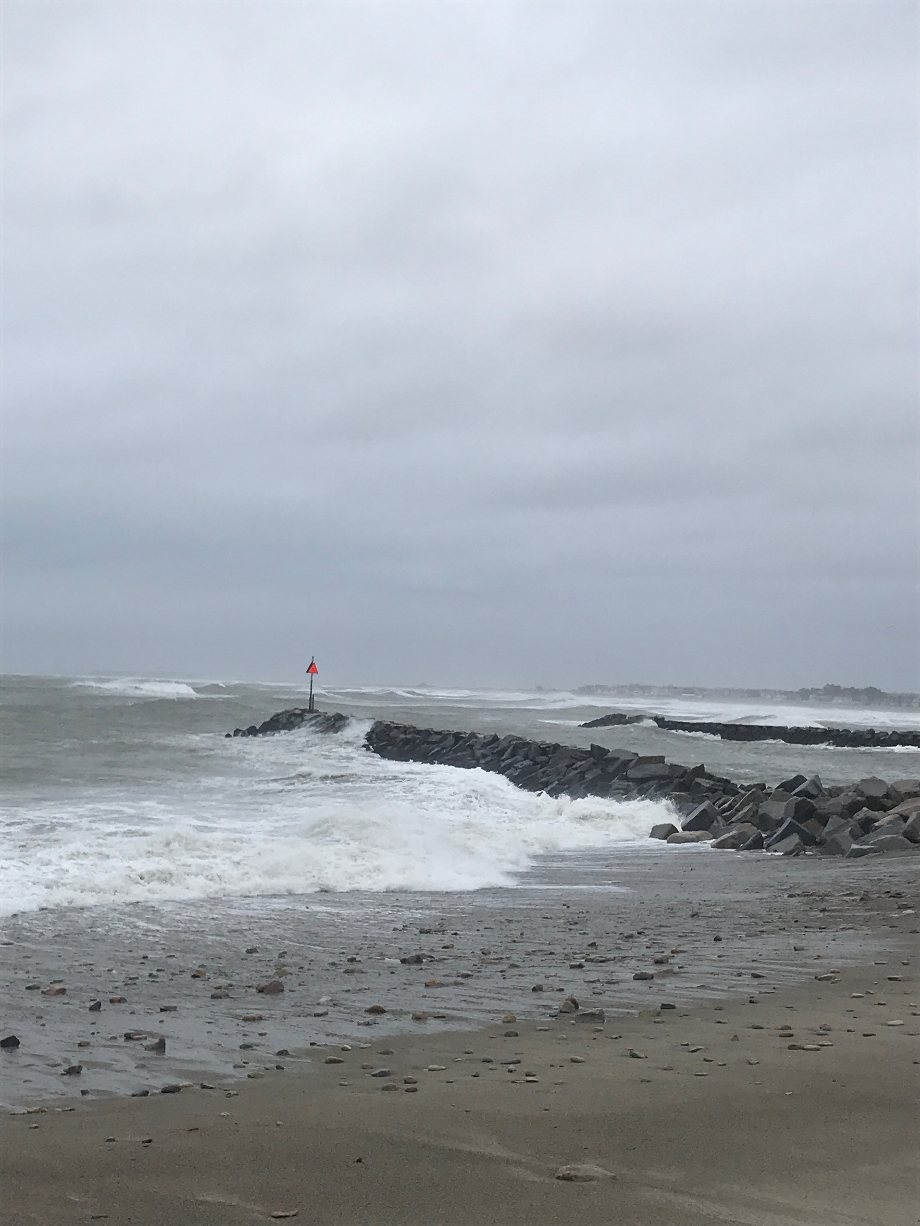
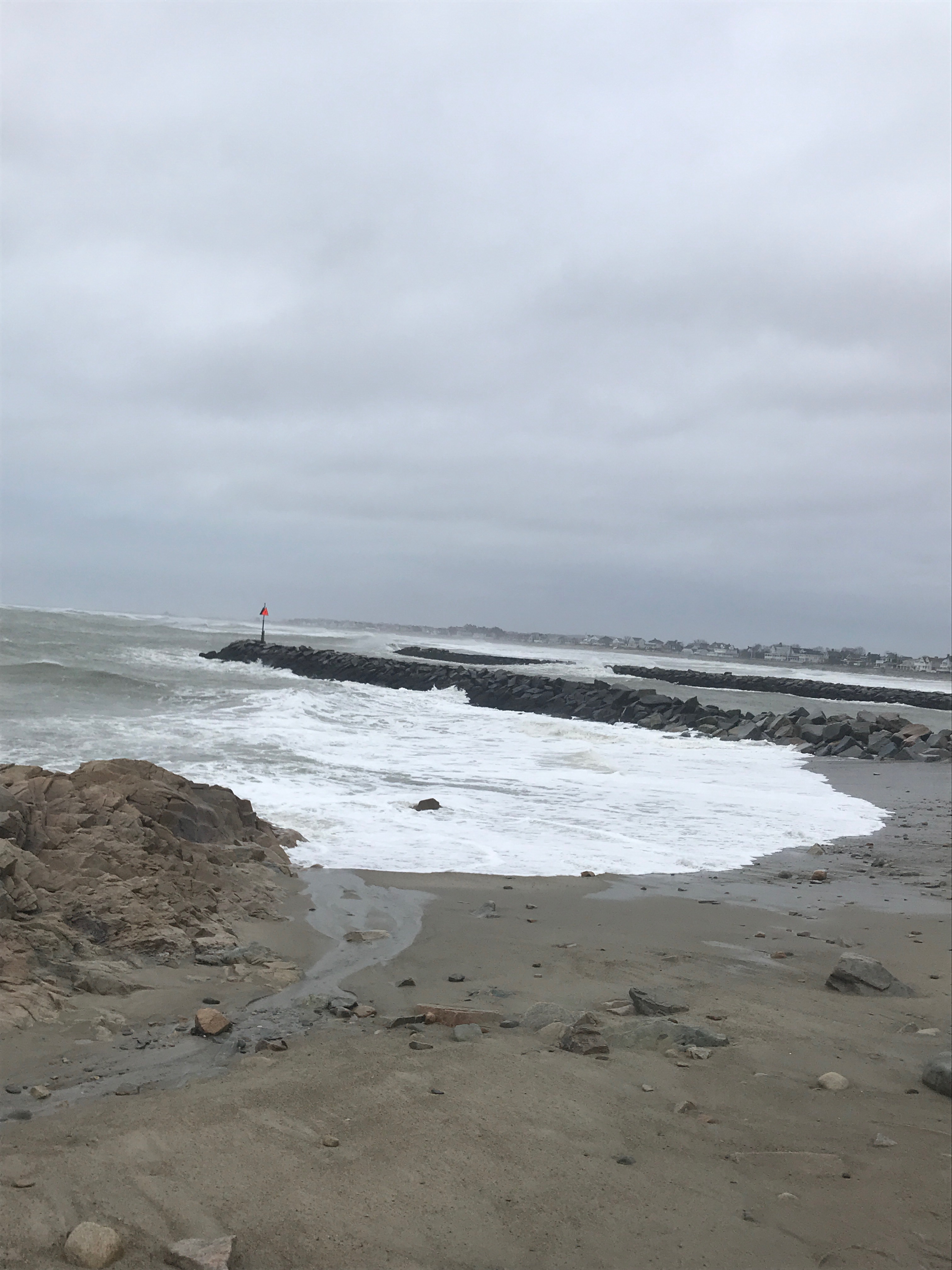
Marshfield, MA
(Green Harbor jetties)
Storm Report
Impacts Reported

User Submitted Data
Roads
Street/Road: Unspecified
Marinas and Harbors
Buildings
Hazardous Materials
Beach
Coastal Structures
Specific Impacts:
- Damaged groin/jetty
Foot/Cycling Paths
Natural Resources
Current Response
Response:
- None
Tidal Overview
![]() 4 hours 23 minutes before high tide
4 hours 23 minutes before high tide
Data from Brant Rock, Green Harbor River (0.4 miles away)
High Tide (Predicted): 12:13 pm, 10.9' MLLW
Loading NOAA Tide Data…
■ Observed
■ Predicted water level
⬤ Report time
Weather Overview
Wind Speed: 16 MPH
Wind Direction: N (1°)
Temperature: 41℉
Rainfall (Calendar Day): 0"
Rainfall (Past 24 Hours): 2.55"
You must be logged in to post a comment.