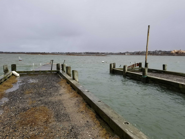
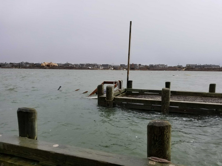
Nantucket, MA (Jackson's Point boat ramp)
Nantucket County
Storm Report
03/04/2018 | 12:51 pm
Impacts Reported
Roads
Street/Road: Unspecified
Specific Impacts:
- Splashover
- Impacted, but passable
Marinas and Harbors
Specific Impacts:
- Damaged piers/docks
- Displaced floats
Displaced floats: 2 floats
Comments: 1 significantly damaged, 1 destroyed and sunk. Entire area washover.
Buildings
Hazardous Materials
Beach
State: Accessible
Coastal Structures
Natural Resources
Current Response
Response:
- None
You must be logged in to post a comment.