Suffolk County
Winthrop, MA
(Northern end Winthrop Beach)
Storm Report
User Submitted Data
Roads
Street/Road: Unspecified
Specific Impacts:
- Impacted, but passable
Marinas and Harbors
Buildings
Hazardous Materials
Beach
Imapacts Reported: Y
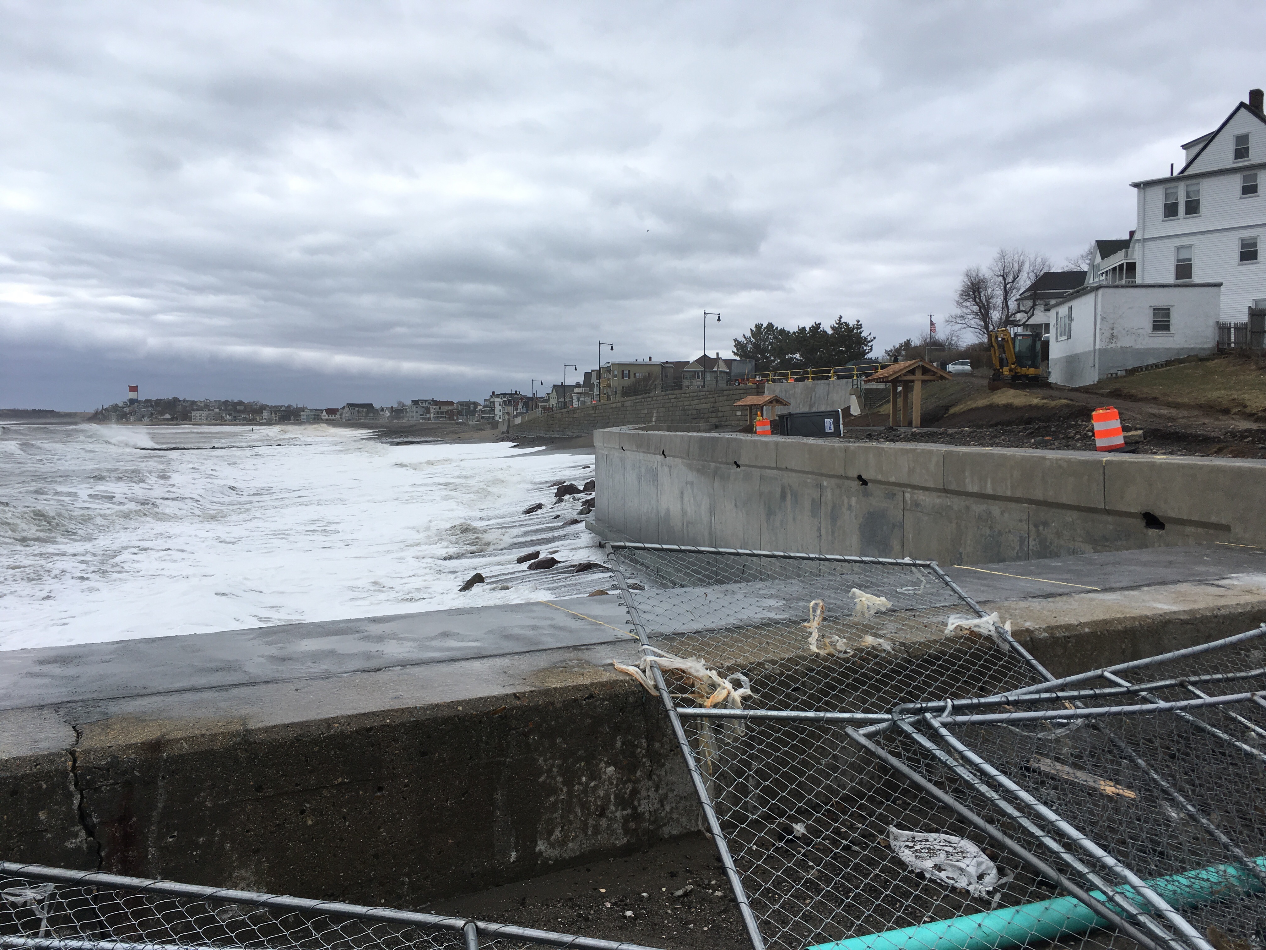
Coastal Structures
Specific Impacts:
- Damaged stairs/walkovers
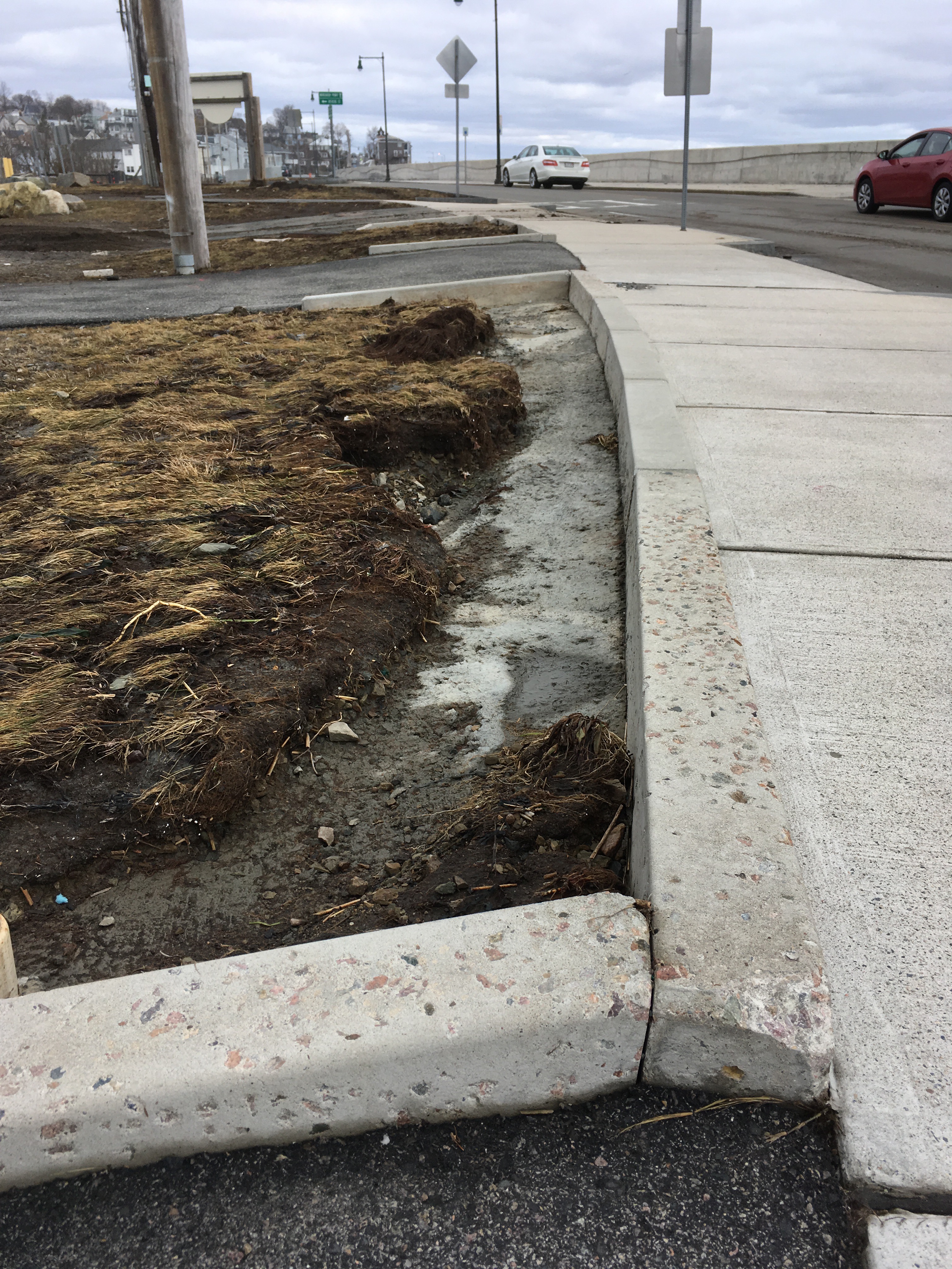
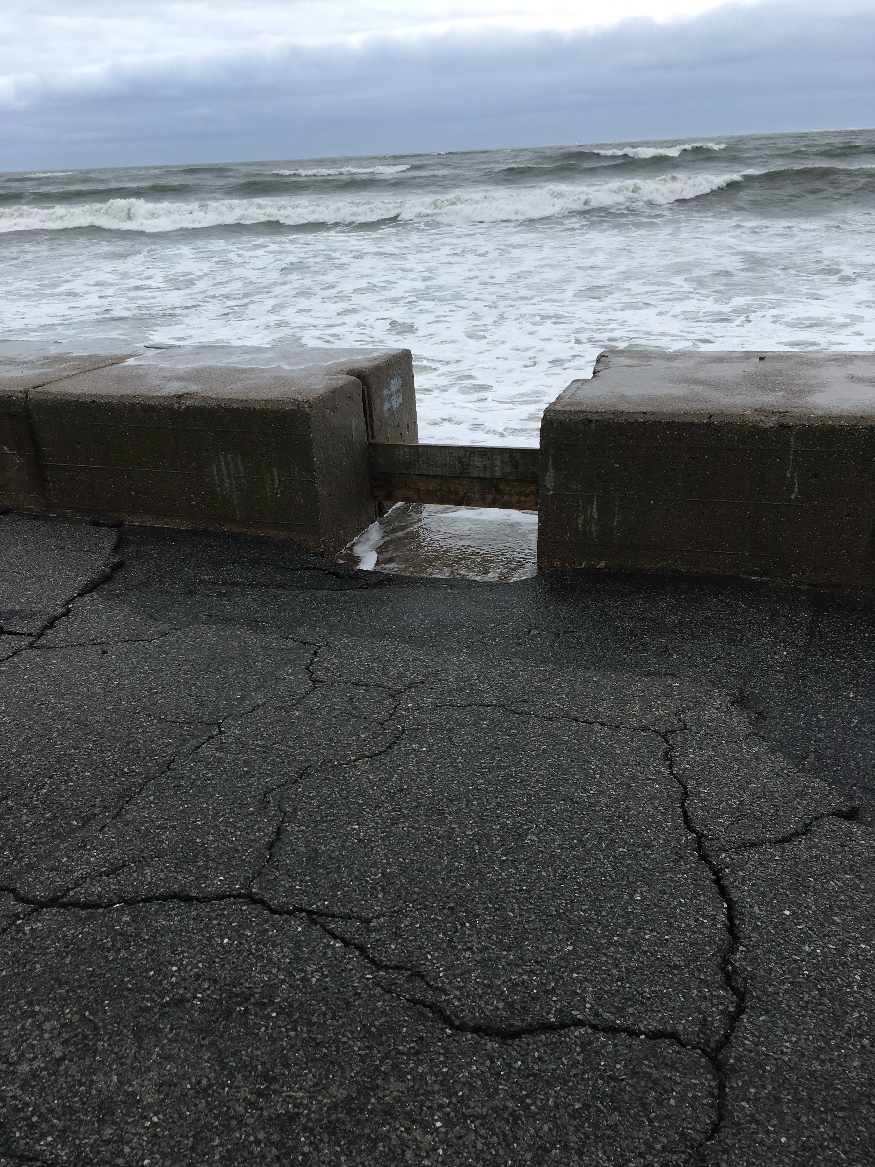
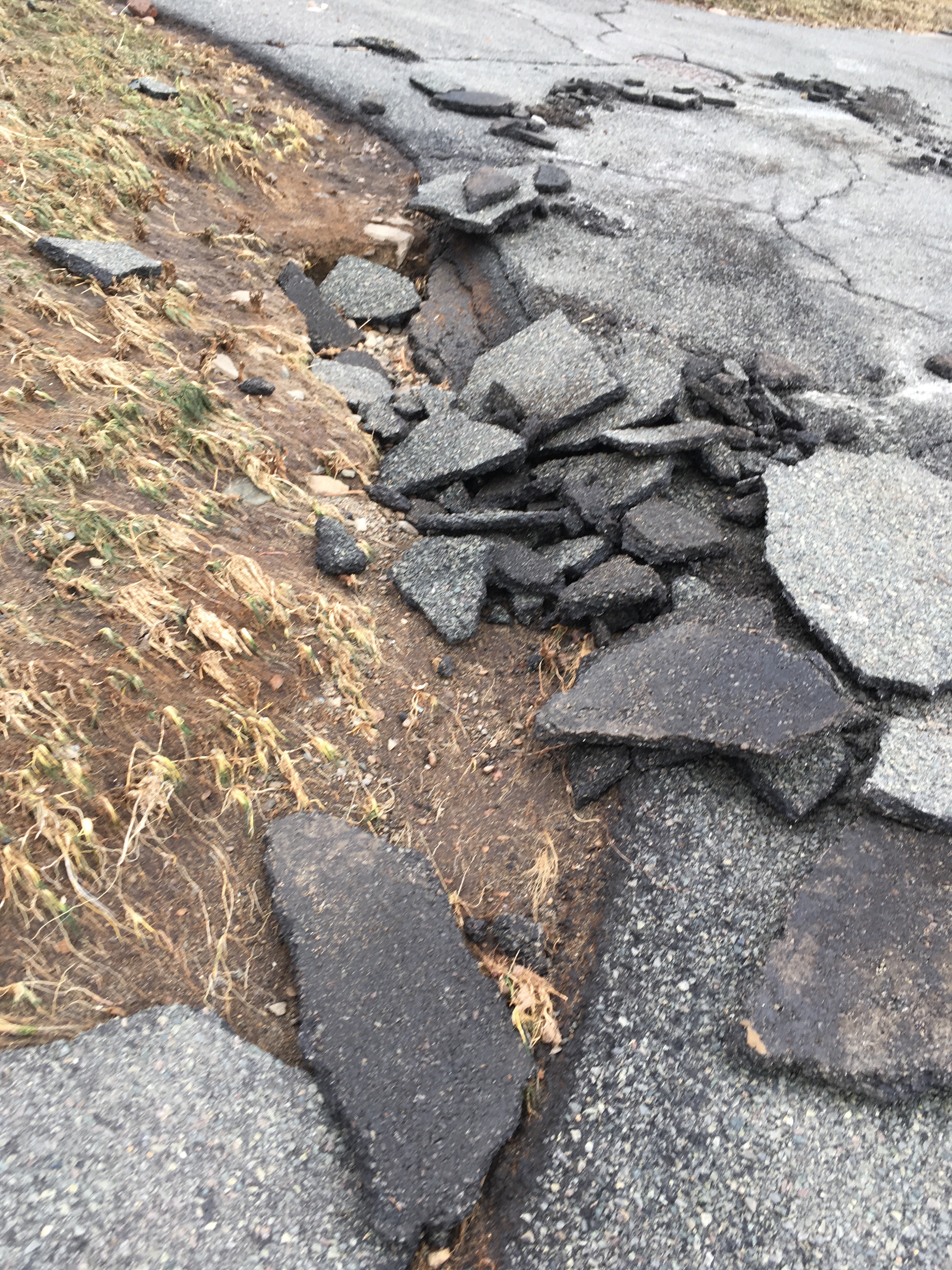
Comments: Asphalt peeling in parts, minor undermining patches at edges of asphalt walkway; minor sea wall pieces gone at top of walls in a couple of spots; stuff under construction looks good; sea wall looking south looks good
Foot/Cycling Paths
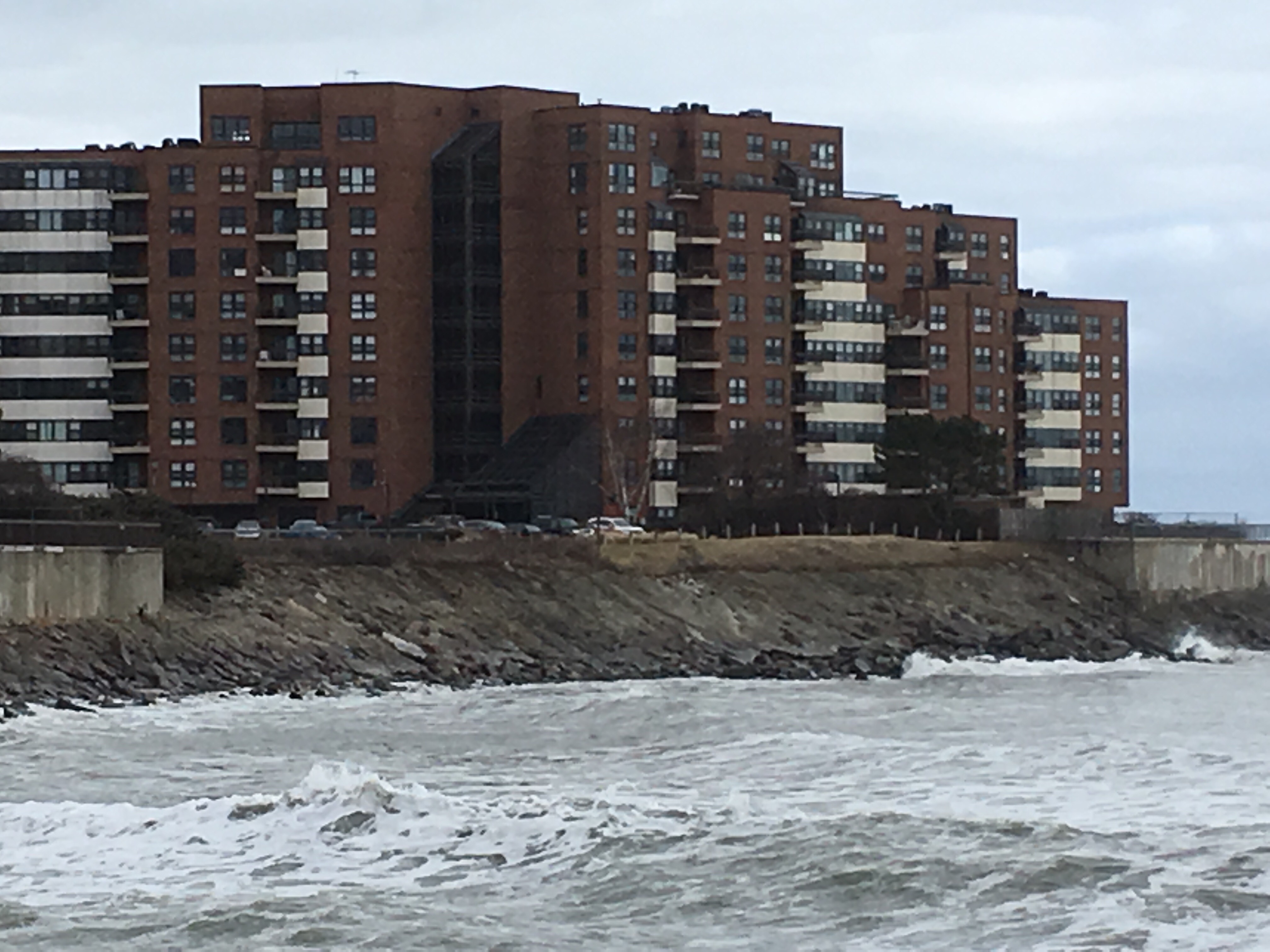
Natural Resources
Specific Impacts:
- Eroded bank/bluff
Comments: Bluff under brick apartment building looks badly eroded, will try and get a closer look
Current Response
Response:
- Road clearing
Tidal Overview
![]() 2 hours 47 minutes before high tide
2 hours 47 minutes before high tide
Data from BOSTON (4.9 miles away)
Water Level (at time of report): 10:11 am, 7.8' MLLW
High Tide (Predicted): 12:54 pm, 10.9' MLLW
High Tide (Observed): 12:54 pm, 12.9' MLLW
Loading NOAA Tide Data…
Weather Overview
Wind Speed: 16.7 MPH
Wind Direction: NNE (30°)
Temperature: 39℉
Rainfall (Calendar Day): 0"
Rainfall (Past 24 Hours): 0"