
Essex County
Newbury, MA
(dartmouth south)

Storm Report
Impacts Reported
User Submitted Data
Roads
Street/Road: Unspecified
Marinas and Harbors
Buildings
Hazardous Materials
Beach
State: Y
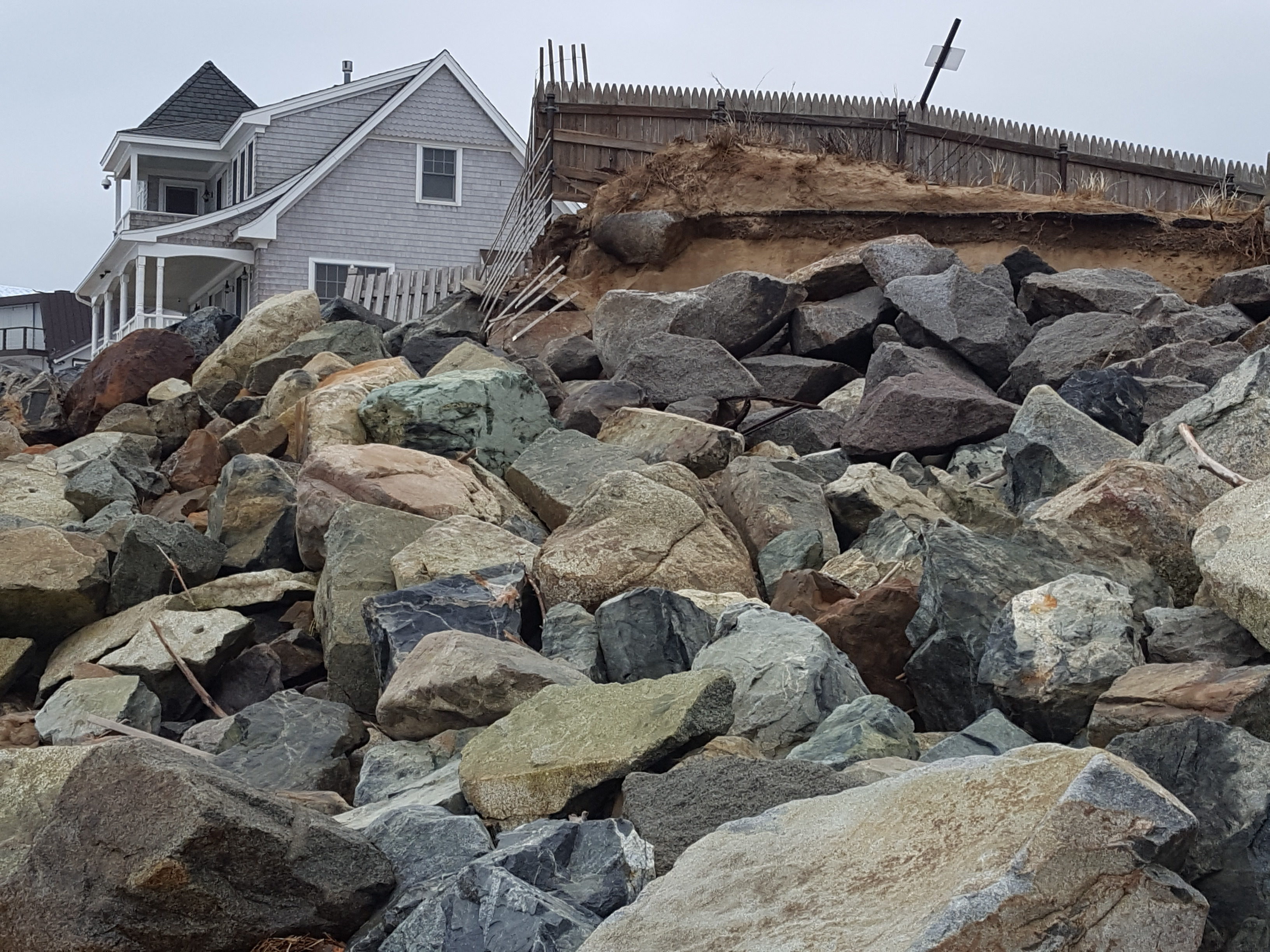
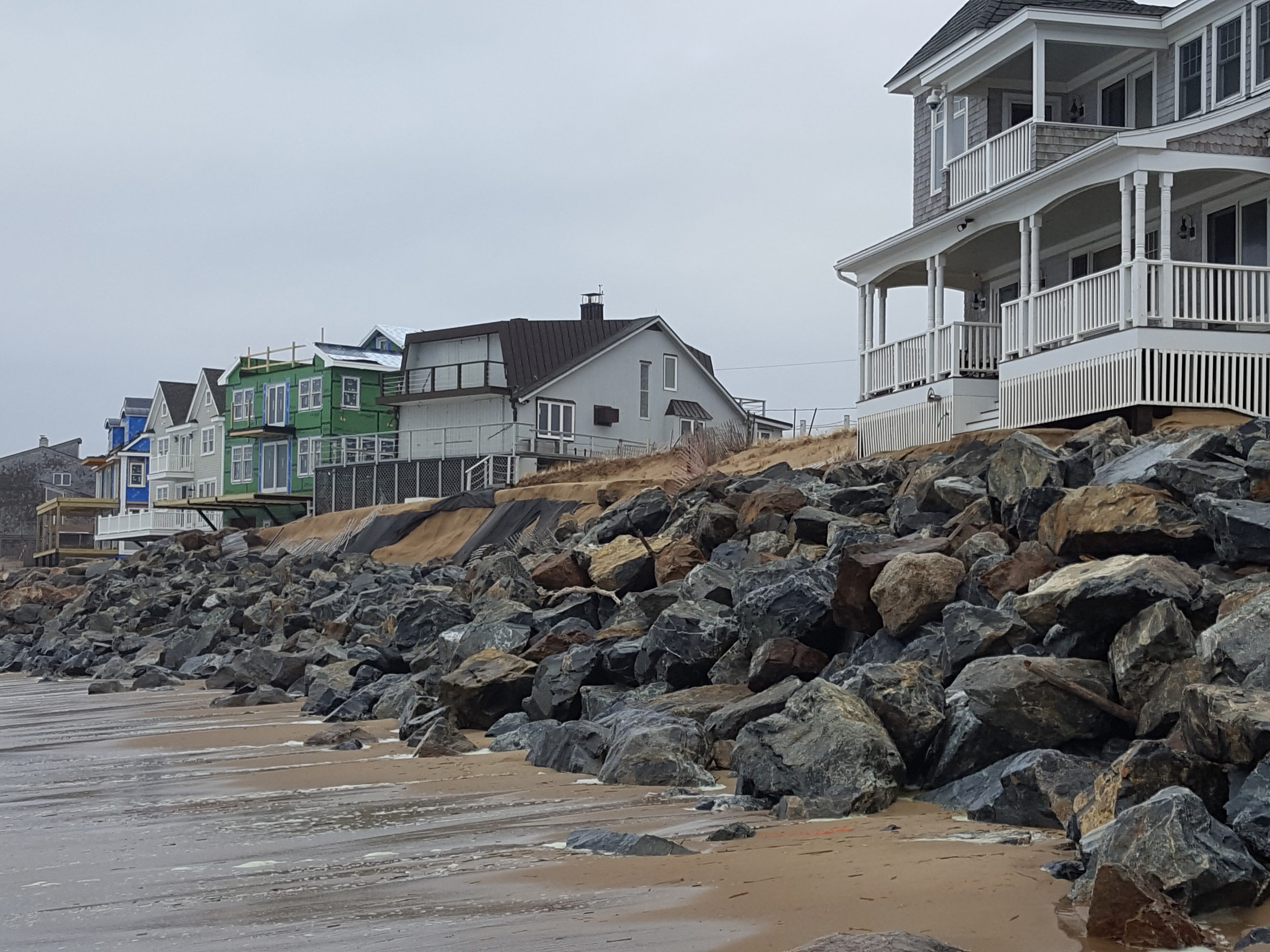
Comments: The surf seems focused on either side of the Dartmouth groin. Though the rock faced dune has kept erosion of the dune to a minimum it is evident that in the area south of Dartmouth the rocks have begun to slide toward the beach. the top of the rocks shows signs of surf well above the rock face.
Coastal Structures
Foot/Cycling Paths
Natural Resources
Specific Impacts:
- Eroded beach
- Eroded dune
Current Response
Response:
- None
Tidal Overview
 4 hours 9 minutes before high tide
Data from Plum Island, Merrimack River Entrance (1.7 miles away)
High Tide (Predicted): 12:19 pm, 9.5' MLLW
■ Observed
■ Predicted water level
⬤ Report time
Weather Overview
Wind Speed: 20 MPH
Wind Direction: N (359°)
Temperature: 41℉
Rainfall (Calendar Day): 0"
Rainfall (Past 24 Hours): 1.41"
You must be logged in to post a comment.