
Roads
Street/Road: Unspecified
Specific Impacts:
- Splashover
- Impacted, but passable
Comments: Sand has been plowed from road.
Marinas and Harbors
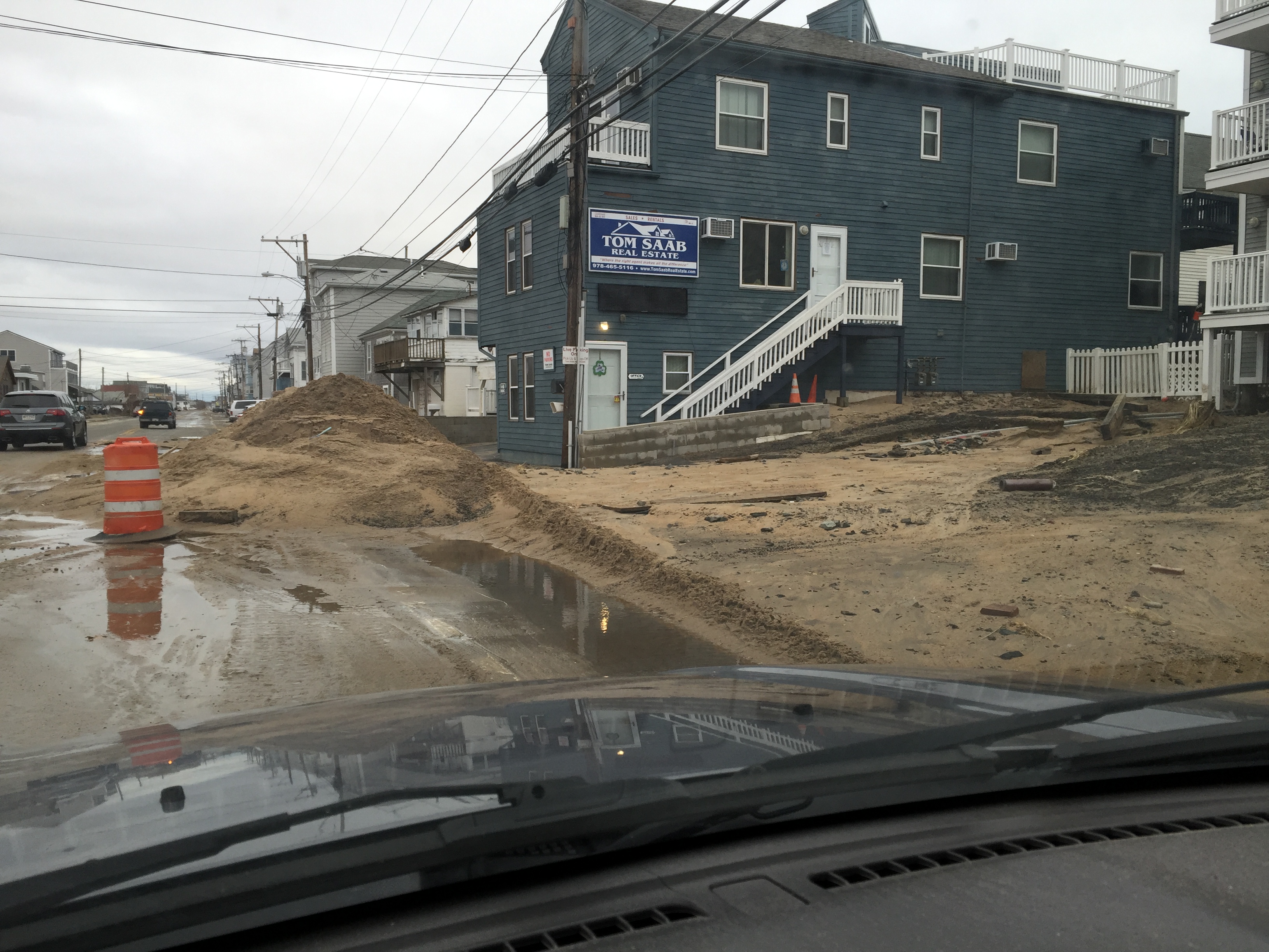
Buildings
Street: Central Street
Specific Impacts:
- Water flow around or under buildings
- Damaged foundations/pilings
Comments: Underground utilities exposed, pilings may have shifted.
Hazardous Materials
Beach
Foot/Cycling Paths
Natural Resources
Specific Impacts:
- Eroded beach
- Overwashed beach/dune
Current Response
Response:
- Road clearing
You must be logged in to post a comment.
"Pilings may have been damaged, subsurface utilities exposed."