
Barnstable County
Sandwich, MA (Sandwich White Cap Path)

Storm Report
Impacts Reported
Roads
Street/Road: Unspecified
Specific Impacts:
- Splashover
Marinas and Harbors
Buildings
Specific Impacts:
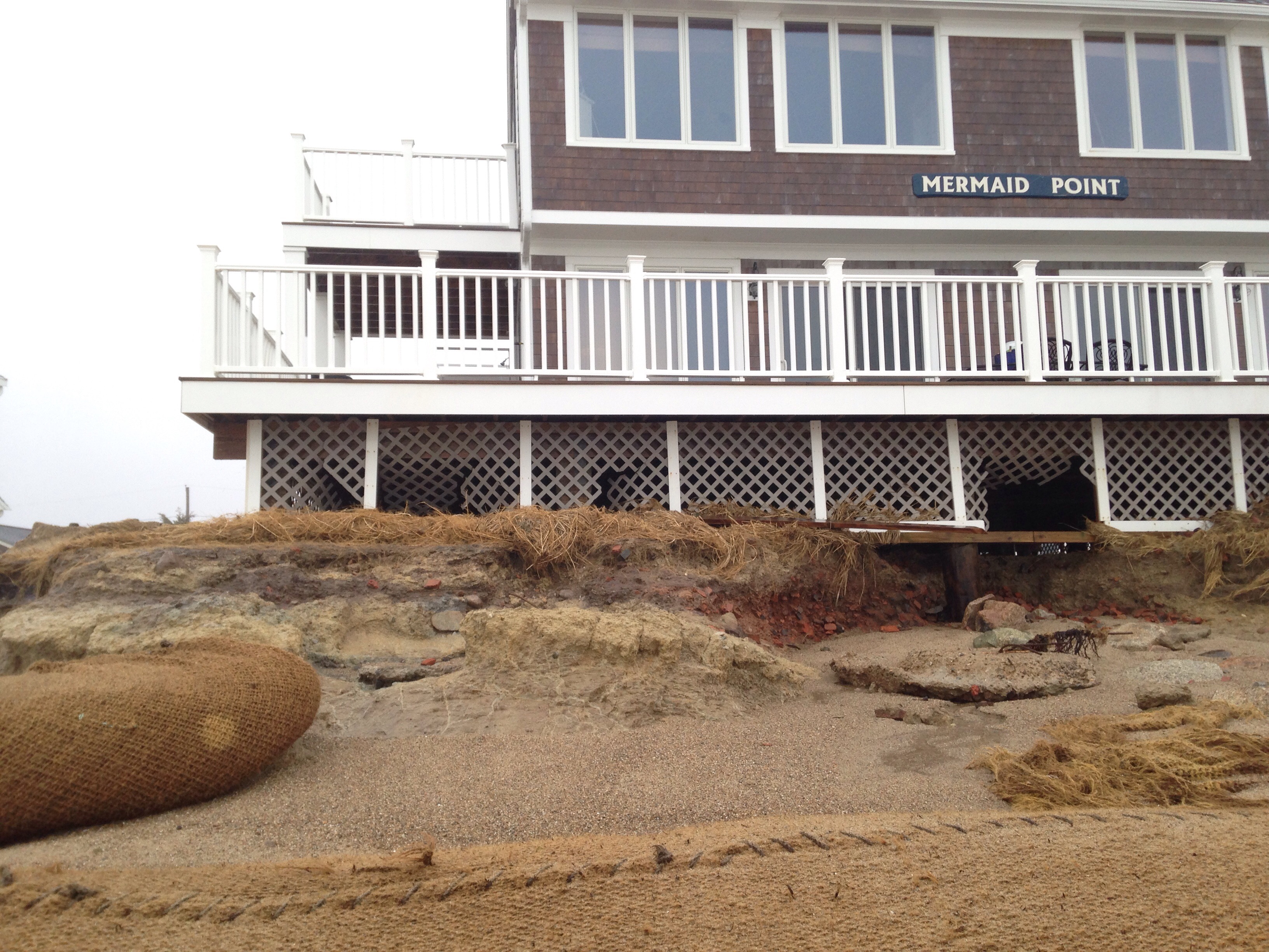
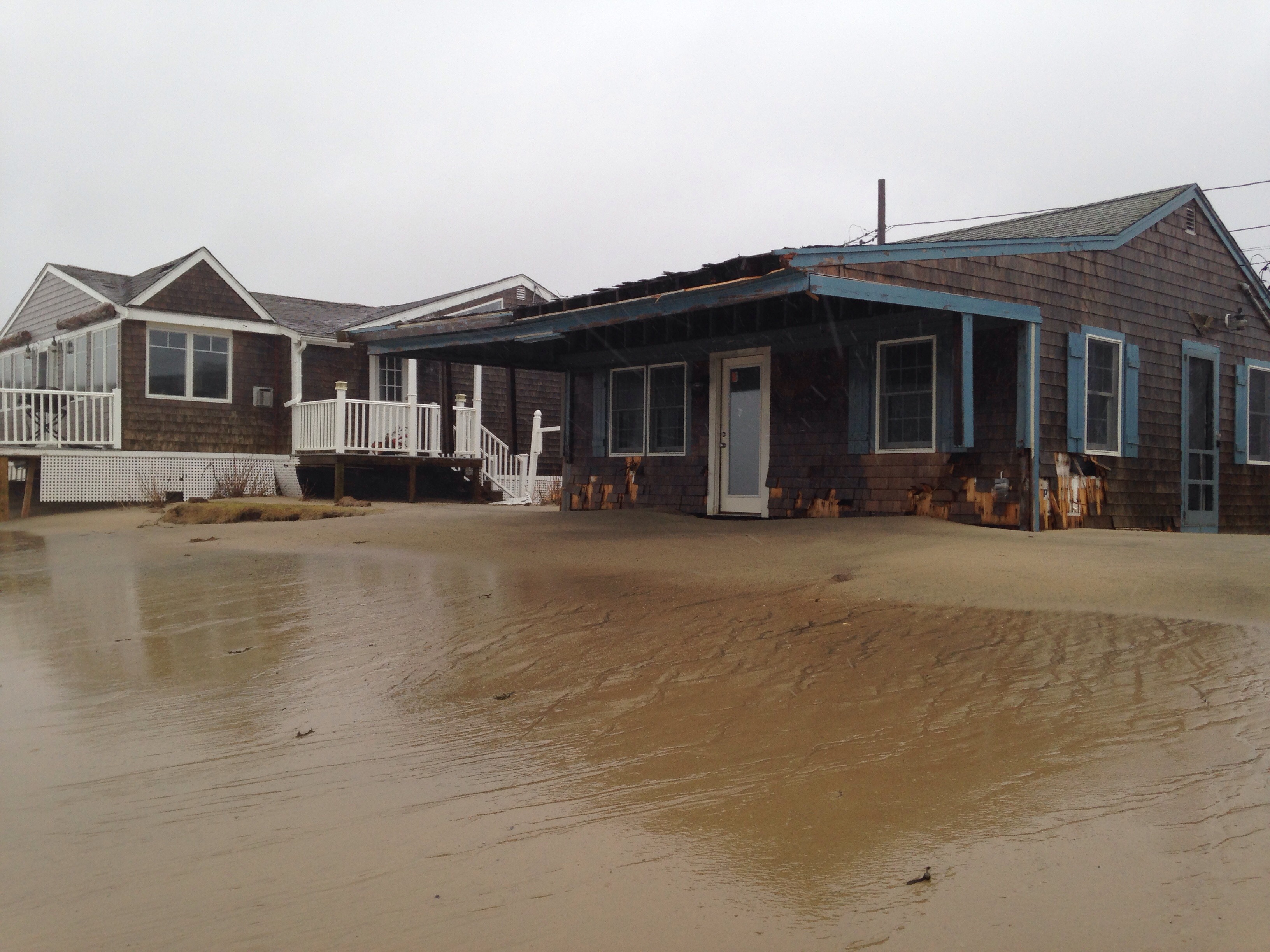
- Water flow around or under buildings
- Damaged stairs/decks
- Damaged windows/sidings
- Damaged walls/roofs
- Damaged foundations/pilings
Comments: Sand and waves sorrounded several houses
Hazardous Materials
Specific Impacts:
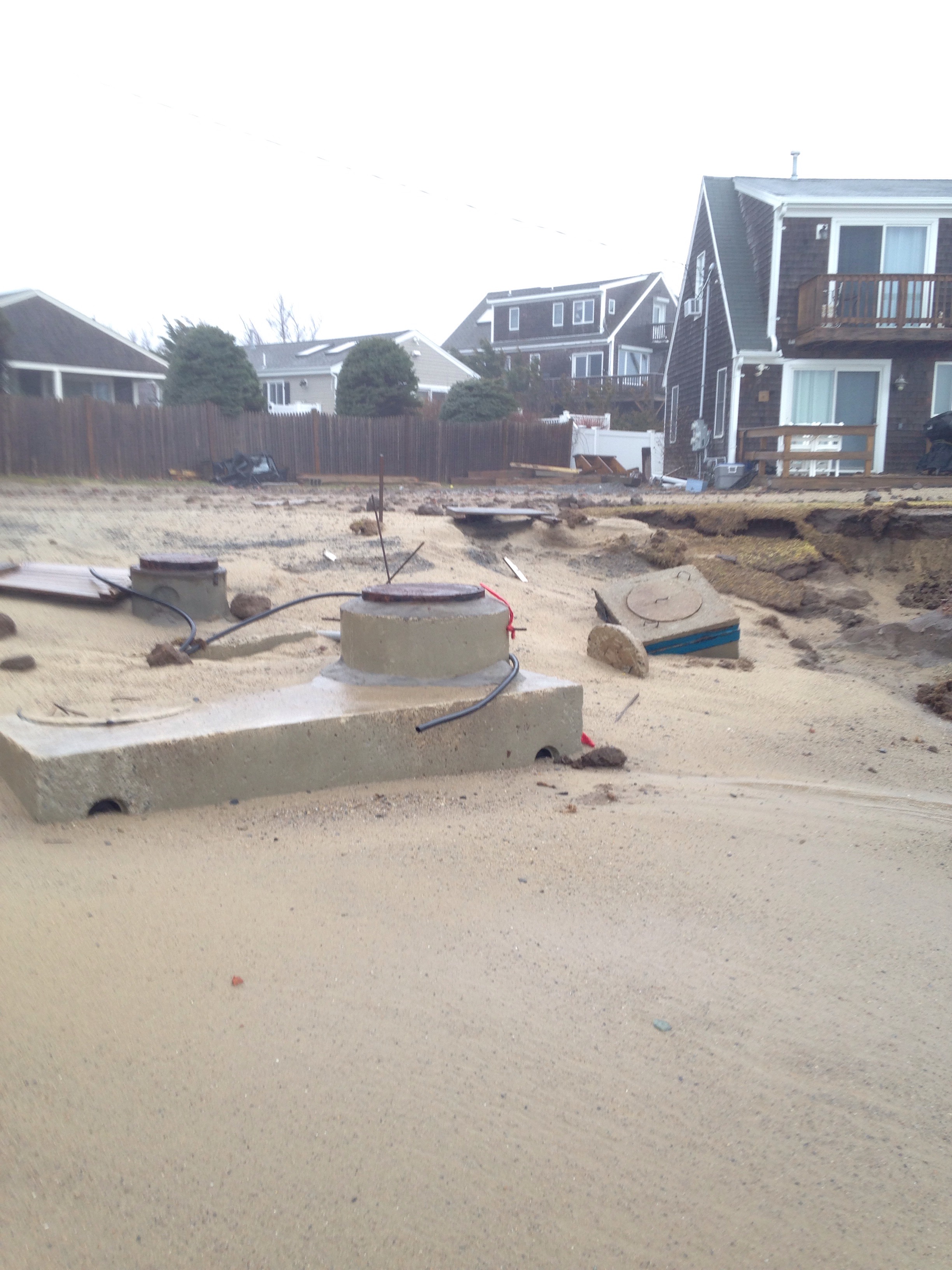
- Septic
Comments: Septic system exposed
Beach
Foot/Cycling Paths
Natural Resources
Specific Impacts:
- Damaged sand fencing
- Eroded beach
- Eroded bank/bluff
Comments: All sacrificial material gone.
Current Response
Response:
- None
Tidal Overview
 3 hours 3 minutes after high tide
Data from Sandwich Marina, Cape Cod Canal, east entrance (1 miles away)
High Tide (Predicted): 11:15 am, 10.8' MLLW
■ Observed
■ Predicted water level
⬤ Report time
Weather Overview
Wind Speed: 30.7 MPH
Wind Direction: NE (47°)
Temperature: 46℉
Rainfall (Calendar Day): 0.221"
Rainfall (Past 24 Hours): 1.76"
You must be logged in to post a comment.