Suffolk County
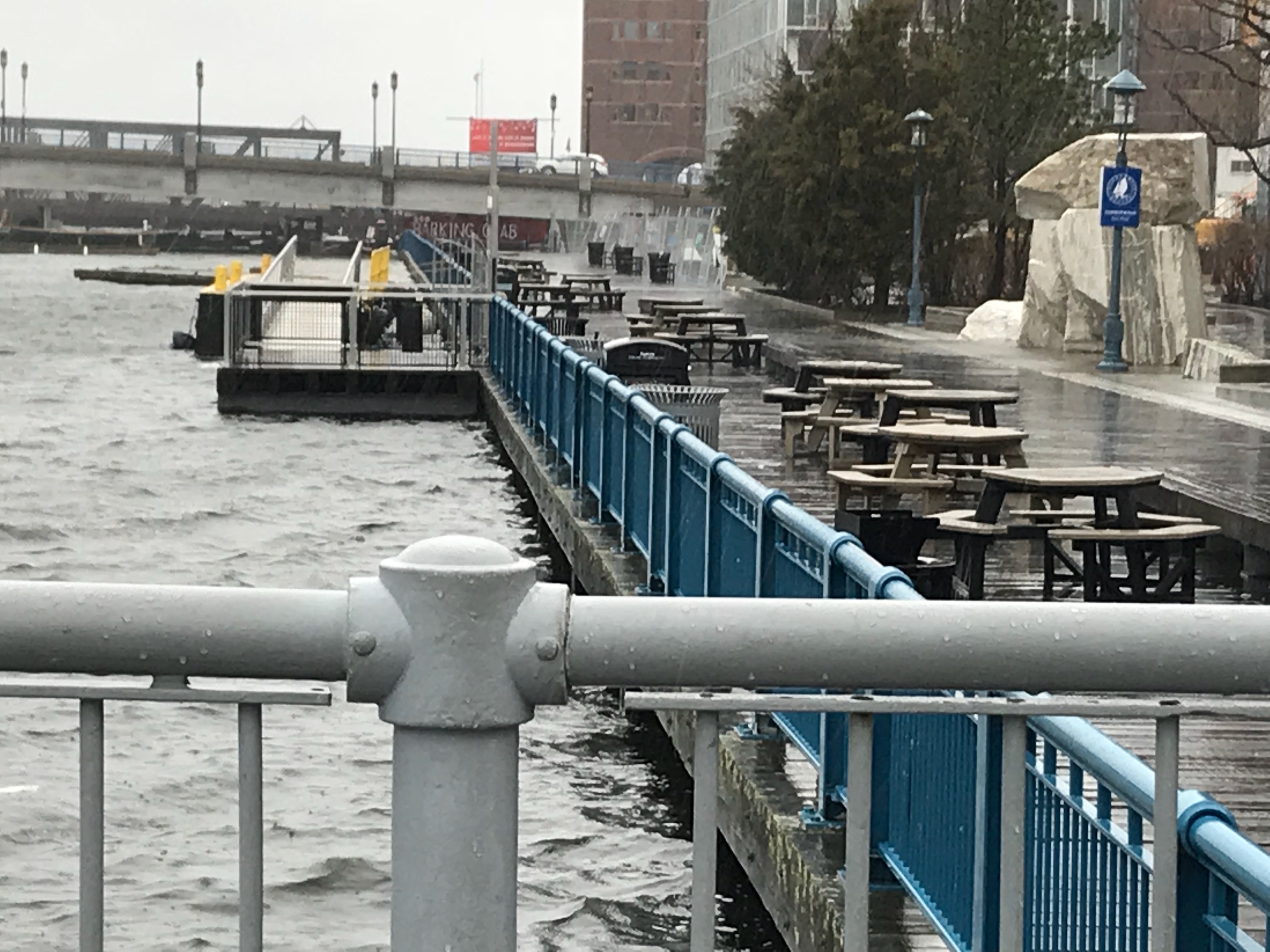
Boston, MA
(Fort Point channel in front of children’s museum)
Storm Report
Impacts Reported

User Submitted Data
Roads
Street/Road: Unspecified
Marinas and Harbors
Buildings
Hazardous Materials
Beach
Coastal Structures
Foot/Cycling Paths
Natural Resources
Current Response
Tidal Overview
![]() 1 hours 21 minutes after high tide
1 hours 21 minutes after high tide
Data from BOSTON (0.3 miles away)
Water Level (at time of report): 12:39 pm, 13.5' MLLW
High Tide (Predicted): 11:14 am, 11.4' MLLW
High Tide (Observed): 11:18 am, 14.6' MLLW
Loading NOAA Tide Data…
■ Observed
■ Predicted water level
⬤ Report time
Weather Overview
Wind Speed: 38.7 MPH
Wind Direction: NNE (30°)
Temperature: 43℉
Rainfall (Calendar Day): 0.152"
Rainfall (Past 24 Hours): 0.7"
You must be logged in to post a comment.