Suffolk County
Boston, MA
(Long Wharf)
Storm Report
Impacts Reported
User Submitted Data
Roads
Street/Road: Unspecified
Marinas and Harbors
Buildings
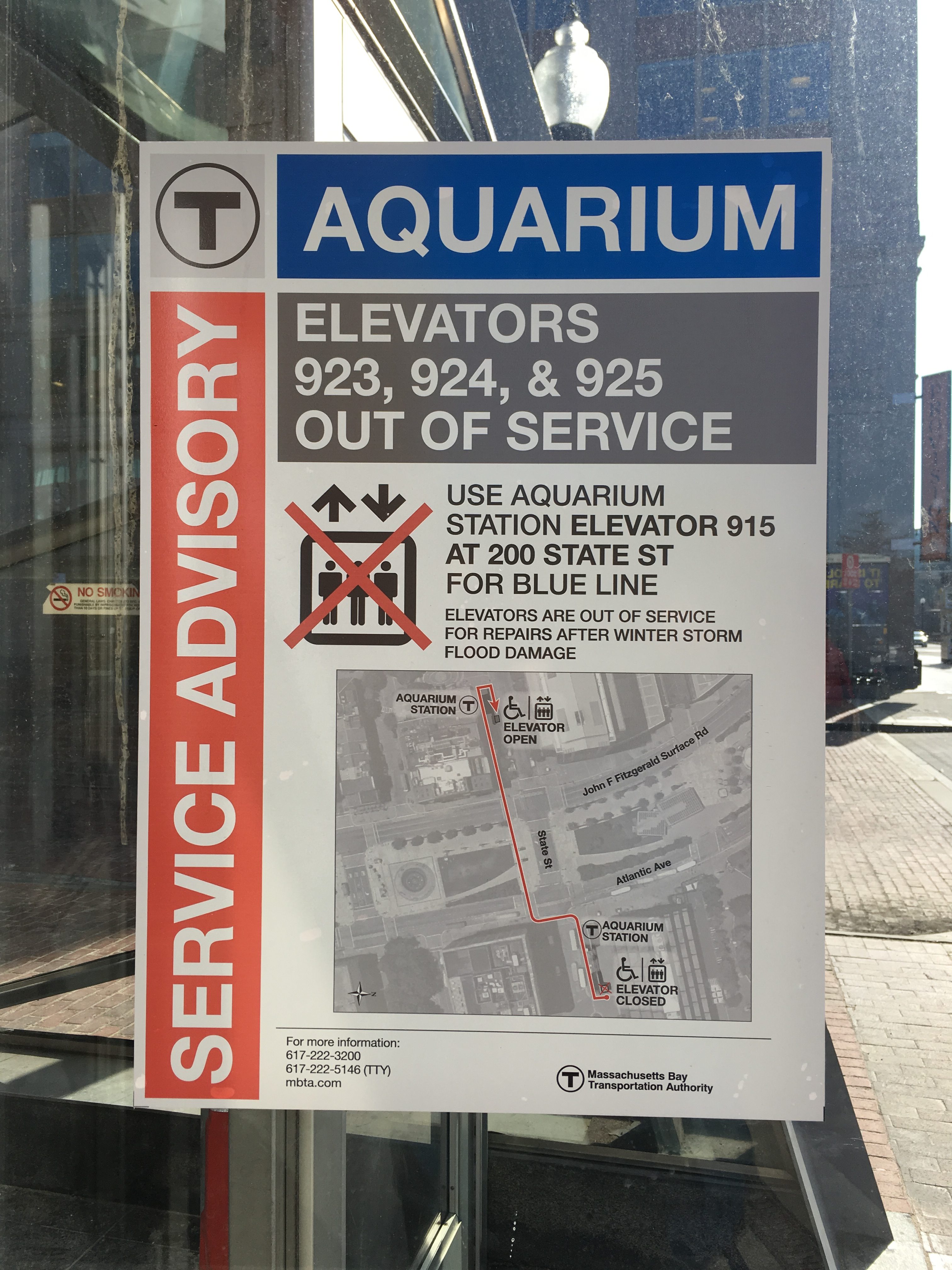
Street: Atlantic Avenue and State Street
Specific Impacts:
- Water flow around or under buildings
- Damaged stairs/decks
Comments: The photo was taken many weeks after Greyson (Jan 4, 2018)
Hazardous Materials
Beach
Coastal Structures
Foot/Cycling Paths
Natural Resources
Current Response
Response:
- Other
Specific response: Presumably the MBTA will have to replace motors on its escalators and elevators on the eastern entrance to the Aquarium T station
Tidal Overview
![]() 1 hours 58 minutes after high tide
1 hours 58 minutes after high tide
Data from BOSTON (0.4 miles away)
Water Level (at time of report): 12:16 pm, 7.9' MLLW
High Tide (Predicted): 10:18 am, 9.8' MLLW
High Tide (Observed): 10:18 am, 9.8' MLLW
Loading NOAA Tide Data…
■ Observed
■ Predicted water level
⬤ Report time
Weather Overview
Wind Speed: 16 MPH
Wind Direction: SW (230°)
Temperature: 44℉
Rainfall (Calendar Day): 0"
Rainfall (Past 24 Hours): 0"
You must be logged in to post a comment.