Roads
Street/Road: Unspecified
Marinas and Harbors
Buildings
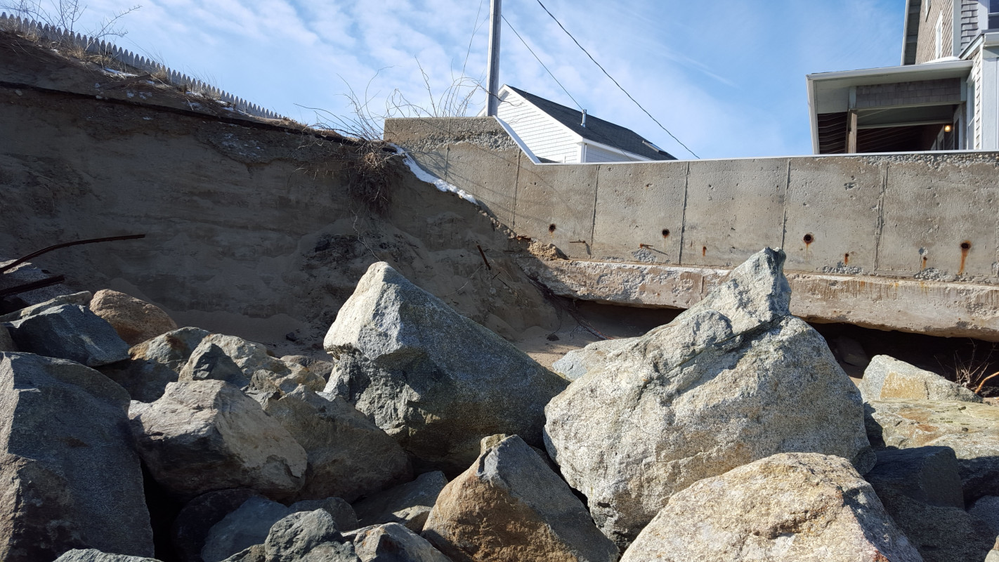
Street: southern ave.
Specific Impacts:
- Water flow around or under buildings
Comments: concrete retaining wall was undermined by surf. sand has flushed out from under the wall and it has slumped and cracked as well as tipped towards the beach. The rock faced dune here and up to the adjacent groin has been compromised.
Hazardous Materials
Beach
Natural Resources
Specific Impacts:
- Eroded beach
- Eroded dune
- Overwashed beach/dune
Comments: Evidence of washover along Southern Ave properties.
Current Response
Response:
- None
"other photos will be attached to other reports for this date. Significant damage was observed well after the storm event on Monday on Friday of this past week."