


Roads
Street/Road: Unspecified
Specific Impacts:
- Impassable (flood water)
- Impassable (overwash)
- Impassable (washed out)
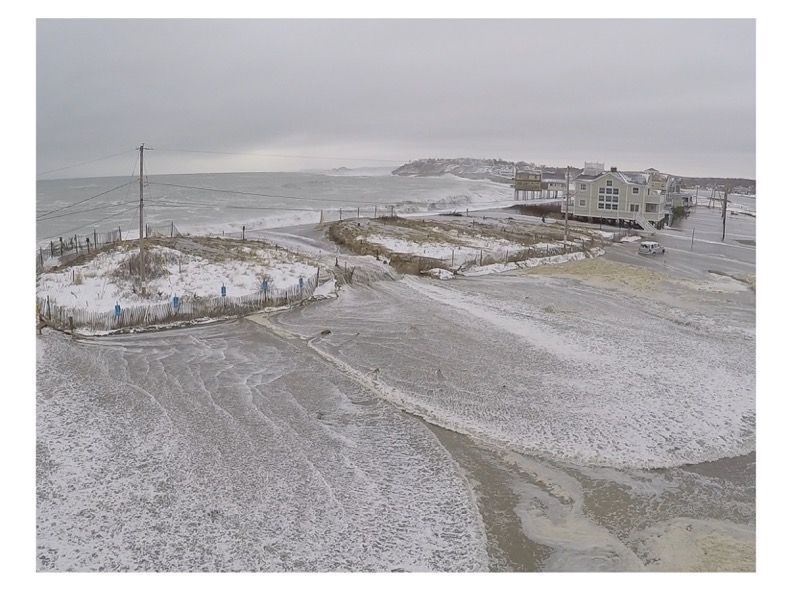
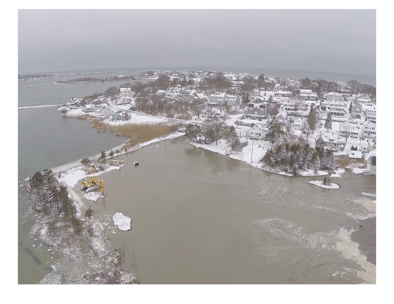
Comments: Peggoty Beach, Inner Harbor and Town Way Extension was impassible due to flood water, overwash, debris of sand and cobble. Including access from Edward Foster Road bridge at the height of the tide.
Marinas and Harbors
Buildings
Street: Inner Harbor and Town Extension impassable due to flood water, overwash, debris of sand and cobble.
Specific Impacts:
- Water flow around or under buildings
- Damaged stairs/decks
- Damaged foundations/pilings
Comments: Comments
Hazardous Materials
Specific Impacts:
- Septic
Comments: Assuming septic damage based on photos
Beach
State: Y
Coastal Structures
Foot/Cycling Paths
Natural Resources
Specific Impacts:
- Damaged sand fencing
- Eroded beach
- Eroded dune
- Overwashed beach/dune
- Wrack on wetlands
Current Response
Response:
- Road clearing
You must be logged in to post a comment.
"Anything else you'd like to add to this report? The photos speak volumes to the vulnerability of this area and the Scituate coastline."