Tompkins County, NY
Ithaca

Flood Watch Report
User Submitted Data
Cause of Flooding:
- Rainfall (Water pooling from direct rainfall)
What is Flooded:
- Lawns/vegetation
- Structures
You must be logged in to post a comment.

Cause of Flooding:
What is Flooded:
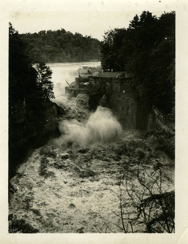
Photo Source: Tompkins County Flood Photographs Collection (History Center of Tompkins County) in the New York Heritage Digital Collections (https://nyheritage.org/collections/tompkins-county-flood-photographs). Photo Title: “Below Beebe Lake's Triphammer Dam from East Ave bridge.” Photo Description: “View from above as water flows wildly and aggressively over the dam, next to the brick hydroelectric facility built against the cliff face. Above the dam trees grow on each side, and the water flows into a raging river below the dam.” Photo Date and Time: The year is based on the photo details from historic records. Actual date and time is unknown. The month and day (7th of July) is based on research found from: https://pubs.usgs.gov/wsp/0773e/report.pdf. Photo Location: Approximate location placed at East Ave Bridge in Ithaca, NY based on photo title. Cause of flooding: Assumed from photo and research from https://pubs.usgs.gov/wsp/0773e/report.pdf. What is flooded: Based on what is shown in the photo.