Storm Report by Kevin O'Brien
Clinton, CT
Damage Reported
"OLISP Field Photo - TS Irene (photo courtesy D Towsend. Location approximate.)"
Damage Reported
Roads
Marinas and Harbors
Buildings
Specific Damage:
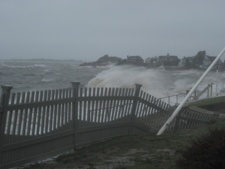
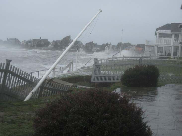
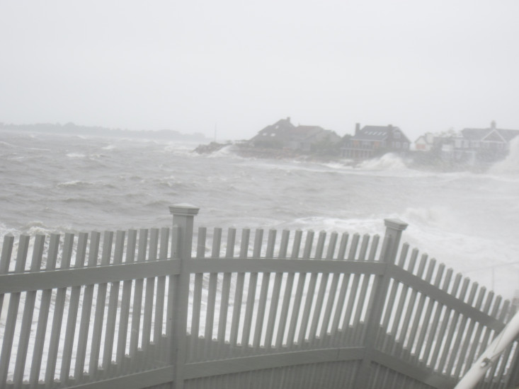
- Damaged stairs/decks
Hazardous Materials
Beach
State: Accessible
Coastal Structures
Specific Damage:
- Splashover
Comments: Seawalls/revetments overtopped with storm surge. General vicinity of Loop Rd.
Natural Resources
Specific Damage:
- Eroded beach
Comments: extreme storm surge/splashover.
Current Response
08/28/2011 | 11:42 am
Tidal Overview
0 hours 38 minutes after high tide
Data from
Orient (14.1 miles away)
Water Level (at time of report): 11:42 am, 5.9'
High Tide (Predicted): 10:01 am, 3.1'
High Tide (Observed): 10:06 am, 6.3'
■ Observed
■ Predicted water level
⬤ Report time
Weather Overview
Wind Speed: 30.6 MPH
Wind Direction: SSE (168°)
Temperature: 70℉
Rainfall (Calendar Day): 1.72"
Rainfall (Past 24 Hours): 2.43"
You must be logged in to post a comment.