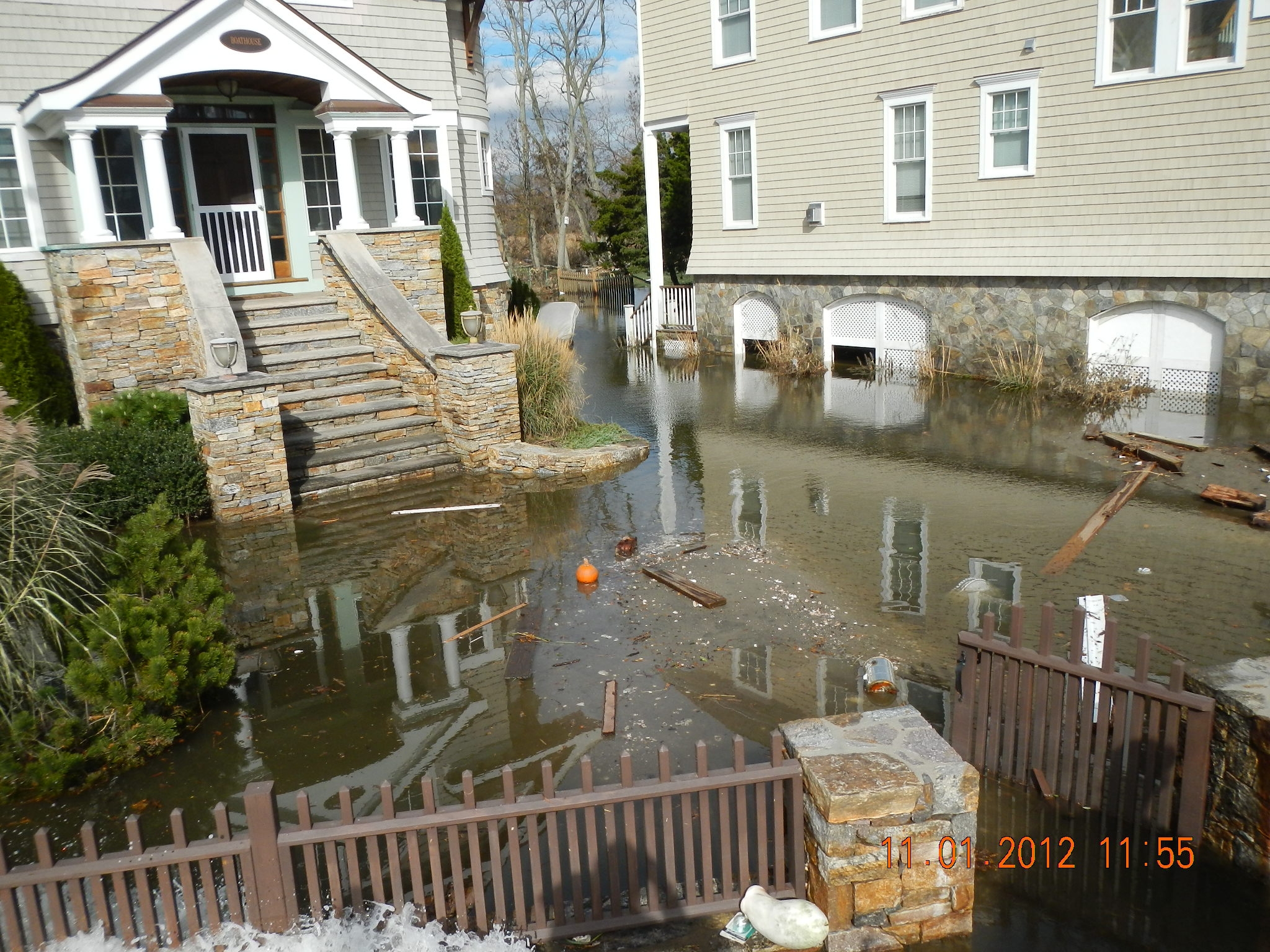
Fairfield, CT
Storm Reporter Report
Damage Reported
Roads
Street/Road: Unspecified
Specific Damage:
- Impacted, but passable
Marinas and Harbors
Buildings
Street: Fairfiled Beach Rd.
Specific Damage:
- Damaged foundations/pilings
Hazardous Materials
Beach
Foot/Cycling Paths
Natural Resources
Current Response
Tidal Overview
![]() 1 hours 31 minutes before high tide
1 hours 31 minutes before high tide
Data from BRIDGEPORT (4.8 miles away)
Water Level (at time of report): 11:55 am, 7.2' MLLW
High Tide (Predicted): 1:23 pm, 7.2' MLLW
High Tide (Observed): 1:12 pm, 8.1' MLLW
■ Observed
■ Predicted water level
⬤ Report time
Weather Overview
Wind Speed: 10.2 MPH
Wind Direction: SW (220°)
Temperature: 52℉
Rainfall (Calendar Day): 0"
Rainfall (Past 24 Hours): 0"
You must be logged in to post a comment.
"OLISP Field Photo - TS Sandy"