Barnstable County
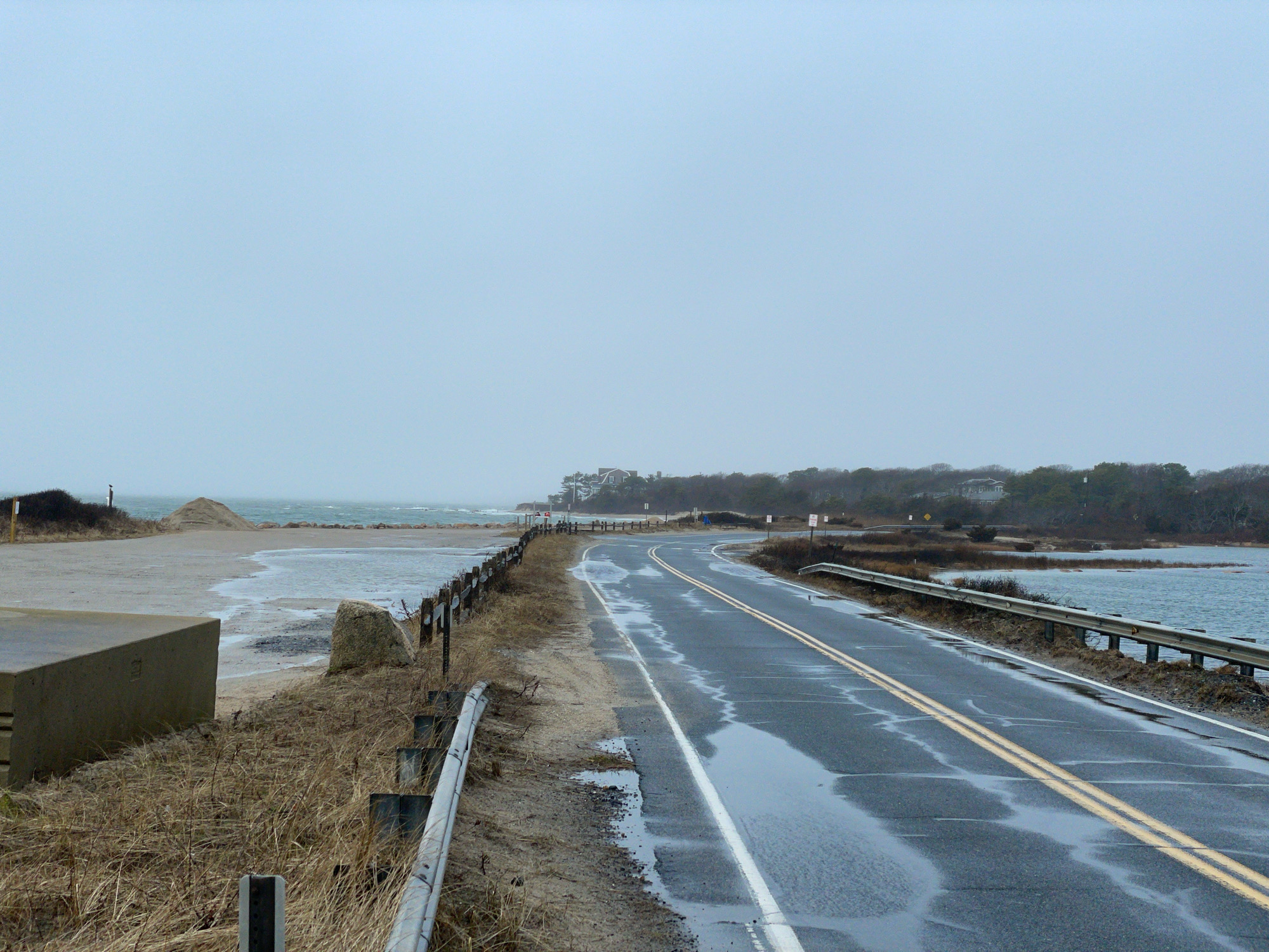
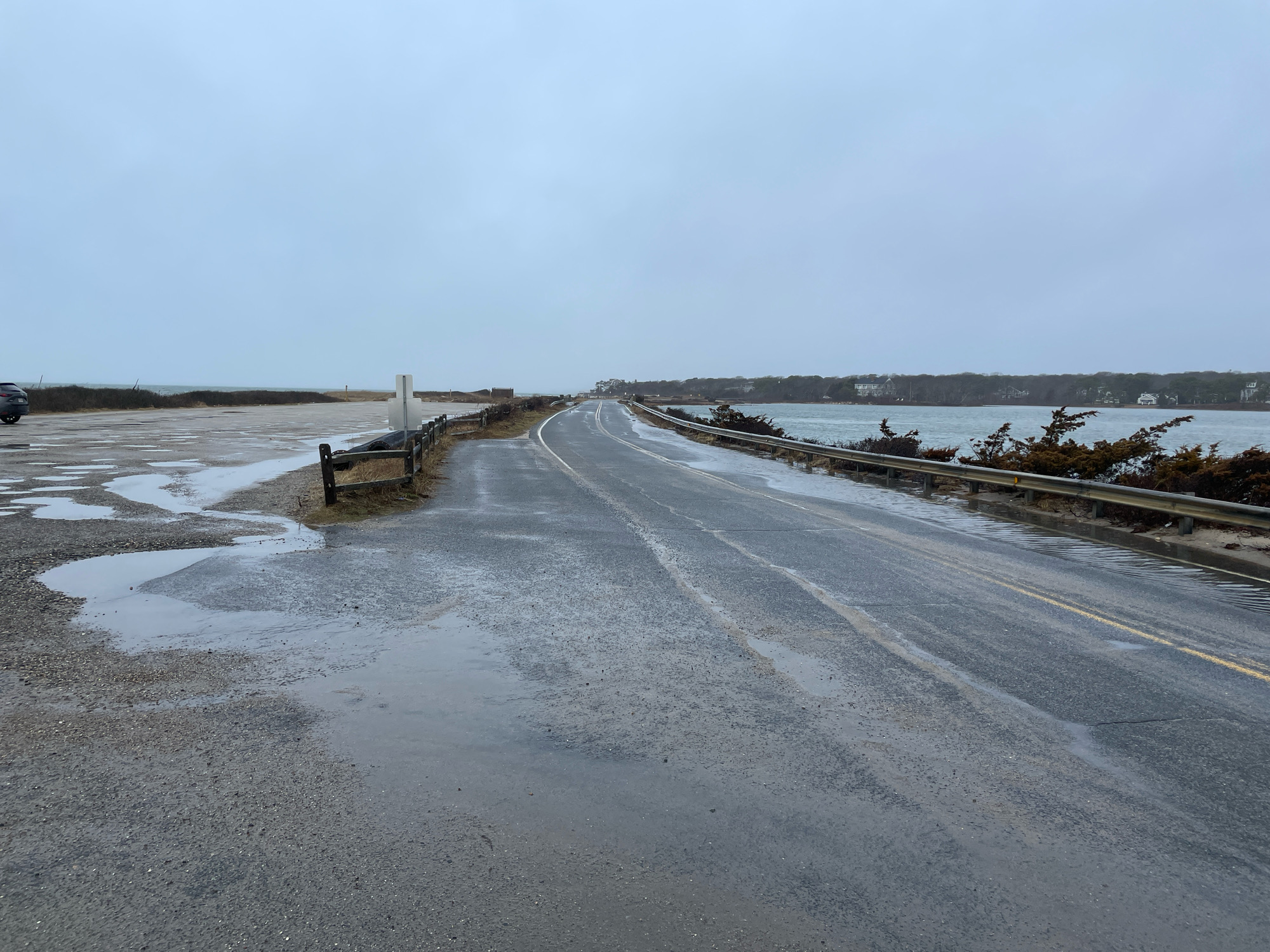
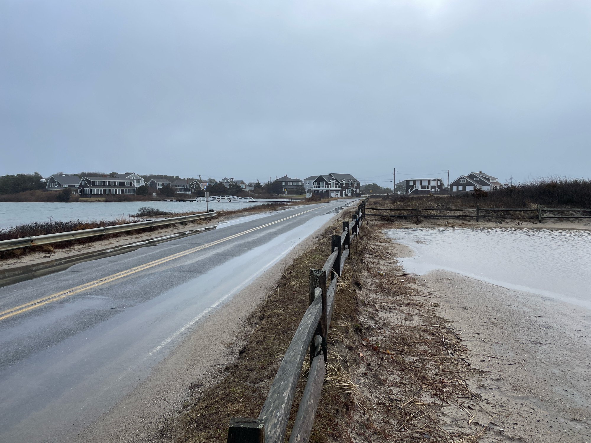
Falmouth, MA
(Menauhant Road, Falmouth)
Storm Report
Impacts Reported

User Submitted Data
Roads
Street/Road: Menauhant Road
Specific Impacts:
- Impacted, but passable
Comments: Minor roadway and parking lot flooding, no significant impacts.
Marinas and Harbors
Buildings
Hazardous Materials
Beach
Coastal Structures
Foot/Cycling Paths
Natural Resources
Current Response
Response:
- None
Tidal Overview
![]() 0 hours 6 minutes after high tide
0 hours 6 minutes after high tide
Data from OCEANOGRAPHIC INSTITUTION (6.5 miles away)
Water Level (at time of report): 8:40 am, 4.4' MLLW
High Tide (Predicted): 8:54 am, 2.4' MLLW
High Tide (Observed): 8:42 am, 4.4' MLLW
Loading NOAA Tide Data…
■ Observed
■ Predicted water level
⬤ Report time
Weather Overview
Wind Speed: 21.9 MPH
Wind Direction: S (190°)
Temperature: 46℉
Rainfall (Calendar Day): 0.031"
Rainfall (Past 24 Hours): 0.91"
You must be logged in to post a comment.
No evidence of overwash or significant coastal erosion.