Essex County
Salisbury, MA
(Salisbury)
Storm Report
Impacts Reported
User Submitted Data
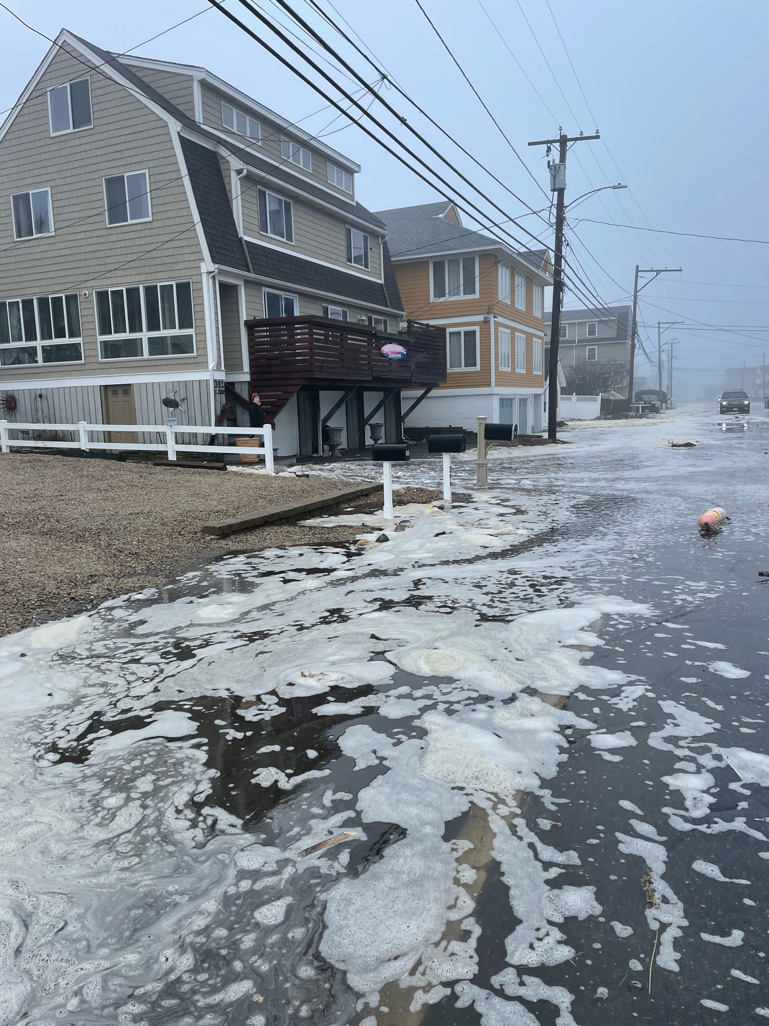
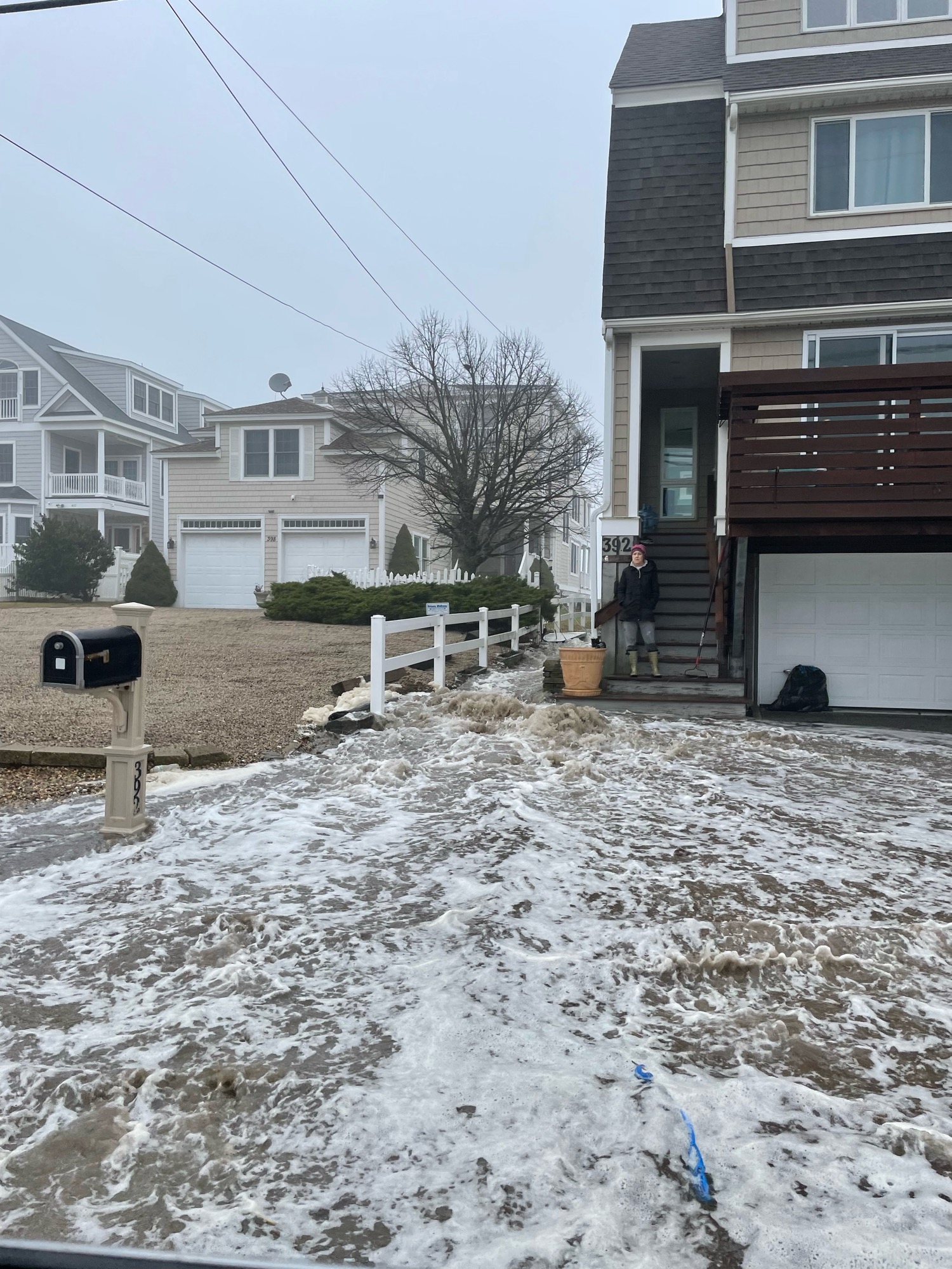
Roads
Street/Road: Unspecified
Specific Impacts:
- Splashover
Marinas and Harbors
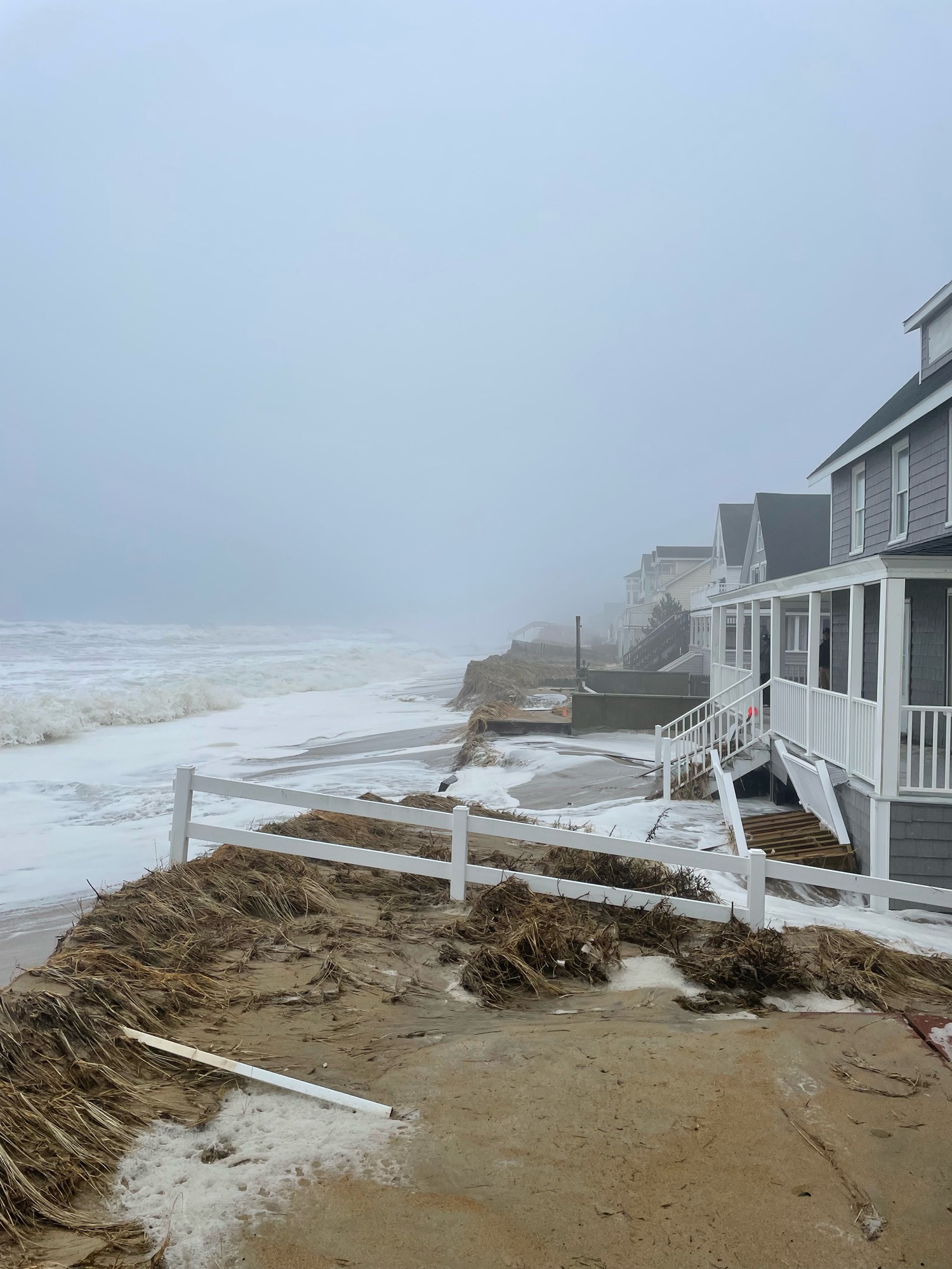
Buildings
Street: 380-400 North end boulevard
Specific Impacts:
- Water flow around or under buildings
- Damaged stairs/decks
Hazardous Materials
Beach
Imapacts Reported: Y
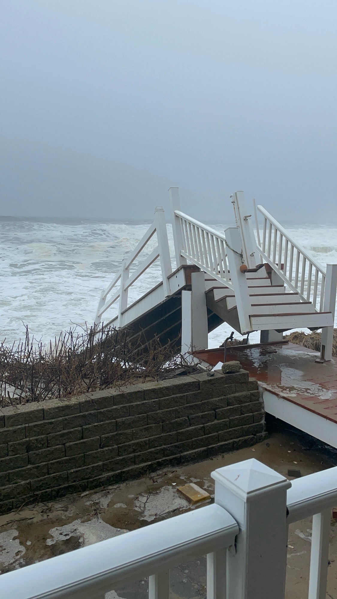
Coastal Structures
Specific Impacts:
- Splashover
- Damaged stairs/walkovers
Foot/Cycling Paths
Natural Resources
Specific Impacts:
- Damaged sand fencing
- Eroded beach
- Overwashed beach/dune
Current Response
Response:
- None
Tidal Overview
![]() 0 hours 17 minutes before high tide
0 hours 17 minutes before high tide
Data from Plum Island, Merrimack River Entrance (3.3 miles away)
High Tide (Predicted): 12:34 pm, 9.6' MLLW
Loading NOAA Tide Data…
■ Observed
■ Predicted water level
⬤ Report time
Weather Overview
Wind Speed: 15 MPH
Wind Direction: SE (145°)
Temperature: 50℉
Rainfall (Calendar Day): 0.023"
Rainfall (Past 24 Hours): 1.46"
You must be logged in to post a comment.