Suffolk County
Winthrop, MA
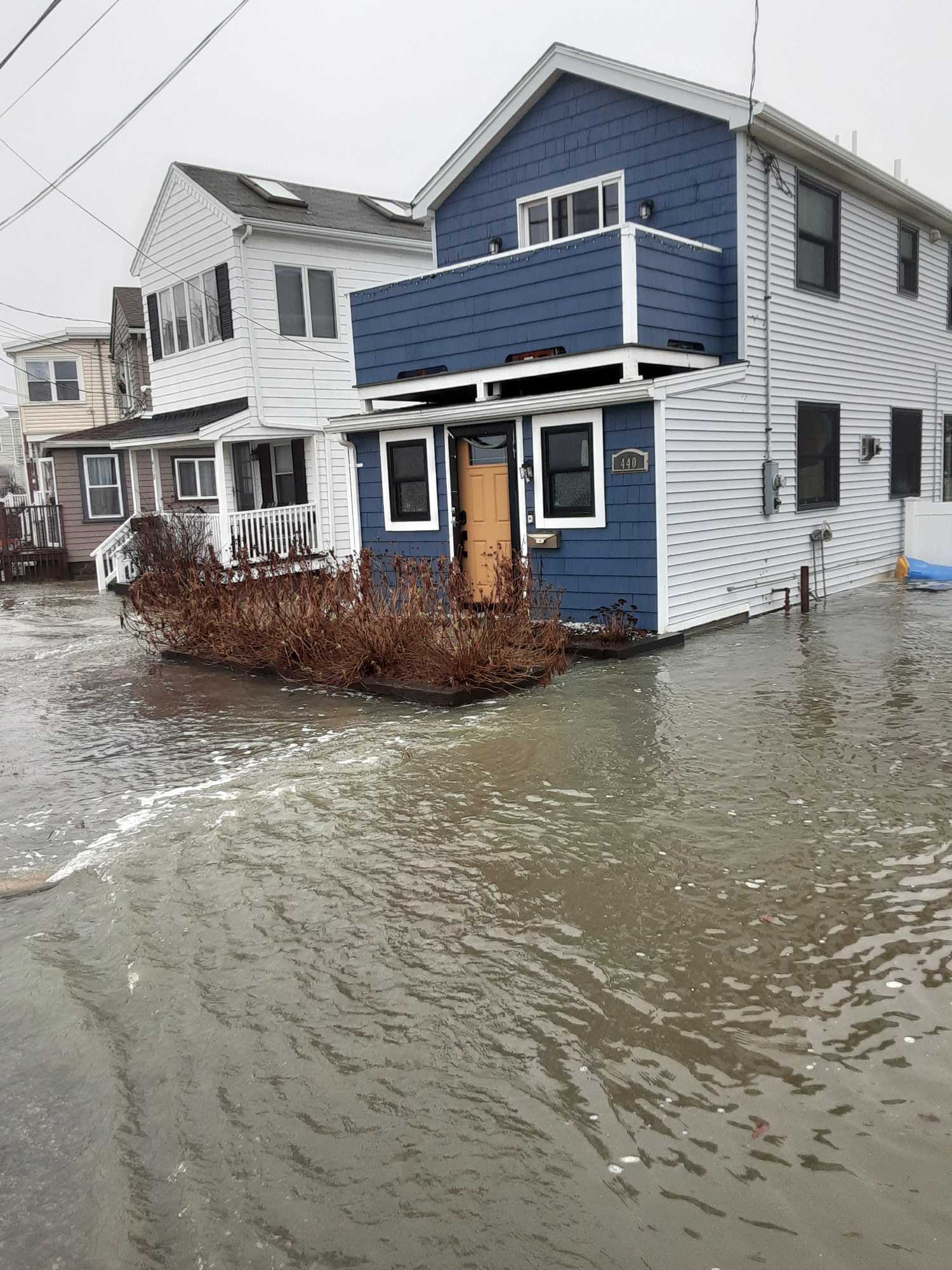
(440 Revere St, Winthrop)
Storm Report
Impacts Reported
User Submitted Data
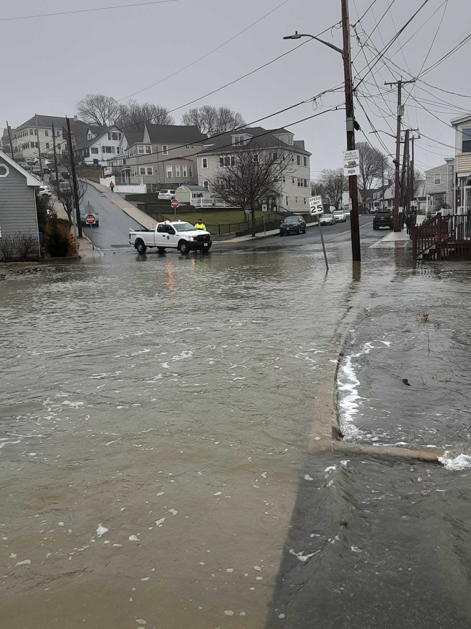
Roads
Street/Road: Unspecified
Specific Impacts:
- Splashover
- Impassable (flood water)
- Impassable (overwash)
Comments: No access to Winthrop Pkwy. at 11:30 a.m. due to flooded road.
Marinas and Harbors
Buildings
Street: Revere St at Winthrop Pkwy
Specific Impacts:
- Water flow around or under buildings
Comments: Water flow around residential home at 440 Revere St.
Hazardous Materials
Beach
Coastal Structures
Foot/Cycling Paths
Natural Resources
Current Response
Tidal Overview
![]() 0 hours 36 minutes before high tide
0 hours 36 minutes before high tide
Data from BOSTON (4.5 miles away)
Water Level (at time of report): 11:44 am, 14.3' MLLW
High Tide (Predicted): 12:17 pm, 11.4' MLLW
High Tide (Observed): 12:00 pm, 14.4' MLLW
Loading NOAA Tide Data…
■ Observed
■ Predicted water level
⬤ Report time
Weather Overview
Wind Speed: 10.3 MPH
Wind Direction: SSE (159°)
Temperature: 50℉
Rainfall (Calendar Day): 0"
Rainfall (Past 24 Hours): 1.42"
You must be logged in to post a comment.