Barnstable County
Falmouth, MA (Oyster pond rd and surf drive)
Storm Report
Impacts Reported
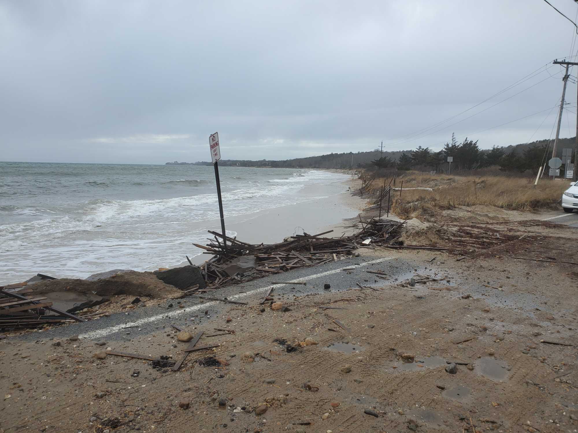
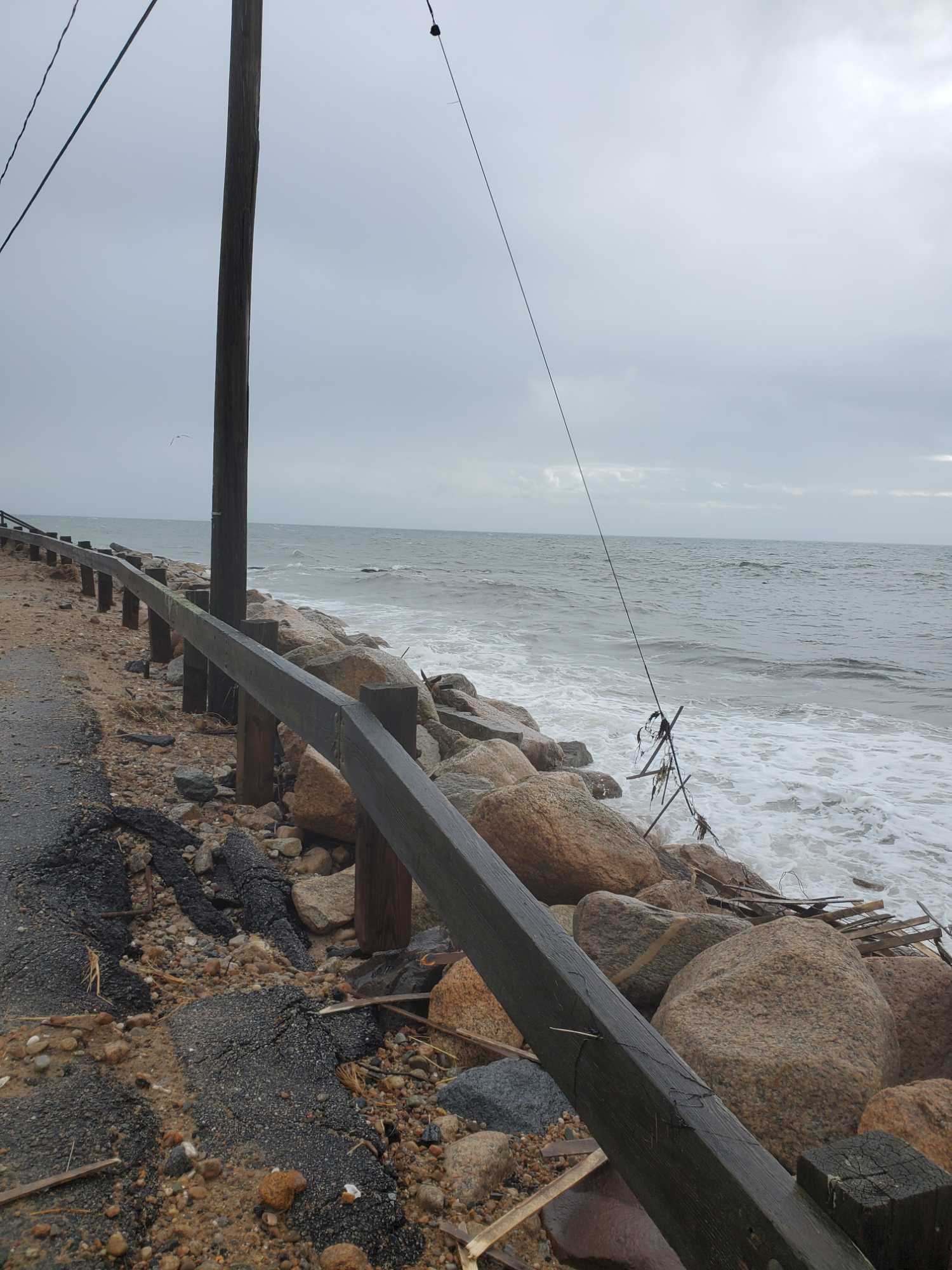
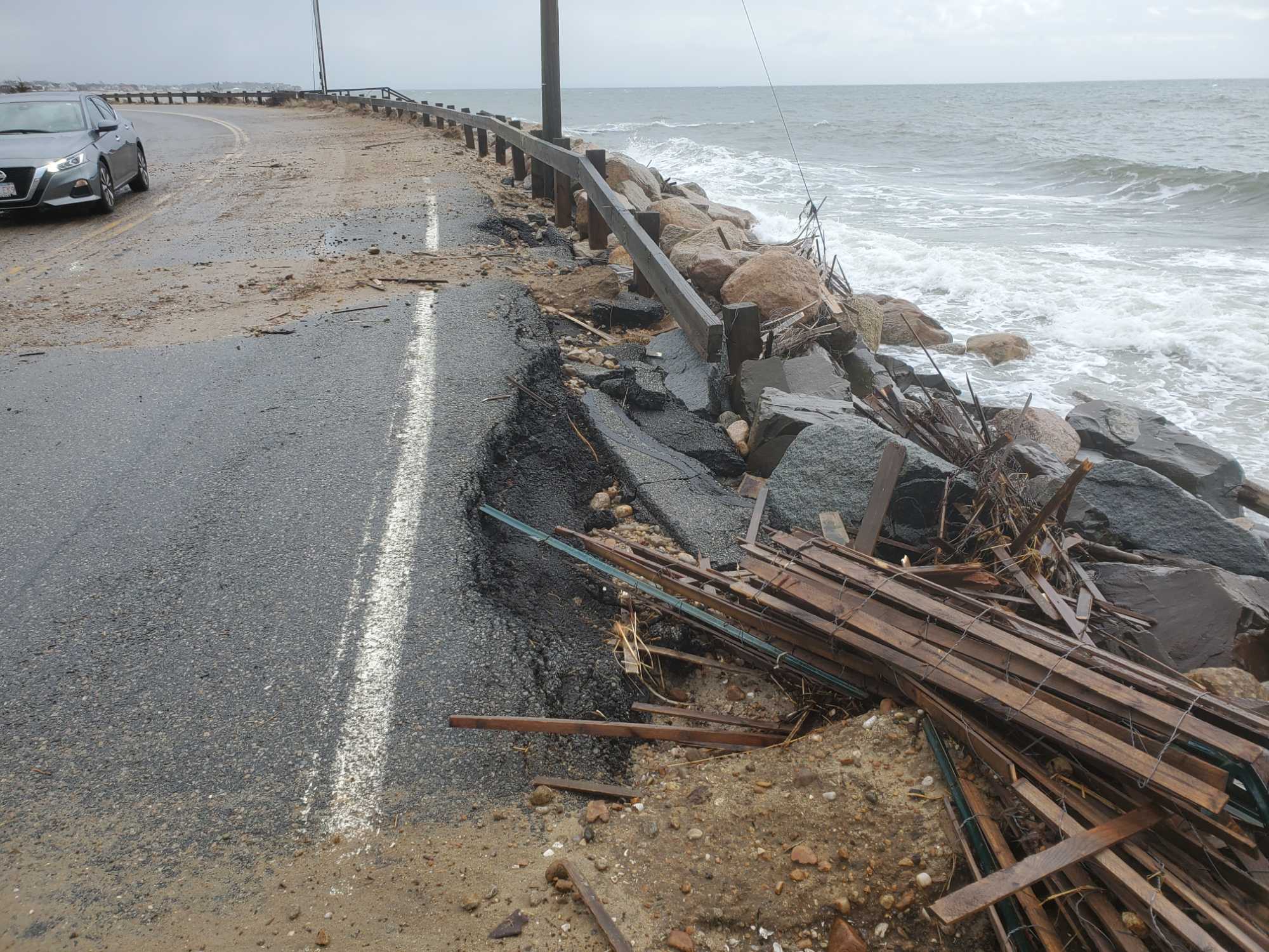
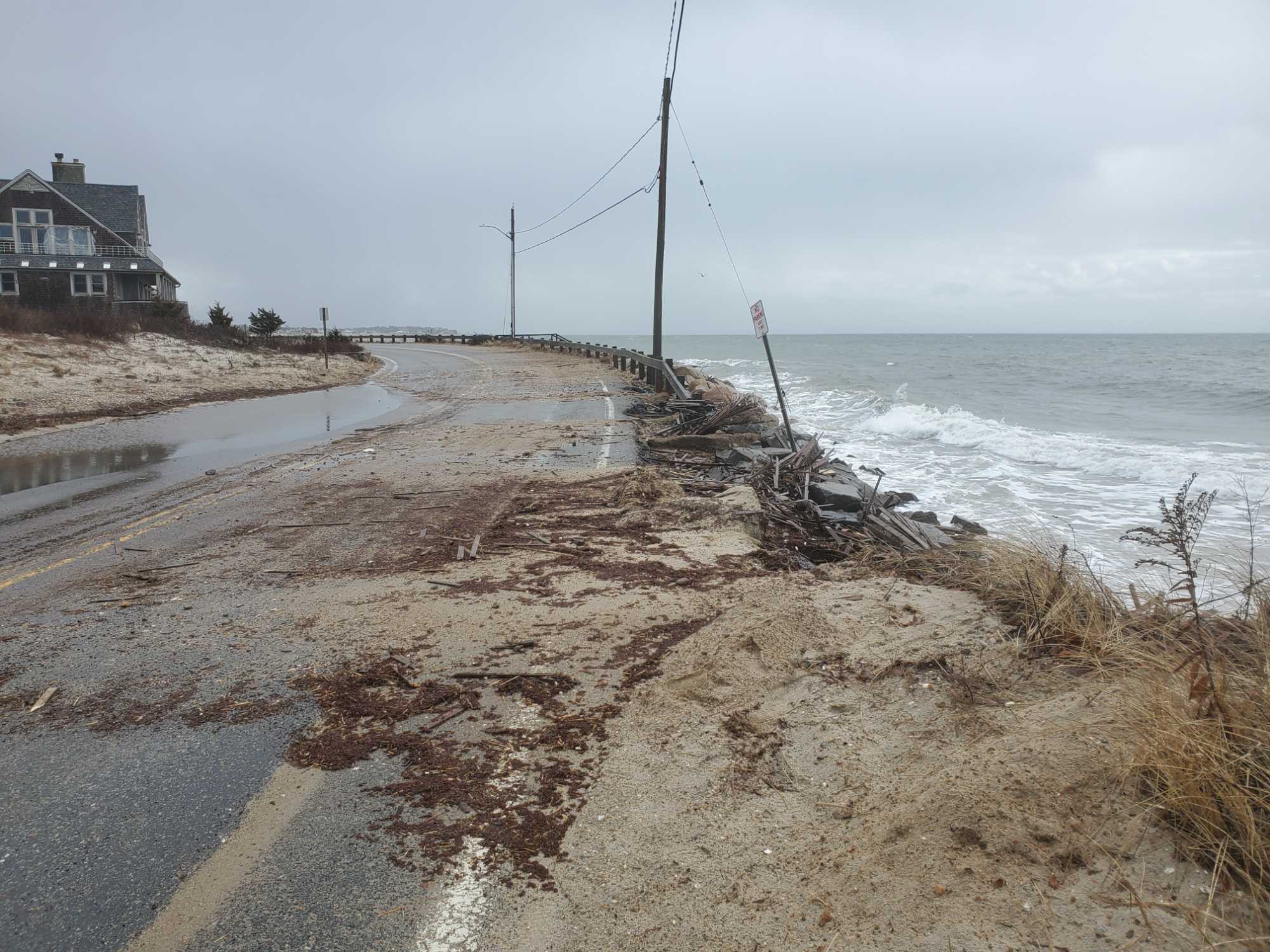
Roads
Street/Road: Unspecified
Specific Impacts:
- Splashover
- Impacted, but passable
- Impassable (flood water)
Comments: Damage to pavement
Marinas and Harbors
Comments: Road railing damaged
Buildings
Hazardous Materials
Beach
State: Y
Coastal Structures
Foot/Cycling Paths
Natural Resources
Specific Impacts:
- Damaged sand fencing
- Eroded beach
- Eroded dune
- Eroded bank/bluff
- Overwashed beach/dune
Current Response
Response:
- None
Tidal Overview
![]() 3 hours 7 minutes after high tide
3 hours 7 minutes after high tide
Data from OCEANOGRAPHIC INSTITUTION (2 miles away)
Water Level (at time of report): 10:31 am, 3.3' MLLW
High Tide (Predicted): 7:00 am, 2.5' MLLW
High Tide (Observed): 7:24 am, 5.3' MLLW
■ Observed
■ Predicted water level
⬤ Report time
Weather Overview
Wind Speed: 17.5 MPH
Wind Direction: SW (233°)
Temperature: 51℉
Rainfall (Calendar Day): 0"
Rainfall (Past 24 Hours): 1.42"
You must be logged in to post a comment.