Plymouth County
Marshfield, MA
Storm Report
Impacts Reported
User Submitted Data
Roads
Street/Road: Unspecified
Specific Impacts:
- Splashover
- Impacted, but passable
Comments: Flood waters receded, debris cleared
Marinas and Harbors
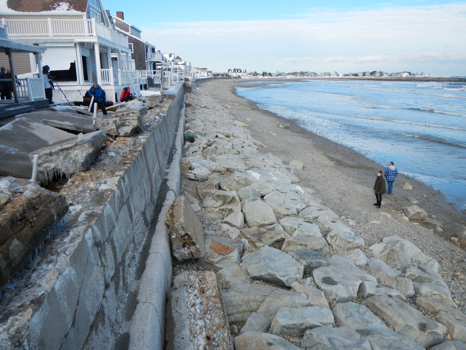
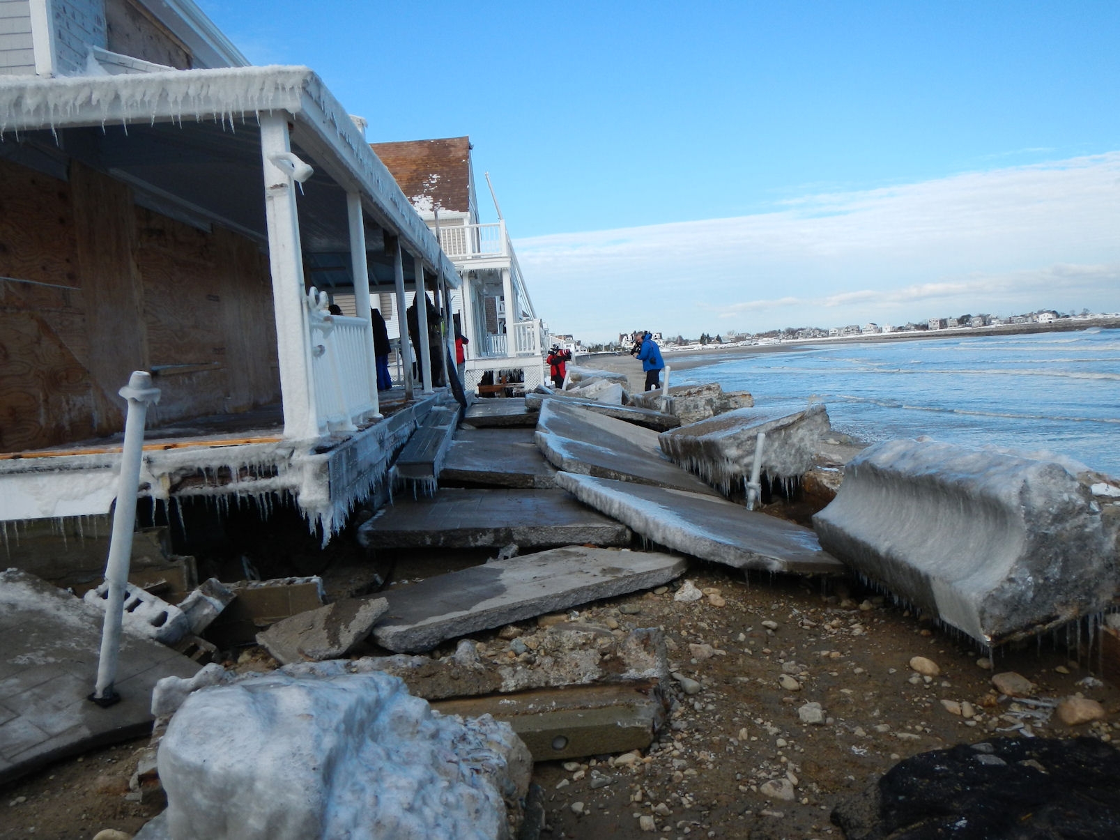
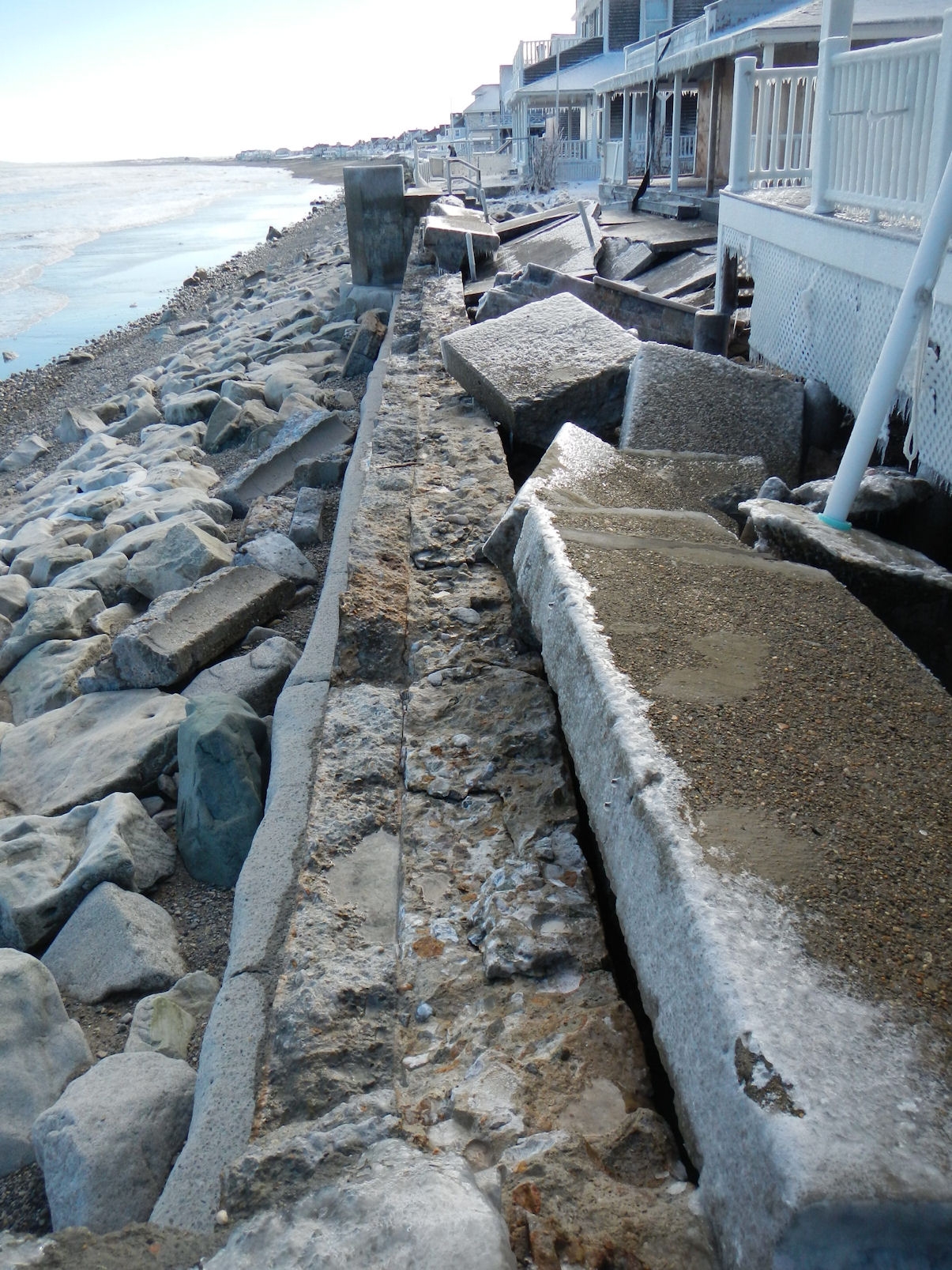
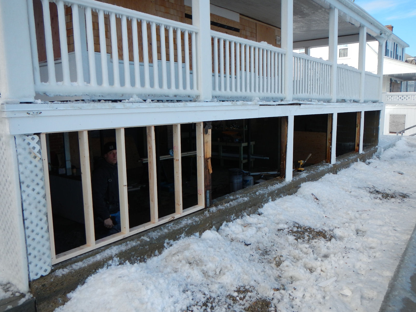
Buildings
Specific Impacts:
- Water flow around or under buildings
- Damaged stairs/decks
- Damaged windows/sidings
- Damaged walls/roofs
- Damaged foundations/pilings
Comments: 46-50 had flow through basements that worked, possibly 10 houses damaged in differing degrees
Hazardous Materials
Beach
Coastal Structures
Specific Impacts:
- Splashover
- Leaning bulkheads/seawalls
- Collapsed bulkheads/seawalls
Comments: 50 feet seawall partial collapsed revetment unravaled
Foot/Cycling Paths
Natural Resources
Specific Impacts:
- Eroded beach
- Overwashed beach/dune
Current Response
Tidal Overview
![]() 4 hours 11 minutes before high tide
4 hours 11 minutes before high tide
Data from Brant Rock, Green Harbor River (0.7 miles away)
High Tide (Predicted): 6:09 pm, 8.9' MLLW
Loading NOAA Tide Data…
■ Observed
■ Predicted water level
⬤ Report time
Weather Overview
Wind Speed: 5.3 MPH
Wind Direction: NNW (330°)
Temperature: 23℉
Rainfall (Calendar Day): 0"
Rainfall (Past 24 Hours): 0.03"
You must be logged in to post a comment.