
Roads
Street/Road: Unspecified
Specific Impacts:
- Impacted, but passable
Comments: Fuller Road
Marinas and Harbors
Buildings
Hazardous Materials
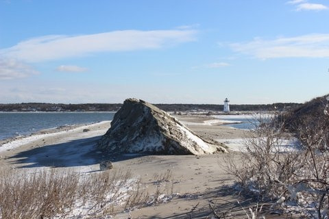
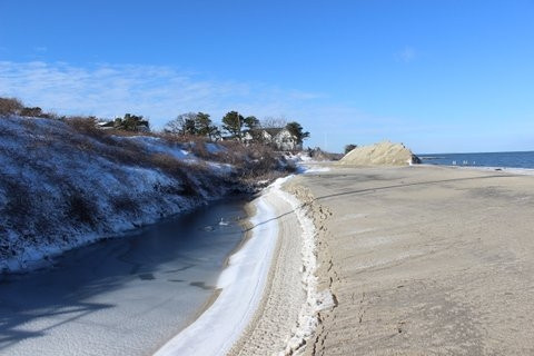
Beach
State: Accessible
Coastal Structures
Natural Resources
Specific Impacts:
- Eroded beach
- Eroded dune
Comments: Ninety-five percent of dredge material stockpiled on the beach to use for nourishment was eroded during the storm.
Current Response
You must be logged in to post a comment.