Queens County, NY
Broad Channel
Flood Watch Report
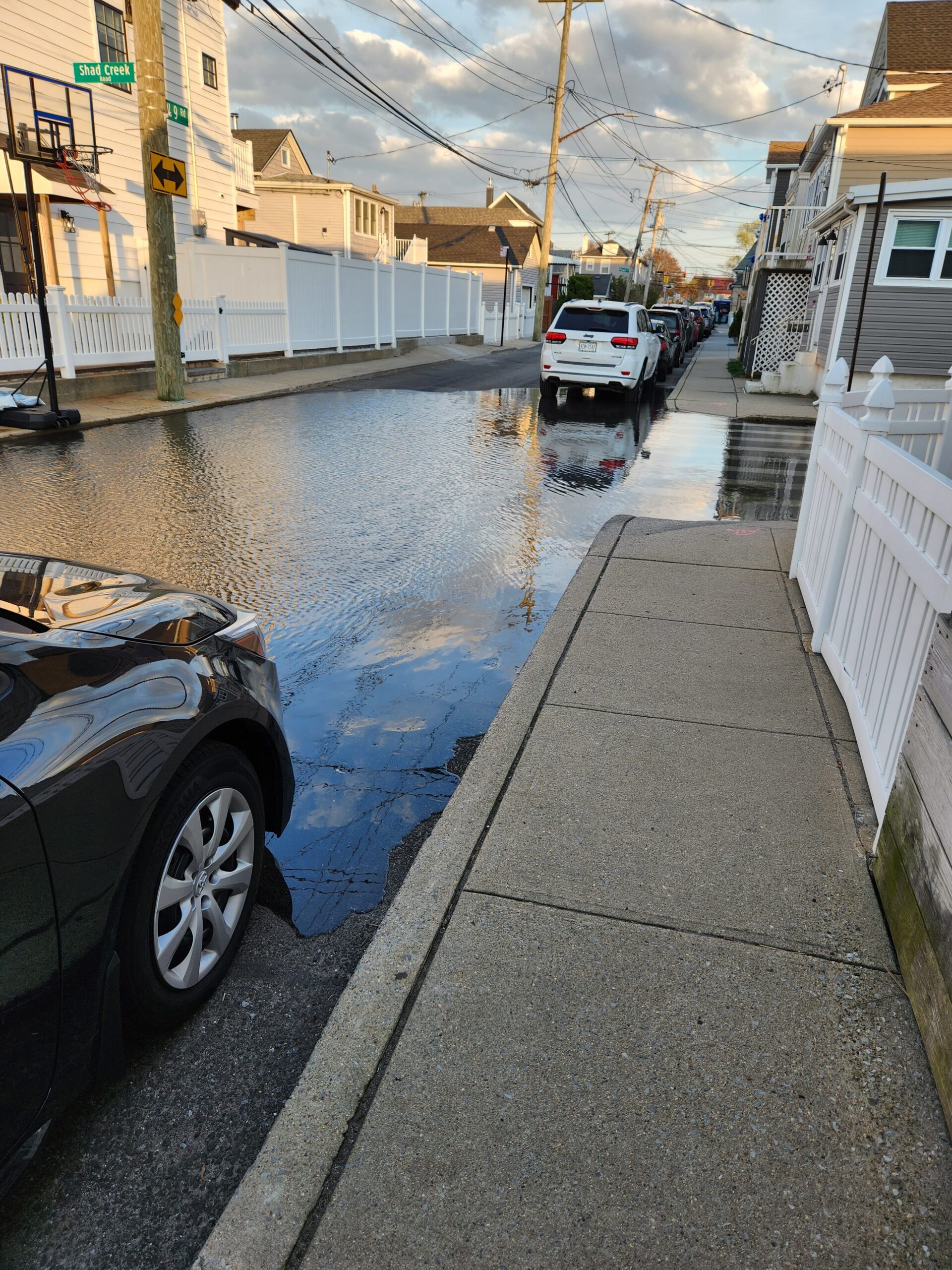
User Submitted Data
Cause of Flooding:
- Storm drain (Water pooling near a storm drain)
What is Flooded:
- Roads/streets
Estimated water depth: 5.5 inches
via NYC Community Flood Watch Project
Tidal Overview
![]() 0 hours 5 minutes before high tide
0 hours 5 minutes before high tide
Data from North Channel Bridge, Grassy Bay (2.8 miles away)
High Tide (Predicted): 7:02 pm, 6.4' MLLW
Loading NOAA Tide Data…
■ Observed
■ Predicted water level
⬤ Report time
Weather Overview
Wind Speed: 19.4 MPH
Wind Direction: W (260°)
Temperature: 64℉
Rainfall (Calendar Day): 0"
Rainfall (Past 24 Hours): 0.01"
1 Comment. Leave new
Photo Credit: Alex Kanonik, American Littoral Society