Hampden County
Springfield, MA
Storm Report
Impacts Reported
Roads
Street/Road: Unspecified
Marinas and Harbors
Buildings
Hazardous Materials
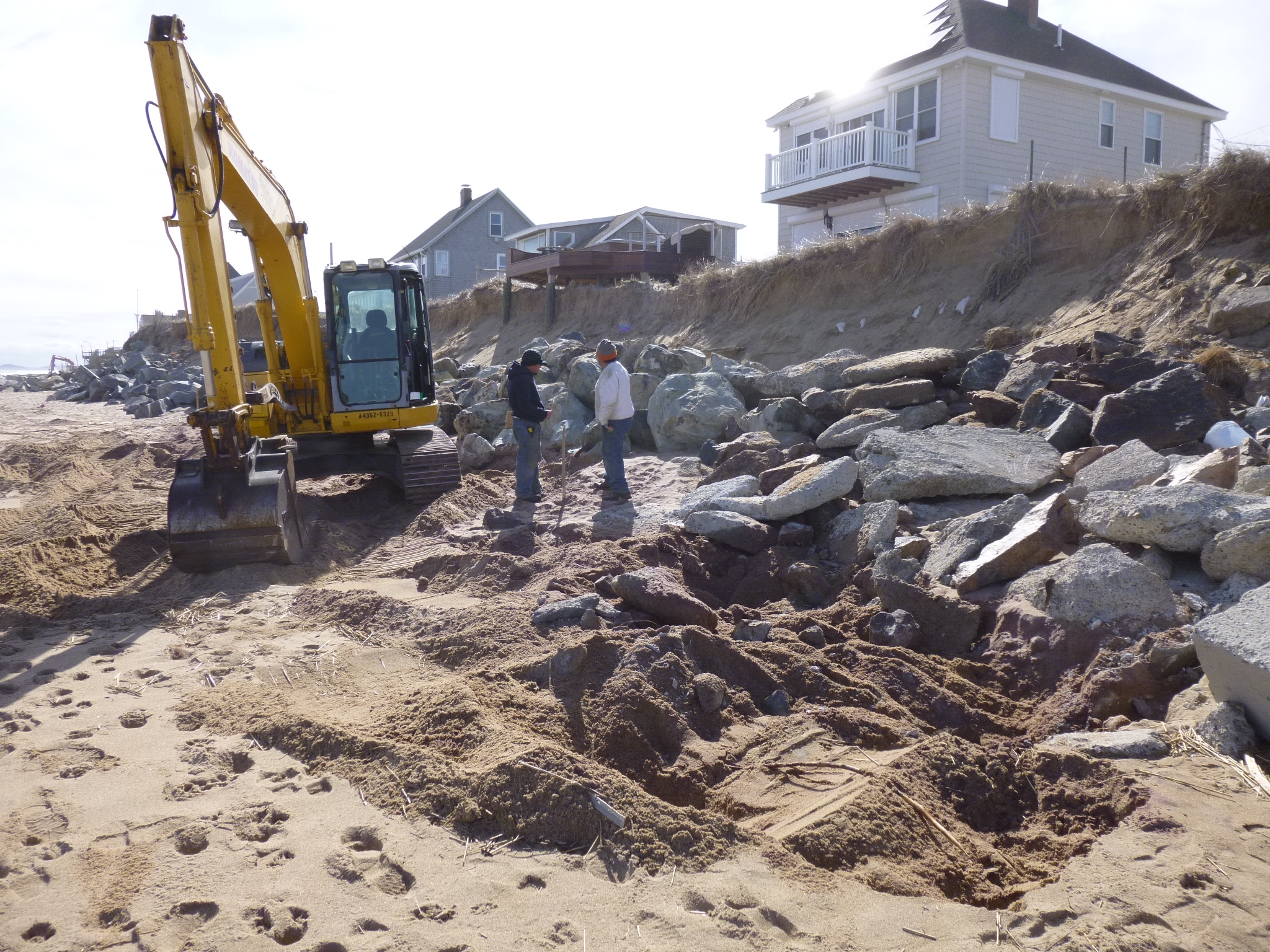
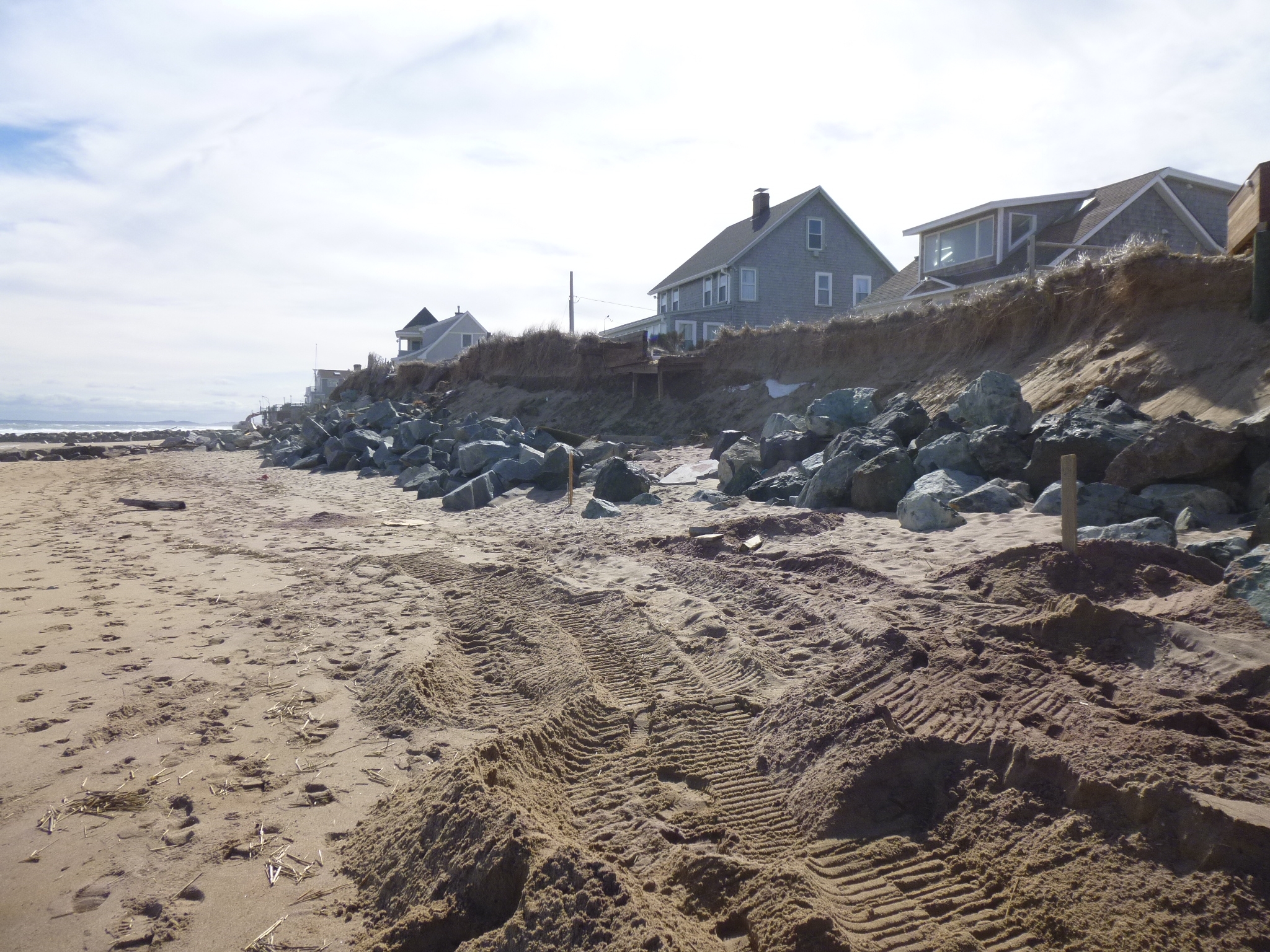
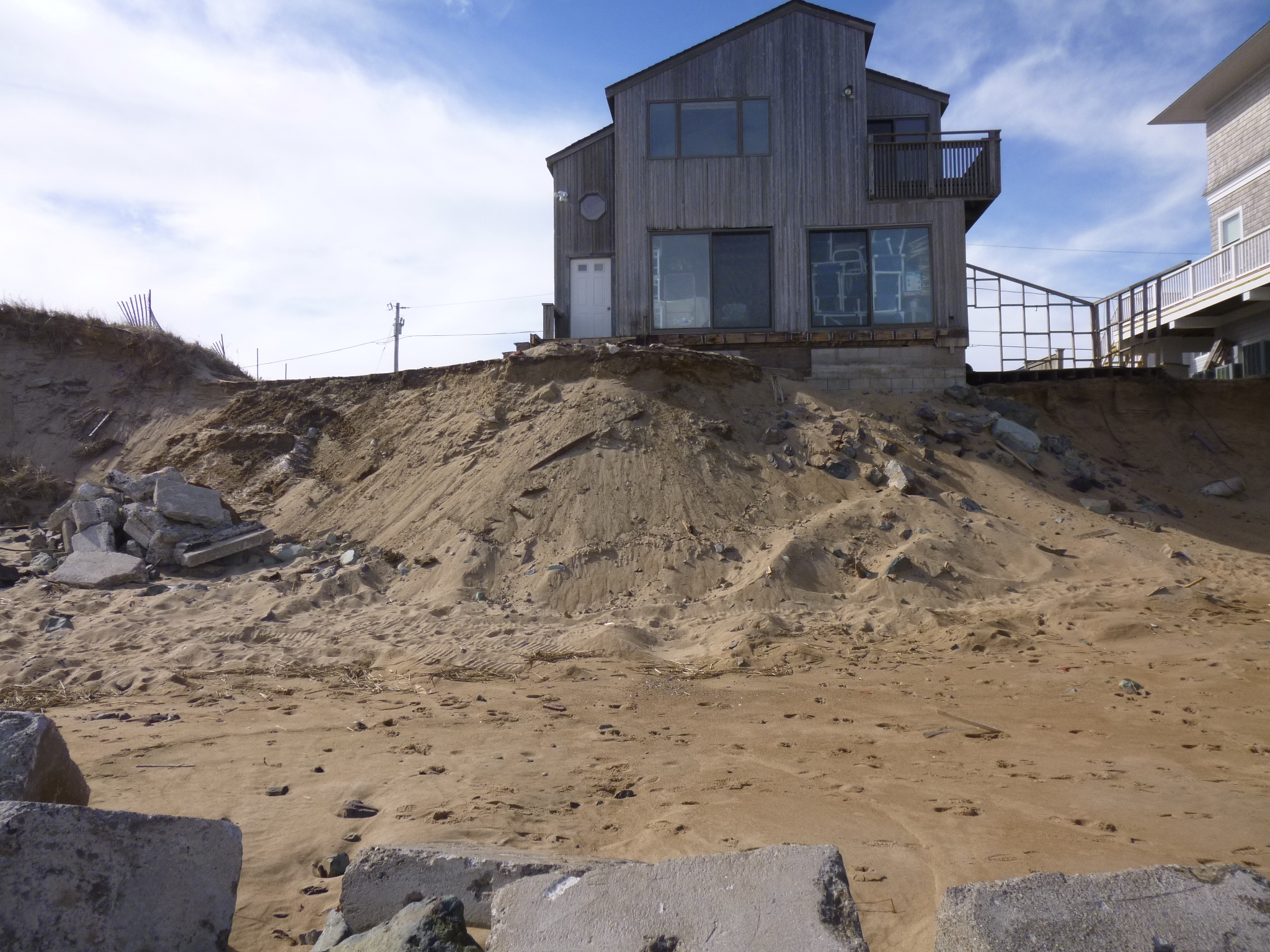
Beach
State: Y
Coastal Structures
Foot/Cycling Paths
Natural Resources
Current Response
Response:
- Sandbagging
Tidal Overview
![]() 3 hours 21 minutes after high tide
3 hours 21 minutes after high tide
Data from NEW LONDON, State Pier (59.4 miles away)
Water Level (at time of report): 10:45 am, 1.4' MLLW
High Tide (Predicted): 7:03 am, 2.5' MLLW
High Tide (Observed): 7:24 am, 2.5' MLLW
■ Observed
■ Predicted water level
⬤ Report time
Weather Overview
Wind Speed: 6.3 MPH
Wind Direction: N (8°)
Temperature: 34℉
Rainfall (Calendar Day): 0"
Rainfall (Past 24 Hours): 0"
You must be logged in to post a comment.
"#1 south of connors rocks are being moved towards dune but not on dune to accomodate more coir bags. #2 stake shows terminal southern end of new coir bags planned. #3 first house south of connors...note blocks and covered rocks."