Newburyport, MA (Beach between 75th & 77th St, NBPT)
Essex County
Storm Report
03/15/2023 | 9:01 am
Impacts Reported
Roads
Street/Road: Unspecified
Marinas and Harbors
Buildings
Hazardous Materials
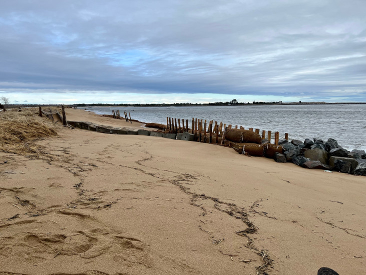
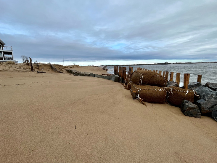
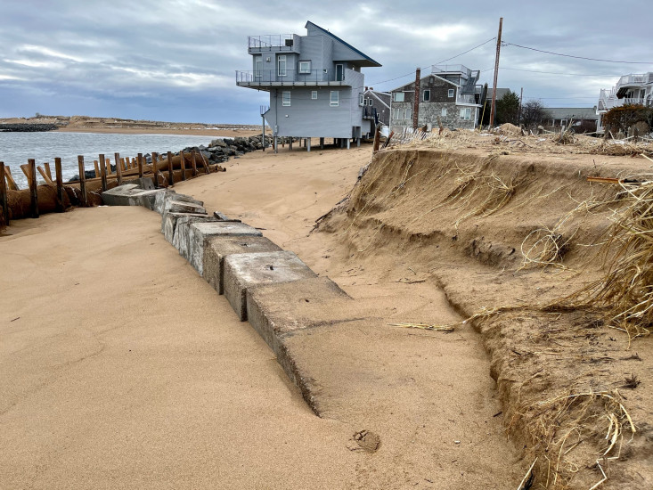
Beach
State: Accessible
Coastal Structures
Specific Impacts:
- Splashover
Comments: Damage to the coir logs observed. Several timber supports were broken and portions of the coir logs have deflated.
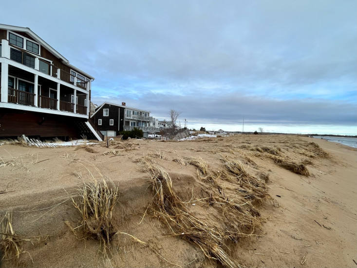
Natural Resources
Specific Impacts:
- Eroded dune
- Overwashed beach/dune
Comments: Dune erosion occurring and observation of dune overwash towards 77th street.
Current Response
Response:
- None
You must be logged in to post a comment.